Route de Sainte-Barbe à Plouharnel

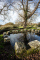
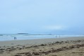
To ensure you don’t leave Sainte-Barbe beach without having learnt something, we suggest this very short circular route to explore its stone alignments, in addition to visiting its chapel, fountains, wash houses, narrow streets and alleyways.

Details

10648033
Creation:
Last update:
Last review:
  • Walking
    Activity: Walking
  • ↔
    Distance: 2.76 mi
  • ◔
    Average duration: 1h 20 
  • ▲
    Difficulty: Easy

  • ⚐
    Back to start: Yes
  • ↗
    Ascent: + 66 ft
  • ↘
    Descent: - 66 ft

  • ▲
    Highest point: 85 ft
  • ▼
    Lowest point: 13 ft
  • ⚐ Country: France
  • ⚐ City: Plouharnel (56340)
  • ⚑
    Start/End: N 47.606439° / W 3.135417°
  • ❏
    IGN map(s): Ref. 0821OT
  • Hour-by-hour weather

Description of the walk

Park in the car park at the Sainte-Barbe Chapel.
Yellow signposting

(S/E) From the car park, with your back to the road, take the track that starts on the right. Walk past a fountain and turn left towards the wash house. Along the way, you’ll see an old windmill, situated on private property.
The path passes under a high-voltage power line and ends at the Chemin du Moulin. Continue to the end of this path.

(1) Turn right for a round trip to the viewpoint overlooking the vast dune landscape, designated a ‘Grand Site de France’ in 2018.
Retrace your steps and, at the engraved stone, continue to the right along Rue de Glévenay. Cross a small wooden bridge into Glévenay. In the village, take the second cul-de-sac, Impasse Lenay. At the bend, turn left and cross the Chemin de Lostiguen.

(2) Turn left and keep to the right until you reach the Stop sign. Cross the road, continue straight ahead and, almost immediately, take the path towards Kerzivienne, between two houses. Head north and join the D781.

(3) Carefully cross the departmental road and follow the path opposite. View of the Alignements du Vieux Moulin. Continue towards the Varquez pond, then skirt it on the left until you reach the 18-metre mark.
Turn left to rejoin the D781.

(4) Cross the departmental road again, taking care, and follow the road opposite which leads into Kerhellegant. Turn right at the Fork in the road, then, in the square, make a first turn left then right. The Chemin de Kerpontic passes by the Kersily campsite and runs alongside a tennis court, before ending on the tarmac at the Route de Kerentrech.

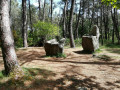
(5) Turn left and admire the Sainte-Barbe Alignments. Enter the village and continue straight on until you reach the car park at the Chapel (S/E).

Waypoints

  1. S/E : mi 0 - alt. 49 ft - Car park at Sainte-Barbe Chapel
  2. 1 : mi 0.5 - alt. 49 ft - Return via the right-hand route
  3. 2 : mi 0.89 - alt. 46 ft - Turn left at the fork
  4. 3 : mi 1.28 - alt. 72 ft - Crossing the D781
  5. 4 : mi 2.08 - alt. 59 ft - Crossing the D781
  6. 5 : mi 2.49 - alt. 72 ft - Turn left at the fork
  7. S/E : mi 2.76 - alt. 49 ft - Car park at Sainte-Barbe Chapel

Worth a visit

(3) The Vieux Moulin Alignments. Erected 7,000 years ago during the Neolithic period, only around ten standing stones in two lines remain today. Listed as Historic Monuments since 1889, these remains of dismantled alignments were linked to those of Sainte-Barbe.

Near the Étang de Varquez, at elevation 18, it is possible to reach the highest point in Plouharnel, Mané Remor (33 m), and its Neolithic tombs.
To do this, turn right then left until you reach the site.
Retrace your steps back towards the pond to continue the route to the right.

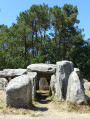
(5) The Sainte-Barbe Alignments, a site listed as a Historic Monument in 1923, of which a few standing stones remain from a vast complex that once stretched between Carnac and Erdeven.

Sainte-Barbe Beach
Sainte-Barbe Chapel – Plouharnel
The Ménec Alignments at Carnac

Reviews and comments

4.3 / 5
Based on 3 reviews

Reliability of the description
4.7 / 5
Ease of following the route
4.3 / 5
Route interest
4 / 5
User 29296205

Overall rating : 4.3 / 5

Date of your route : Jun 29, 2026
Reliability of the description : ★★★★★ Very good
Ease of following the route : ★★★★☆ Good
Route interest : ★★★★☆ Good
Very busy route : No

A lovely little walk through the countryside in the Breton drizzle

Machine-translated

Daniel Vervier
Daniel Vervier

Overall rating : 4.3 / 5

Date of your route : Jun 04, 2024
Reliability of the description : ★★★★★ Very good
Ease of following the route : ★★★★☆ Good
Route interest : ★★★★☆ Good
Very busy route : No

A short, peaceful walk

Machine-translated

Claudine Wattrelot
Claudine Wattrelot

Overall rating : 4.3 / 5

Date of your route : Sep 21, 2021
Reliability of the description : ★★★★☆ Good
Ease of following the route : ★★★★★ Very good
Route interest : ★★★★☆ Good
Very busy route : No

A lovely, well-signposted walk which, whilst it doesn’t take you along the coast, does have the advantage of allowing you to discover the village’s pretty church, followed by a stroll along its beautiful beach.
Off the beaten track but a very lovely route taking in the local heritage.

Machine-translated

Other walks in the area

For more walks, use our search engine .

The GPS track and description are the property of this route's author. Please do not copy them without permission.