Schwarzsee – The Witch’s Trail

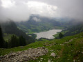
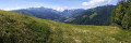
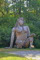
A magnificent walk around Schwarzsee (Black Lake). Most of the route follows the Häxewääg (Witch’s Path). In a copse, you’ll spot the dragon, a metal sculpture. A short detour will take you to the Seeweidbach waterfall. On the way back, by the lakeside, the Schwarzseeturm (a tower rising above the reeds) offers a panoramic view of the lake. At the start of the walk, you’ll come across a grotto dedicated to the Virgin Mary (which, of course, is off the Häxewääg trail).

Details

n°4474076
Creation:
Last update:
Last review:
  • Walking
    Activity: Walking
  • ↔
    Distance: 3.38 mi
  • ◔
    Average duration: 2h 00 
  • ▲
    Difficulty: Easy

  • ⚐
    Back to start: Yes
  • ↗
    Ascent: + 492 ft
  • ↘
    Descent: - 495 ft

  • ▲
    Highest point: 3,763 ft
  • ▼
    Lowest point: 3,425 ft

Photos

Description of the walk

The start of this walk is at the Gypsera car park in Schwarzsee. See the ‘Practical Information’ section for details on how to get to Schwarzsee. The route follows the ‘Witch’s Trail’, which is fully signposted.

(S/E) From the car park, head to the lakeside and turn left, following the path along the eastern shore, heading south. After walking alongside the lake for about 500 m, a fork on the left leads to a cave. Turn left and climb the path, which ends in a flight of steps opposite the statue of the Virgin Mary at the Dankes Grotte. (This visit is, of course, off the Witch’s Trail.)

(1) Return towards the lake and head south until you reach a junction at Staldenloch, just before a small bridge.

(2) Ignore the path branching off to the left, cross the small bridge and head back towards the lake. Once you reach the southern end of the lake, facing north-west, walk past the Seeweid campsite and head north to a junction with the road, just before a bridge over the Seeweidbach.

(3) Before the bridge, take the path on the left which leads to the Seeweidbach waterfall.

(4) Return to the bridge via the same route.

(3) Heading north-east, cross the bridge and follow the road to the Hôtel des Bains (Hôtel Bad).

(5) At the Hôtel Bad, take the path on the right which leads down to the lakeshore. Walk along the western shore of the lake and return to the Schwarzsee Turm (a small wooden observation tower, raised to provide a clear view above the reeds).

(6) From this viewpoint, enjoy the superb panoramic view of the lake. Return along the lakeside path, which rejoins the road just before the Hostellerie am Schwarzsee. Walk past the jetty and head to the Gypsera car park to complete the circular route (S/E).

Waypoints

  1. S/E : mi 0 - alt. 3,432 ft - Schwarzsee – La Gypsera
  2. 1 : mi 0.43 - alt. 3,560 ft - Cave
  3. 2 : mi 0.97 - alt. 3,484 ft - Crossroads
  4. 3 : mi 1.64 - alt. 3,478 ft - Turn-off towards the waterfall
  5. 4 : mi 1.97 - alt. 3,763 ft - Waterfall
  6. 5 : mi 2.55 - alt. 3,465 ft - Hotel Bad
  7. 6 : mi 2.93 - alt. 3,448 ft - Schwarzsee Tower
  8. S/E : mi 3.38 - alt. 3,432 ft - Schwarzsee – La Gypsera

Notes

  • This easy walk can be done in any season; doing it in winter also has a certain charm.

To get to Schwarzsee
? By public transport:

  • ? By train to Fribourg, then
  • ? take bus 123
  • Get off at the Schwarzsee, Gypsera stop.

? By road:

  • From Fribourg, follow the Hauptstrasse to Schwarzsee (paid car park at the Gypsera stop)

Reviews and comments

5 / 5
Based on 1 review

Reliability of the description
5 / 5
Ease of following the route
5 / 5
Route interest
5 / 5
Chris Alsace
Chris Alsace

Overall rating : 5 / 5

Date of your route : Apr 20, 2025
Reliability of the description : ★★★★★ Very good
Ease of following the route : ★★★★★ Very good
Route interest : ★★★★★ Very good
Very busy route : Yes

A short, easy hike with a beautiful view of the mountains and lake, as well as many sights (golden frog, cave, dragon, playground, Kneipp circuit for blood circulation, etc.). Wheelchair and pushchair access. Great with children. Dogs allowed.

Machine-translated

Other walks in the area

For more walks, use our search engine .

The GPS track and description are the property of this route's author. Please do not copy them without permission.