


 Country:

 City:
City:


The route starts from the car park at the Salle Otavela in Hauteville. The trail is marked in yellow throughout.
(S/E) From the car park, head south towards the Salle Otavela and then the school.
(1) After the school, turn left and cross the Route de la Gruyère. At the junction with the Route de l’Auberge, take the road on the right, then the Route d’Impart on the left to head uphill towards the east.
(2) Before the bridge over the Ruisseau des Branches, take the road on the right and leave it 50 metres further on, continuing straight ahead along a path.
(3) Before a small wooden bridge, leave the track and take a path with steps leading uphill to the right until you reach the Chemin de la Sauge; follow this to the left, heading south-southeast, until you reach the Route de la Sauge.
(4) Follow it to the left as far as the Grosse Sauge and continue straight on towards the east, then 100 metres further on towards the south-east. Ignore a path branching off to the left which crosses over the stream and continue for about a hundred metres.
(5) Continue climbing to the left, ignoring the path branching off to the right towards Les Méley d’Avau, until you reach the Chemin de la Saffise.
(6) Follow it to the right as far as the Méley d’Amont farm, then take the path on the left, heading due south and then eastwards to reach La Pata à Bise.
(7) At the junction, take the path on the left towards La Chablex (Alt. 1172). Continue along the path, ignoring a turn-off to the left and another to the right for about 400 m.
(8) Leave the track and take a path that climbs to the right towards Le Crozet, continuing to follow the yellow markings and climbing steadily until you reach the ridge and the Route du Croset (alt. 1,377).
(9) Continue along the road to the right, heading south-south-west for about 300 m. At a left-hand bend, continue straight on along the footpath, which is initially fairly flat before descending to reach Solitou, then a junction and the Route du Solitou.
(10) Head down the path on the right, heading north towards Corbières, with some fairly steep sections, until you reach the Route du Solitou.
(11) Follow it to the right for about 300 m, then leave it to head down a path on the left. 500 m further on at the fork, continue down to the left until you rejoin the Route du Solitou.
(12) Turn right onto this road and follow it for about a hundred metres, then leave it at the 959-metre mark to head down to the left until you reach a road.
(13) Follow it to the right for 20 metres, then turn left onto the path that descends alongside the woodland. Continue along a road until you reach the Route de Villarvollard. Cross it and continue opposite, walking alongside the football pitch.
(14) Follow the road to the left, heading south then west. Leave the road and take a signposted path which leads to a car park along the Route du Vanel.
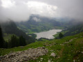
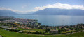
(15) Head left across the car park for 20 metres, then cross the road to take the path leading down towards the lake. Follow this signposted path to the right, along the lake.
(16) Leave the road and take the path which continues to the left, more or less following the lakeshore, and which climbs towards the end up to the plateau, joining the Chemin des Méley.
(17) Follow it to the left (north-west), along the edge of the plateau, until you reach a house (Les Méley), then continue along the road towards Hauteville church.
(18) At the junction, take the road on the right, then at the next junction take the one on the right again. Ignore a dead-end road on the left. Then, at the next junction, take the road on the left.
(19) Turn left, cross over the Ruisseau des Branches and continue straight on for about 300 m, then turn right to return to the car park (S/E).
 Visorando Member
 Difficult
 Very difficult
