Country:

 City:
City:


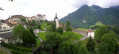
This walk in the Val de Charmey starts at the church in the village of Cerniat, where there are around twenty parking spaces available.
It is signposted throughout: initially in yellow (hiking trails) and then in white-red-white (mountain trails) on the upper section.
(S/E) Head north-east along the road that crosses the village and leads towards the Chartreuse de la Valsainte for about 1.5 km.
(1) Before a right-hand bend, take the Route de la Vieille Scie on the left, signposted with a road sign and a sign for forest tracks.
(2) After about 400 m and before a bridge crossing the Ruisseau de Javrex, take the signposted path on the left towards La Berra. This path climbs, skirting pastures and passing through woodland until it rejoins the Route de la Vieille Scie.
(3) Follow the road to the left for 50 m, ignore the road branching off to the right and continue straight on along the yellow-marked path.
(4) Cross the Route de la Guille to take the yellow-marked path, which crosses the road again 150 m further on. Continue climbing straight ahead.
(5) Back on the road, follow it to the left for about 500 m to reach La Guille farm.
(6) Just before the farm, take the path on the left, now marked in white-red-white, towards the Vanil des Cours, crossing through pastures ( please ensure you close the gates behind you) until you reach a ridge.
(7) On the ridge, take the path to the right for 150 m. At the Fork in the road, take the path on the right, which winds its way up through the forest to the summit of the Vanil du Cours (alt. 1,562 m). After a well-deserved rest on the bench at the summit, continue along the path, following the ridges.
(8) In a pasture, ignore the path leading down to the left towards a farm and carry on until you reach a small ridge. Climb to the right towards the summit of Mont Bifé. After admiring the view, descend the small metal ladder and follow the path downwards, following the ridges.
(9) After a short climb through a pasture, take the path on the right which descends and then climbs again to pass the 1342-metre point. The path continues to follow the ridges until you reach a track; follow this to the right for 50 metres.
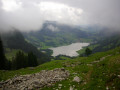
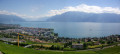
(10) At the left-hand bend, follow the path to the right towards the ruins of Montsalvens. After 200 m, you’ll reach a promontory with a beautiful view of Lake Gruyère, the Moléson and Gruyère Castle. But there are no ruins in sight...
(11) So, turn back.
(10) At the junction, head down to the right towards Châtel-sur-Monsalvens.
(12) At a hairpin bend to the right, take the path on the left for about 150 m, then a narrow track that winds down to the right. 250 m further on, at the Fork in the road, turn left onto the path, now marked in yellow, towards Mont Bifé.
(13) After crossing the Ruisseau de la Maladère, 150 m further on, at the fork, take the left-hand path, still heading towards Mont Bifé. The path climbs northwards then branches off eastwards to join the Route des Petits Monts. Follow this road uphill to the house.
(14) Just before the house, climb the embankment on the left, go past the fence around the meadow and cross it for 40 m. Then take the path that descends to the right (signposted towards Crésuz) to go round the back of the house and rejoin the Route des Petits Monts.
(15) From here, the walk continues along the road. At the hairpin bend, head down to the left along the road, continue downhill through a second hairpin bend to the right, then a third to the left. 200 m further on, take the Route des Roches to the left, towards Cerniat, to reach Cerniat church after 1.4 km (S/E).
 Visorando Member

 Moderate
 Very difficult