Refine your search for walks in Schinznach Dorf
Schinznach Dorf walks
 Staffelegg - Brugg
 Visorando Member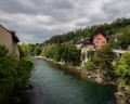
 11.97 mi
 +978 ft
 -1,906 ft
 6h 20
6h 20
 Difficult
 Departure from Küttigen (Aargau)
Fourteenth stage From Les Rousses to Lake Constance via the Jura ridges. This relatively short stage takes you from the lowest pass in the Jura, the Staffelegg, offering breathtaking views of the Herzberg, Asperstrihe and Wasserfluh. You then cross vast alpine-style pastures before entering the peaceful Linnerberg forest. Take the time to stop in front of the majestic Linn Linden Tree, a legendary tree over 700 years old, with a circumference of over eleven metres, which has survived three fires. The hike continues with a long descent through the impressive Aare Gorge, finally leading to the charming historic town of Brugg, rich in heritage and atmosphere.
Brugg - Dielsdorf
 14.93 mi
+2,428 ft
-2,192 ft
9h 00
14.93 mi
+2,428 ft
-2,192 ft
9h 00
 Very difficult
Departure from Windisch (Aargau)
Very difficult
Departure from Windisch (Aargau)
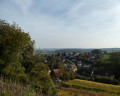
Fifteenth stage From Les Rousses to Lake Constance via the Jura ridges. This stage marks the end of the ridge trail, running from west to east through the typical landscapes of the Swiss Jura. To conclude, a gentle descent winds its way through the vineyards, taking you to Dielsdorf, a charming village nestled at the foot of the Lägern, the last rocky outcrop of the eastern Jura.
Albsteig (E1) from Albbruck to Göhrwihl
 8.53 mi
+2,077 ft
-955 ft
5h 45
8.53 mi
+2,077 ft
-955 ft
5h 45
 Moderate
Departure from Albbruck (Regierungsbezirk Freiburg)
Moderate
Departure from Albbruck (Regierungsbezirk Freiburg)
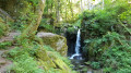
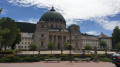
This version of the Albsteig (Black Forest) takes you on a 112-kilometre journey through the Alb Valley along the river from Albbruck to the Feldberg, the highest peak in the southern Black Forest. The first stage takes you upstream from Albbruck through and along the picturesque Alb Valley and, towards the end, through the Höllbach Valley up to Göhrwihl.
In 5 stages from Albbruck to Feldberg and back
 69.61 mi
+11,762 ft
-11,696 ft
5 days
Difficult
Departure from Albbruck (Regierungsbezirk Freiburg)
69.61 mi
+11,762 ft
-11,696 ft
5 days
Difficult
Departure from Albbruck (Regierungsbezirk Freiburg)
This variant of the Albsteig (Black Forest) takes you through the Alb Valley along the river from Albbruck to the Feldberg, the roof of the southern Black Forest, covering around 111 kilometres. Along the route, the Albsteig crosses two other long-distance hiking trails, the Schluchtensteig near St. Blasien and the Westweg on the Feldberg. The multi-day tour described here takes you along the western route to the Feldberg and back down to Höchenschwand via the eastern route. From there, the Wolfssteig (23 km) takes you down to Waldshut-Tiengen and finally by train back to the starting point in Albbruck.
The banks of the Aare between Olten and Aarau
 11.93 mi
+79 ft
-131 ft
5h 35
Moderate
Departure from Olten (Canton of Solothurn)
11.93 mi
+79 ft
-131 ft
5h 35
Moderate
Departure from Olten (Canton of Solothurn)
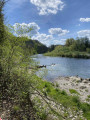
A spring walk, a good 19 km warm-up that follows the Aare between Olten and Aarau. Nothing exceptional, but a few lovely stretches along the water’s edge, with plenty of water birds whose song is unfortunately drowned out on several occasions by the railway line, which is never far from the path. The Gösgen nuclear power station is ever-present during the first half of the route, which circles around it.
Görwihl - Albbruck
 8.25 mi
+1,184 ft
-2,365 ft
4h 50
Moderate
Departure from Görwihl (Regierungsbezirk Freiburg)
8.25 mi
+1,184 ft
-2,365 ft
4h 50
Moderate
Departure from Görwihl (Regierungsbezirk Freiburg)
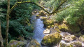
This ninth stage will take you from Görwihl to Albbruck. The route follows the Albsteig Schwartzwald. You will enjoy the pretty waterfalls of the Höllbach and follow the Alb to its confluence with the Rhine. Once you arrive in Albbruck, the end of the hike, you can choose between Albbruck or Laufenburg, a beautiful German-Swiss village, for your overnight stay.
Albsteig (E2) from Göhrwihl to Häusern
 15.71 mi
+3,320 ft
-2,746 ft
10h 05
Difficult
Departure from Görwihl (Regierungsbezirk Freiburg)
15.71 mi
+3,320 ft
-2,746 ft
10h 05
Difficult
Departure from Görwihl (Regierungsbezirk Freiburg)
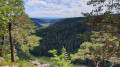
This variant of the Albsteig (Black Forest) takes you on a 112-kilometre journey through the Alb Valley along the river from Albbruck to the Feldberg, the roof of the southern Black Forest. Stage 2 takes you from Göhrwihl back down into the Alb Valley, then over the Dachsberg, to the Albstausee reservoir and up to Häusern.
Hauenstein - Staffelegg
 12.50 mi
+2,297 ft
-2,421 ft
7h 45
Difficult
Departure from Trimbach (Canton de Soleure) (Canton of Solothurn)
12.50 mi
+2,297 ft
-2,421 ft
7h 45
Difficult
Departure from Trimbach (Canton de Soleure) (Canton of Solothurn)
Stage 13 – From Les Rousses to Lake Constance via the Jura ridges.
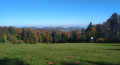
This demanding stage takes us over five successive passes: after Hauenstein come Schafmatt, Salhöhe, Bänkerjoch and finally the Staffelegg Pass. Between these passes, the terrain becomes more intense with the ascent of the Geissfluh, a steep peak marking the border of the canton of Basel-Landschaft. The route alternates between dense Jura forests, peaceful clearings and a few open pastures, offering a beautiful variety of landscapes and atmospheres.
Belchenflue mountain through the "Devil" gorges
 9.13 mi
+2,562 ft
-2,533 ft
6h 25
Moderate
Departure from Hägendorf (Canton of Solothurn)
9.13 mi
+2,562 ft
-2,533 ft
6h 25
Moderate
Departure from Hägendorf (Canton of Solothurn)
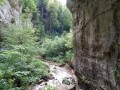
The Swiss Jura Belchen, the Alsatian Belchen (Ballon d'Alsace) and the Black Forest Belchen all form the peaks of a right-angle triangle, mystical sunrise observation point dating back to Celtic times (Belchen comes from "Belenus" the celtic god of sun). You'll gain access to this exceptional viewpoint through the "Devil's" gorges lined with steep walls, waterfalls, caves and caverns. The way back, along the "military path" is full of vestiges and ends with typical Jura landscapes.
Circular walk from and to Finsterlingen, above the Ibach and in Hierholz
5.96 mi
+915 ft
-899 ft
3h 30
 Easy
Departure from Dachsberg (Südschwarzwald) (Regierungsbezirk Freiburg)
Easy
Departure from Dachsberg (Südschwarzwald) (Regierungsbezirk Freiburg)
More than half of the route takes you through a shady, picturesque forest. Part of the route runs high above the Ibach, whilst another part runs deep below it. You can go for a swim in the Hierholzer Weiher. Part of the route is along the road in Hierholz. Most of the paths are unmarked forest tracks that do not appear on hiking maps, but can be found on the Visorando app.
Circular walk to and from Finsterlingen through the woods above Hierholz
3.79 mi
+453 ft
-436 ft
2h 10
Easy
Departure from Dachsberg (Südschwarzwald) (Regierungsbezirk Freiburg)
A short walk, mostly in the shade of the dense forest. The paths are largely unmarked, but as forest tracks they are very easy to follow using the app. There are two spots offering lovely views of the Alps and also of the Hierholzer Weiher further down.
Route of peat bogs in the Southern Black Forest near Todtmoos
5.27 mi
+554 ft
-531 ft
2h 55
Easy
Departure from Herrischried (Regierungsbezirk Freiburg)
A lovely walk through a pine forest, this outing will take you past the seven peat bogs along the path known as the “7 Moore Weg”.
Halfway 7 Moore
3.33 mi
+364 ft
-361 ft
1h 50
Easy
Departure from Herrischried (Regierungsbezirk Freiburg)
A large part of the 7 Moore walk is over regular (forest) roads. Because the entire walk was too long for our 12-year-old dog in the sweltering heat, we cut straight through the forest about halfway, following an ancient route (Kirchspielgrenzweg). This makes for a nicer walk through untrodden paths (yet maintained by the foresters).
Eichener See and Wehrer Boden
3.53 mi
+417 ft
-407 ft
2h 00
Easy
Departure from Schopfheim (Regierungsbezirk Freiburg)
The route is largely in open country. The paths are wide and well signposted. On the way there, we’ll walk past Eichener See to see if it’s there, as it’s a seasonal lake. Information boards along the route and inside the shelter explain how this lake works. We will then cross a small wood and the Dinkelberg hills to the south of Eichener See before reaching the village of Eichen. We will cross the Dorfbach, which flows only through Eichen, and leave the village after a short walk through its eastern part.
Eichener See: in search of a lake that appears and disappears
3.96 mi
+302 ft
-318 ft
2h 05
Easy
Departure from Schopfheim (Regierungsbezirk Freiburg)
The main attraction is Eichener See. You’ll probably need to visit several times as it’s quite rare. It may appear once or twice a year; in some years, not at all. After a period of heavy rain, groundwater from a cavity 50 metres deep rises through the subsoil and fills the basin. It’s a magical spot. We’ll then head up into the hills north of the Dinkelberg.
 Tourist office