The Lambon
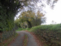
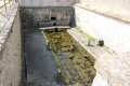
The Lambon rises at Goux, in the commune of La Couarde, at an altitude of 154 metres.
It arises from a multitude of springs, which are distinctive in that they are situated at an elevation of approximately 155 metres above sea level.
With a length of 37.85 km, it flows through the territory of the following 11 communes: La Couarde, Beaussais, Vitré, Thorigné, Prailles, Mougon, Aigonnay, Fressines, La Crèche, Vouillé and Niort, where it flows into the Sèvre Niortaise at an elevation of 12 metres above sea level, near the source of the Vivier, after passing through the Bois de Vachette.
From its source to Thorigné, it crosses the Mellois plateau and already drops 50 metres in elevation.
From Fressines to Niort, the Lambon flows through the cereal-growing plain of the Niort region with a gentler gradient.
The geological structure of the plain, consisting of loam overlying limestone, causes the river to meander more.
It has five tributaries:
on the left bank: the Fombelle
on the right bank: the Lussaudière, the Villebeurre, the Aigonnay and the Mayolle
The ecological and hydrological status of the Lambon
The Lambon’s hydrological regime is severely disrupted by severe low-water periods; regular and repeated dry-ups are observed along one-third of its length for up to eight years in ten.
These dry spells are due to the geological and hydrogeological characteristics of the catchment but are exacerbated by ever-increasing water use:
- water abstraction,
- boreholes,
- the construction of ponds alongside the Lambon riverbed.
This drying-up phenomenon is accompanied by disruption and degradation of the riverbanks. Furthermore, water quality varies greatly.
To ensure the management and protection of the 61 km of riverbanks along this watercourse, the Joint Authority for the Restoration of the Lambon and its Tributaries (SYRLA) was established in early 2010.
This new public body replaced the Association for the Restoration of the Lambon and its Tributaries (ARLA), which had existed since 1997 but whose articles of association did not permit it to undertake the works in the public interest required by the Water Framework Directive.
This joint authority will therefore be able to submit a Declaration of General Interest, which is essential for the implementation, in particular, of hydromorphological improvements to the watercourse. All the planned actions are aimed, as was the case with the ARLA, at restoring the Lambon and its tributaries to good ecological status.
Furthermore, the Lambon forms part of the Sèvre Niortaise catchment area, for which the Water Development and Management Plan (SAGE) was approved in April 2011.
This is a planning tool designed to promote, across the territory of a catchment area, a coordinated and balanced management of water resources and the associated aquatic environments. Covering an area of 3,650 km², the territory of the ‘Sèvre Niortaise and Marais Poitevin’ SAGE encompasses 217 local authorities.
Riparian vegetation: an element to be maintained and preserved
The good ecological status of a watercourse depends on the maintenance of its banks and riparian woodland.
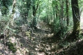
Riparian vegetation refers to the abundant and varied vegetation that lines the river.
It comprises three distinct layers, consisting, in the case of the Lambon, of the following plants:
- Trees: alders, ash trees, oaks, etc.
- Shrubs: hazel, spindle, hawthorn, blackthorn, etc.
- Herbaceous plants: grasses, nettles, ‘reeds’, etc.
The riparian forest serves many functions:
- stabilising the banks and limiting erosion,
- preventing flooding,
- self-purification and the absorption of certain pollutants,
- providing shade that supports the life cycle of aquatic fauna,
- providing firewood...
It is therefore essential to maintain the vegetation along the riverbanks by preserving a diversity of sizes and species and ensuring a balanced structure for all trees and shrubs.
For example, one should avoid leaving only the branches above the watercourse or systematically felling leaning trees!
It is not necessarily the case that these trees are at risk of falling. On the contrary, they can play an important role in providing shelter for fish.
As such, for fishing purposes, the Lambon is classified as a second-category fishing water (minnow, gudgeon, carp, tench, eel, trout).
The Lambon and the tragic history of the Protestants
The upper reaches of the Lambon flow through an area where there was a large Protestant population in the 17th century.
In 1681, this Protestant community suffered the first wave of persecution known as the ‘dragonnades’.
The dragoons were sent by Louvois, Louis XIV’s Minister of War; they were normally employed to collect taxes.
Thus, soldiers on horseback were tasked with forcibly converting Protestants to Catholicism…
Jean Migault, in his diary, recounts the passage of the ‘Cavaliers’ in 1681 and the violence they inflicted.
Protestants who refused to recant were threatened and went into hiding; their belongings were destroyed or sold at a pittance to neighbouring ‘Papists’ (Catholics).
Jean Migault was a reader and schoolmaster and taught the tenets of Protestantism to young children.
Jean Migault was born in 1645 and lived near Lambon; his father, Louis, died at Les Touches de Thorigné in 1662.
To escape persecution, Jean Migault went into exile with his large family in Holland.
He set sail from the Port of La Rochelle in April 1688 and spent the rest of his life there in exile.
Around 1990, the little Bellevue Bridge was restored by the Thorigné local council.
This small bridge was reserved for pedestrians and mules carrying wheat to the mill; carts had to fords the river to the left of the bridge.
This small bridge spans the River Lambon; it stood next to the Moulin des Basses Touches – which no longer exists – believed to be the birthplace of Jean Migault.
Source: internet



 Country:
 City:
City:



 Visorando Member
 Moderate