Country:
 City:
City:


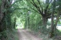
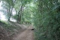
Park in the Lac Lambon car park, near the Camping du Lambon.
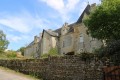
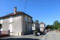
(S/E) Leave the car park heading west and take the road leading to the hamlet of Pied l’Ouaille. Walk through the hamlet to the crossroads after the last building.
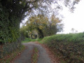
(1) Turn left onto the road which descends slightly. Further on, pass a farm track on your right.
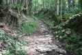
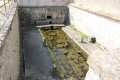
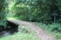
(2) Shortly afterwards, on the left, take a fairly narrow path that descends quite steeply (well signposted). The very shaded path leads down to the Lambon, which you cross via a wooden bridge. On the other side of the Lambon, there is an information board about the protected water. Take the path leading uphill opposite, ignoring the path on the right which follows the course of the Lambon. During the climb, you can admire a fountain emerging from a stone wall on the left-hand side. Continue along this path until you reach the plateau. When you arrive at the level stretch at a junction of farm tracks, turn right (the track opposite leads quickly to a road (Route du Lac – Route de Vitré)).
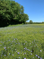
The path is now flat, running through fields and grassland. A little further on, the path crosses the road leading to the hamlet of Verruie (on the right) and runs alongside the buildings at Chêne Besson. Shortly afterwards, the path reaches a road leading to Bessé. Cross the road and continue straight on. The path initially runs alongside a wooded area on the right-hand side. The path reaches another road leading to Bessé.
(3) The road bends almost at a right angle to the right. Cross it and ignore the farm track on the right, which leads to Montreuil and rejoins the road you originally left after Pied d’Ouaille. Similarly, ignore the farm track furthest to the left and take the one opposite. This wide farm track runs along the edge of the woodland with the Lambon stream below on the right (not visible from the track). Further on, ignore the forest track on the left which leads to Thorigné and carry on straight ahead (contrary to the numerous road signs, which all point towards Thorigné).
The track then descends through the heart of the forest. At the bottom of the descent, take the track on the right and ignore the one on the left, which leads to the D304 road after a few dozen metres. The track on the right crosses the Lambon and joins the D304 road. In bad weather, you can reach the road by turning left at the previous crossroads and following the road.
Once on the road, turn right onto it.
(4) The route passes the service track leading to the Cinq Coux quarry geological site. This track offers an alternative route (see practical information).
About three hundred metres further on, the route passes the exit point of the track running through the Cinq Coux geological site. Immediately afterwards, the route reaches a crossroads: turn right onto the road leading to the hamlet of Beausoleil (Beau Soleil on the map). Continue along the road which runs alongside a large estate. Pass a dead-end track on the left, then, a little further on, a service track on the right.
(5) At the crossroads shortly afterwards, turn left towards Le Clouzeau (signposted). The road passes several houses. At the houses, pass a farm track on the right (dead end), then a little further on, another on the left, and take the farm track opposite, which turns left immediately. Further on, pass a farm track on the right: this could provide a shortcut of about 1 km for walkers, bypassing Le Grand Ry.
The farm track eventually joins a road which, branching off the D304, leads to the Grand Ry, amongst other places.
(6) Turn right. Shortly afterwards, at the bottom of a gentle descent on the left-hand side, you’ll see the Plaine de Jussay pond (private property). The road climbs slightly and reaches a crossroads. Turn right towards Le Grand Ry (painted wooden signposts).
Shortly afterwards, the road skirts the private estate of Le Grand Ry, which was a stronghold of the Reformation (see the ‘During the walk’ section)
(7) The road reaches a junction of farm tracks. Take the one on the right at a right angle. The track fords an intermittent stream flowing from the Saint Martin spring. A little further on, leave the farm track on the right (marked by several signposts – this is the junction of the shortcut mentioned earlier) and continue to the left. The path climbs gently, curves to the right shortly afterwards and levels out to become a slight incline. The path runs alongside a woodland on the right-hand side, before being flanked by crops on both sides.
(8) At the next crossroads of four farm tracks, turn right onto the one that slopes gently down towards Le Vigneau. On this stretch, the track is not very suitable for vehicles and is strewn with stones. The farm track joins a road coming from Beausoleil to the west and heading towards La Couarde to the east. Cross the road and take the road opposite leading to the hamlet of Le Vigneau (signposted ‘Le Vignault’). Shortly afterwards, the road takes a right-angled bend to the left at the entrance to the hamlet.
(9) In the hamlet, leave the road – which leads off to the right towards a private property – and take a farm track on the left that goes round two houses. The farm track is now clearly marked and has grass growing down the centre.
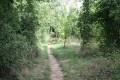
Just as the farm track bends almost at a right angle to the right and is joined by a very shaded farm track on the left, take the small, straight path opposite. After a few hundred metres, this narrow but well-marked path leads back to the crossroads you passed at the start of the route on leaving the hamlet of Pied d’Ouaille.
(1) From there, follow the same road as on the way out, passing through the hamlet of Pied d’Ouaille to return to the Lac du Lambon car park (S/E).


 At point 5, near the houses, there are dogs guarding the two farms. They aren’t tied up, so when you walk past the farms, they bark and growl at you; one of them even ran towards us. Don’t run away yourself – stay calm and carry on; they won’t harm you. So be careful if you’re afraid of dogs or if you’re with children – they’re imposing dogs, and we didn’t feel very comfortable passing through this section.
  Visorando Member
 Easy
Easy