Sarrat de Culège from Luchon

A lovely walk starting from Luchon.
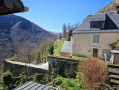
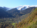
You can admire the surroundings of the spa town throughout the walk.
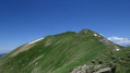
You can extend the walk by continuing along the ridge towards Cap de la Pène and Cap de la Montagnette.

Details

n°5307666
Creation:
Last update:
Last review:
  • Walking
    Activity: Walking
  • ↔
    Distance: 7.53 mi
  • ◔
    Average duration: 6h 10 
  • ▲
    Difficulty: Difficult

  • ⚐
    Back to start: Yes
  • ↗
    Ascent: + 3,107 ft
  • ↘
    Descent: - 3,097 ft

  • ▲
    Highest point: 4,895 ft
  • ▼
    Lowest point: 2,064 ft

Photos

Description of the walk

You can park in the cemetery car park off the D618.

(S/E) Walk past the cemetery and take the path furthest to the right. The walk begins – follow the tracks.
The coordinates may not be exact, but the tracks are clear. Pass under the first electricity pylon and continue to follow the tracks.

(1) Just after that, one path branches off to the left and another to the right. Both lead to the same place. You can take the one on the left. You’ll come to a junction.

(2) Carry on straight ahead. You’ll then pass under a second pylon and come to a junction

(3) At the junction, take the path heading left towards Cazarilh; the path turns westwards into Cazarith-Laspènes – walk through the village until you reach the fountain.

(4) After the fountain, head uphill. At the end of the road, open the gate to rejoin the dirt track and continue the climb. Carry on straight ahead. After a bend, you’ll reach a junction with several signposts.

(5) Take the path furthest to the left, the one that climbs towards the headland. Carry on climbing, remembering to look back from time to time to admire the view of the Luchon valleys.

(6) When you reach Sarrat de Culège, at the start of the new climb, take the path that branches off to the left and soon joins a forest track. After about 1.5 km, the track takes a hairpin bend to the left, then another to the right.

(7) At this bend, ignore the path branching off to the left. Continue for about 500 m; a path branches off to the left.

(8) On your left, open the gate to take this path through the forest. Pass by a fountain. Continue southwards to the Ruisseau de Caure and, after a bend to the right, to the crossroads before the village of Saccourvielle.

(9) Leave the forest road and turn left, heading south, towards the Tour de Castel Blancat.

(10) Carry on straight ahead and, at the following junctions, keep to the left to return to the village of Cazarilh and its fountain.

(4) Back in Cazarilh, take the same path as on the way out to finish the walk and return to the cemetery car park (S/E).

Waypoints

  1. S/E : mi 0 - alt. 2,070 ft - Cemetery car park. Near the - One (rivière)
  2. 1 : mi 0.5 - alt. 2,559 ft - Pylon
  3. 2 : mi 0.64 - alt. 2,831 ft - Crossroads
  4. 3 : mi 0.73 - alt. 3,005 ft - Pylon
  5. 4 : mi 1.28 - alt. 3,225 ft - Cazarilh – The fountain
  6. 5 : mi 1.92 - alt. 3,842 ft - Junction after the bend
  7. 6 : mi 2.8 - alt. 4,846 ft - Sarat de Culège
  8. 7 : mi 4.16 - alt. 4,045 ft - Hairpin bend
  9. 8 : mi 4.32 - alt. 3,967 ft - Path on the left
  10. 9 : mi 4.77 - alt. 3,445 ft - Before Saccourvielle
  11. 10 : mi 5.23 - alt. 3,360 ft - Castel Blancat
  12. S/E : mi 7.53 - alt. 2,070 ft - Back at the car park

Notes

It’s a steep climb. Make sure you’re wearing sturdy shoes.
It’s windy at the headland. Take something to protect yourself from the wind.

Reviews and comments

4.7 / 5
Based on 1 review

Reliability of the description
4 / 5
Ease of following the route
5 / 5
Route interest
5 / 5
tegon
tegon

Overall rating : 4.7 / 5

Date of your route : Dec 29, 2022
Reliability of the description : ★★★★☆ Good
Ease of following the route : ★★★★★ Very good
Route interest : ★★★★★ Very good
Very busy route : Yes

I walked this route in the opposite direction to the description; in fact, what misled me was that the description states ‘after the fountain’ (point 4, Cazarilh), whereas it’s actually before the fountain on the right; it’s partly my fault as the signposts are clearly there
Heading in this direction, after the gate, it feels as though you’re entering a house; the front door is to the right of the path. As I was heading down, I asked the people there if I could pass (there are no yellow markers on this short stretch). Anyway,
Carrying on towards the Castel Blancat tower, I was surprised to spot, a few metres to the right on slightly higher ground, about ten vultures feasting on a sheep’s carcass alongside a few brave crows; the sight of them taking flight from there both impressed and frightened me.
Then, at point 9, I came across four hunting hounds fitted with tracking collars; they turned round and accompanied me back to point 8, where their owner collected them.
And I’d say that, as I walked, there was a constant view of the town of Luchon. Stop off at the little church in Cazarith, where a guestbook is available. A lovely walk with the snow-capped 3,000-metre peaks around Luchon. The Superbagnères ski resort was closed; no snow. About twenty walkers on the circular route, a few runners, then around thirty between Luchon and Cazarith in the early afternoon. I set off on this walk wearing a hat, gloves and a windcheater, but I very quickly ditched these layers because, with the rising sun and the fairly steep climb, it quickly got warm. With these high temperatures for the season, this sort of walk is perfect.

Machine-translated

Other walks in the area

For more walks, use our search engine .

The GPS track and description are the property of this route's author. Please do not copy them without permission.