maximepawlak

 Visorando Member
 Premium user
Sign up:
Published route(s)
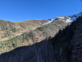
 From Goulier to the resort via the ridges and woods
 9.06 mi
 +2,667 ft
 -2,657 ft
 6h 30
6h 30
 Difficult
 Departure from Goulier (Ariège)
A lovely circular walk starting from Goulier, passing through the ski resort and following theGR®10.
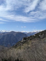
Col d'Ussat via Clot de la Carbonnière
 5.87 mi
+2,484 ft
-2,464 ft
4h 50
5.87 mi
+2,484 ft
-2,464 ft
4h 50
 Moderate
Departure from Ornolac-Ussat-les-Bains (Ariège)
Moderate
Departure from Ornolac-Ussat-les-Bains (Ariège)
Located on the outskirts of Tarascon-sur-Ariège, this hike gradually takes you up the slopes where you can admire the Ariège, Tarascon and several peaks of the Pyrenees!
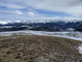
 Pic Fourcat from Col de Marmare
 5.00 mi
+1,919 ft
-1,906 ft
3 hrs
Moderate
Departure from Prades (Ariège) (Ariège)
5.00 mi
+1,919 ft
-1,906 ft
3 hrs
Moderate
Departure from Prades (Ariège) (Ariège)
On the outskirts of Ax les Thermes, this walk along the ridges offers exceptional panoramic views.
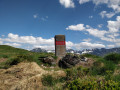
Tuc des Pans
 7.72 mi
+3,996 ft
-3,993 ft
7h 00
Difficult
Departure from Fos (Haute-Garonne)
7.72 mi
+3,996 ft
-3,993 ft
7h 00
Difficult
Departure from Fos (Haute-Garonne)
In Fos, just before the Spanish border, this walk takes you through woodland and along a ridge where you’ll pass several border markers. The climb is very steep at the start but offers magnificent views.
I recommend using a GPS or the app, particularly between points (3) and (4), where the path is not visible.