


Refine your search for walks in Sargé-sur-Braye
Sargé-sur-Braye walks


 Les Galouries and the La Mutte quarries
 Visorando Member
 4.83 mi
 +308 ft
 -341 ft
 2h 30
2h 30
 Easy
Easy
 Departure from Sargé-sur-Braye (Loir-et-Cher)
An easy circular walk. One point of interest is the La Mutte quarries, which for many centuries produced the stone known as ‘roussard’, used in construction throughout the region. This stone is easily spotted on houses in the village of Sargé-sur-Braye, amongst other places. A picnic table (seating 6 people) is available at these quarries.
The Calaisienne Loop
 Tourism professional
 9.62 mi
+318 ft
-305 ft
4h 40
9.62 mi
+318 ft
-305 ft
4h 40
 Moderate
Departure from Saint-Calais (Sarthe)
Moderate
Departure from Saint-Calais (Sarthe)
The evolution of Saint-Calais is evident in its town planning, which developed in the Middle Ages on either side of the Anille. On the right bank, the former abbey site founded inthe 6th century is still visible in the two tall gables of the current resource centre. During the Revolution, it gave way to another administrative centre with imposing buildings and the straight streets typical ofthe 19th century. On the left bank, on the hillside between the river and the castle founded inthe 11th century to rival the powerful abbey, you can easily make out the medieval quarter, which was built around the axis of the Grande Rue on an irregular and densely packed grid of plots.
The ‘Route des Cormiers’
 10.01 mi
+541 ft
-512 ft
5h 05
Moderate
Departure from Conflans-sur-Anille (Sarthe)
10.01 mi
+541 ft
-512 ft
5h 05
Moderate
Departure from Conflans-sur-Anille (Sarthe)
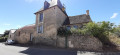
Setting off from this village-street with its rich architectural heritage, head along the ancient sunken paths, sections (1) to (6) ofthe GR®® 235, lined with a variety of trees – oaks, service trees, serviceberries, wild pear trees and so on – offering walkers an enchanting, shaded route. These paths, in the heart of the rolling countryside of the Perche Sarthois, are linked by a network of quiet country lanes, offering stunning 180° panoramic views from the higher points.
Route of photography from Conflans-sur-Anille
 14.34 mi
+617 ft
-600 ft
7h 10
14.34 mi
+617 ft
-600 ft
7h 10
 Difficult
Departure from Conflans-sur-Anille (Sarthe)
Difficult
Departure from Conflans-sur-Anille (Sarthe)
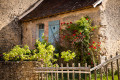
Situated on a small spur at the confluence of the Anille and Roulecrotte rivers, the village, first mentioned in the 13th century, retains several old houses, including the town hall, a former presbytery built in the 15th century. The church, rebuilt around 1780, features a beautiful collection of murals painted around 1860 using potassium silicate (a new technique for the time).
In the eye of the Saint-Jean Fountain
 9.14 mi
+354 ft
-344 ft
4h 30
Moderate
Departure from Montaillé (Sarthe)
9.14 mi
+354 ft
-344 ft
4h 30
Moderate
Departure from Montaillé (Sarthe)
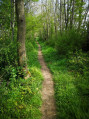
Montaillé has developed around two centres: the village centre, built up around the church, and La Brenaille, a cluster of hamlets and farms to the north of the village. The site of La Brenaille appears to have been inhabited since ancient times, whilst the village centre seems to have been settled during the Gallo-Roman period, as evidenced by the route of an ancient road between Le Mans and Orléans. ‘Montaillé’ likely derives from a contraction of the Latin ‘montem’, meaning mountain or high ground, and the name ‘Alhierus’, a Germanic name that may have referred to the landowner following the barbarian invasions ofthe 5th century. As the name suggests, the land is situated on high ground and is close to a stream, the Pibeau, and a spring, the Fontaine Saint Jean-Baptiste.
Over hill and dale to Courtanvaux
3.93 mi
+177 ft
-190 ft
2h 00
Easy
Departure from Bessé-sur-Braye (Sarthe)
The Braye, celebrated in song by Ronsard, meets the Loir here. Whilst Bessé-sur-Braye is best known to locals for its thriving paper industry, this village in the Calais region is also home to a Renaissance gem, the Château de Courtanvaux, which is said to have hosted Henry IV. Its large wooded park is open to the public all year round, and serves as the starting point for this walk, which also takes you through lovely countryside along a small tarmac road.
The Jewel of Courtanvaux
 4.41 mi
+305 ft
-322 ft
2h 20
Easy
Departure from Bessé-sur-Braye (Sarthe)
4.41 mi
+305 ft
-322 ft
2h 20
Easy
Departure from Bessé-sur-Braye (Sarthe)
Bessé dates back to the Middle Ages. At that time, the parish comprised numerous fiefdoms, including Courtanvaux, a parish seigneury elevated to a marquisate in 1609. The village developed particularly from the18th century onwards thanks to the establishment of pre-industrial sites, as evidenced by the cotton mill set up by Elie Savatier in 1735 (on the site of a former linen weaving mill) or the paper mill established at La Roche in 1824. The latter has since become the town’s main industrial site.
Lunay Pond
 6.00 mi
+269 ft
-276 ft
3h 00
Easy
Departure from Lunay (Loir-et-Cher)
6.00 mi
+269 ft
-276 ft
3h 00
Easy
Departure from Lunay (Loir-et-Cher)
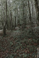
A pleasant little walk through woods and vineyards.
La Redonne
 8.53 mi
+351 ft
-367 ft
4h 15
Moderate
Departure from La Chapelle-Huon (Sarthe)
8.53 mi
+351 ft
-367 ft
4h 15
Moderate
Departure from La Chapelle-Huon (Sarthe)
La Chapelle-Huon developed gradually from the Middle Ages onwards. Saint-André Church is a Romanesque building (11th–12th century) with a Renaissance seigneurial chapel added later. The current bell tower was built in 2000 as part of the building’s general restoration. On this occasion, contemporary stained-glass windows were added to enhance the interior. Saint-Gervais-de-Vic likely has very ancient origins. The place name ‘Vic’, from the Latin vicus, meaning village, may refer to the Gallo-Roman period. Iron slag and pottery shards, discovered during work on the railway line, are also evidence of an ancient presence. Admire the15th- and16th-century Manoir de la Béchuère, the Redonne stream and the beautiful wooded countryside.
A map and full description of the route are available in the Perche Sarthois Hiking Guide (50 routes). On sale at Perche Sarthois tourist offices for €10.
Petit Pont to Azé circular route
4.32 mi
+226 ft
-217 ft
2h 10
Easy
Departure from Azé (Loir-et-Cher)
An easy, family-friendly walk in a lovely little village.
Circular route around Buissay
 5.51 mi
+174 ft
-174 ft
2h 40
Easy
Departure from Azé (Loir-et-Cher)
5.51 mi
+174 ft
-174 ft
2h 40
Easy
Departure from Azé (Loir-et-Cher)
A walk through the forest along the Boulon and through beautiful valleys. A family walk.
Along the Boulon in Mazangé
 5.93 mi
+259 ft
-259 ft
2h 55
Easy
Departure from Mazangé (Loir-et-Cher)
5.93 mi
+259 ft
-259 ft
2h 55
Easy
Departure from Mazangé (Loir-et-Cher)
A very beautiful walk along the Boulon Valley.
The cave dwellings of Les Roches-Lévêque
4.25 mi
+351 ft
-348 ft
2h 15
Easy
Departure from Les Roches-l'Évêque (Loir-et-Cher)
Situated between the Loir and the rock on the hillside, this route allows you to discover a picturesque natural heritage, typical of the Loir Valley and its troglodyte dwellings.
The ore route in Vibraye
 6.49 mi
+243 ft
-269 ft
3h 10
Moderate
Departure from Vibraye (Sarthe)
6.49 mi
+243 ft
-269 ft
3h 10
Moderate
Departure from Vibraye (Sarthe)
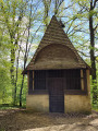
Rated as easy, this hike crosses the Vibraye Forest. To make it a circular route, allow about 3 hours and do not leave the marked trail, which is public. Unlike the forest, which is private, the route is marked with round signs 10 cm in diameter reminiscent of the work of the forge. You are in the Haut Maine region. In the Middle Ages, this region was home to a significant metallurgical industry, made possible by the presence of iron ore, extracted from flint clay and quartz sand, as well as the large quantities of wood needed for the forges. The forest was managed by cutting down coppice wood every 18 years to renew the resource. The dominant species is oak, but the forest also consists of aspens, birches, chestnuts and pines. This pleasant route describes a craft activity through the display boards scattered around the former mining sites.
Route du père from Vibraye
 9.68 mi
+453 ft
-449 ft
4h 50
Moderate
Departure from Vibraye (Sarthe)
9.68 mi
+453 ft
-449 ft
4h 50
Moderate
Departure from Vibraye (Sarthe)
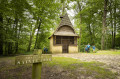
The village is characterised by the presence of the forest. This enabled its owner, the Marquis de Vibraye, to establish forges on the Braye river in Champrond in the early 17th century, where charcoal from the forest fuelled the furnaces producing pig iron and wrought iron until 1913. The trail partly follows the route taken by the convoys laden with heavy iron bars to the workshop in the hamlet of La Fenderie, on the pond of the same name. At La Bouverie, another vanished hamlet, eight houses provided accommodation for the forges’ carters, whilst charcoal burners and miners lived in makeshift huts. Now silent once more, the forest retains of this past activity only the network of paths. Part of it is now a Natura 2000 site.
Along the hillside of Thoré-la-Rochette
 6.47 mi
+394 ft
-390 ft
3h 20
Moderate
Departure from Thoré-la-Rochette (Loir-et-Cher)
6.47 mi
+394 ft
-390 ft
3h 20
Moderate
Departure from Thoré-la-Rochette (Loir-et-Cher)
This route will take you from the world of vineyards to the defence line of the Saint-Rimay Tunnel. From cellars to blockhouses, you will also discover two restoration projects led by the Résurgence association along the way.
A beautiful view of the Loir valley will accompany you for much of your journey.