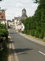
Circular route around Buissay

A walk through the forest along the Boulon and through beautiful valleys. A family walk.

Details

2455845
Creation:
Last update:
Last review:
  • Walking
    Activity: Walking
  • ↔
    Distance: 5.51 mi
  • ◔
    Average duration: 2h 40 
  • ▲
    Difficulty: Easy

  • ⚐
    Back to start: Yes
  • ↗
    Ascent: + 174 ft
  • ↘
    Descent: - 174 ft

  • ▲
    Highest point: 499 ft
  • ▼
    Lowest point: 305 ft
  • ⚐ Country: France
  • ⚐ City: Azé (41100)
  • ⚑
    Start/End: N 47.856985° / E 1.017531°
  • ❏
    IGN map(s): Ref. 1919SB, 1920SB
  • Hour-by-hour weather

Photos

Description of the walk

Park on the left-hand side of the road just before Buissay when coming from Azé.

(S/E) Head straight on (north-east).

(1) At the junction, carry on straight ahead towards Rahart.

(2) Turn left onto the path and enter the Bois des Reculées.

(3) Carry on straight ahead through the woods and then along the edge, ignoring the path on the left further on.

(4) At the end of the Bois Cochon, ignore the first path on the left and continue left towards the hamlet of Bois Malon.

(5) Just before the hamlet, turn left towards the oldGRP® and then left again. Continue along this path.

(6) Go straight on and ignore the path marked ‘Unisylva’ on the left. Further on, ignore the path on the right (marked red and yellow) and then the one on the left (Unisylva No. 1 on the tree) to continue straight on. Finally, at the bend, ignore the path on the right (private property) and you will reach a junction.

(7) Head down the path on the right, cross a small concrete bridge before heading back up. Further up, ignore the path on the right (private property – traps) and continue to the left

(8) Leave the woods and turn left onto a slightly wider path running alongside the woods on the left and meadows on the right. At the end of the path at La Roulière, turn left onto the road, then immediately afterwards, running alongside the estate, turn right and take the path that leads uphill.

(9) Turn left towards Le Petit Nuisement, then join the road and the car park (S/E).

Waypoints

  1. S/E : mi 0 - alt. 479 ft - Parking by the roadside before Buissay
  2. 1 : mi 0.2 - alt. 472 ft - Les Bellezeveries/Rahart crossroads
  3. 2 : mi 0.39 - alt. 472 ft - Path on the left
  4. 3 : mi 0.89 - alt. 459 ft - Bois des Reculées, straight ahead
  5. 4 : mi 1.41 - alt. 495 ft - Exit at Bois Cochon
  6. 5 : mi 1.87 - alt. 492 ft - Near Bois Malon, on the left
  7. 6 : mi 2.5 - alt. 486 ft - Crossroads, go straight on
  8. 7 : mi 3.04 - alt. 413 ft - Head down the path on the right
  9. 8 : mi 3.87 - alt. 318 ft - As you come out of the woods, turn left
  10. 9 : mi 4.98 - alt. 469 ft - Le Petit Nuisement
  11. S/E : mi 5.51 - alt. 479 ft - Parking by the roadside before Buissay

Notes

Park at the side of the road.
No water supply.
No toilets.
No shelters.

Worth a visit

Visit Les Bellezeveries, a model farm established in 1921 and now an equestrian centre.

Reviews and comments

4 / 5
Based on 3 reviews

Reliability of the description
3.7 / 5
Ease of following the route
4.3 / 5
Route interest
4 / 5
leriche gérard
leriche gérard

Overall rating : 4.7 / 5

Date of your route : May 14, 2022
Reliability of the description : ★★★★★ Very good
Ease of following the route : ★★★★★ Very good
Route interest : ★★★★☆ Good
Very busy route : No

An autumn walk. Lots of beautiful colours on the trees and on the ground, close to a site of definite geological interest: the source of the River Le Boulon and its dry valley. In fact, the route could make better use of this feature with the landowners’ consent.
It’s worth noting the lack of signposts.
A walk well worth recommending. GL

Machine-translated

thibault421
thibault421

Overall rating : 3.7 / 5

Date of your route : Sep 26, 2021
Reliability of the description : ★★★☆☆ Average
Ease of following the route : ★★★★☆ Good
Route interest : ★★★★☆ Good
Very busy route : No

A lovely walk with not much time spent on the road... and mostly through the forest.

Machine-translated

tango 1
tango 1

Overall rating : 3.7 / 5

Date of your route : Mar 01, 2021
Reliability of the description : ★★★☆☆ Average
Ease of following the route : ★★★★☆ Good
Route interest : ★★★★☆ Good
Very busy route : No

As this is an unmarked route, it is not advisable to use Unisylva signposts as a guide.
With the map, you can’t go wrong.
It’s a pleasant walk.

Machine-translated

Other walks in the area

For more walks, use our search engine .

The GPS track and description are the property of this route's author. Please do not copy them without permission.