Country:
 City:
City:


At the start of the path, where it meets the D56, there is a car park with space for two to three cars.
(S/E) Set off south-east, i.e. away from the D56. Walk up a gentle slope and follow the edge of the Bois des Galouries. When you reach a road, follow it as it continues.
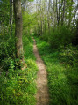
(1) Just before the junction with another road, turn left onto a footpath. Further on, enter a woodland and continue straight on until you reach the D56.
(2) Follow this road to the right on flat ground until you reach a junction at the foot of a water tower.
(3) Then turn left onto a small, flat road.
(4) After about 500 m, turn towards Les Petites Godinières. Continue along a path at the edge of the woods and ignore a turn-off on the right.
(5) You’ll come out onto a small road near the Belle Joyeuse farm; follow it to the left. Further on, join the GRP® Perche-Vendômois trail and follow it along the road (red and yellow markings).
(6) Take the first road on the right towards the Pierre du Breuil. Then take the first left. Ignore a turn-off on the right and follow the GRP® down a gentle slope to the entrance to the Carrières de la Mutte.
(7) Turn left for a short circular loop to explore the old Mutte quarries. There are information boards and a picnic table for six people.
(7) Return to the GRP® and follow it to the left. Ignore a path branching off to the right and you will eventually reach a junction.
(8) Turn left. Cross the D56 and you’ll immediately reach the car park (S/E).
 Tourism professional
 Moderate
 Visorando Member
 Difficult