Refine your search for walks in San-Gavino-di-Carbini
San-Gavino-di-Carbini walks


 Return trip from Cucuruzzu to the footbridge towards Zonza
 Visorando Member
 5.67 mi
 +725 ft
 -725 ft
 3h 15
3h 15
 Easy
Easy
 Departure from Levie (Corse-du-Sud)
A beautiful historical and cultural walk on a variant of the Mare à Mare Sud. A well-maintained and signposted trail for an easy family hike, mostly shaded, to a ruined mill and a beautiful footbridge. Return via the same route.
In Alta Rocca, around Zonza and Quenza
 9.14 mi
+1,755 ft
-1,772 ft
5h 45
9.14 mi
+1,755 ft
-1,772 ft
5h 45
 Moderate
Departure from Zonza (Corse-du-Sud)
Moderate
Departure from Zonza (Corse-du-Sud)
A beautiful walk in the Alta Rocca, following shaded paths cooled by the proximity of numerous streams. You also pass through the village of Quenza, where you can stop for a bite to eat. Best done in mid-season or even in summer when it is very hot.
I have been informed (September 2024) that the walk now starts from the restaurant La Ferme A Stadda, just below Zonza, 200 metres below point no. 1.
From Sorbollano to Serra di Scopamena and its heritage trail
 Local authority
 3.26 mi
+1,181 ft
-1,178 ft
2h 30
Easy
Departure from Sorbollano (Corse-du-Sud)
3.26 mi
+1,181 ft
-1,178 ft
2h 30
Easy
Departure from Sorbollano (Corse-du-Sud)
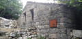
Starting from the village of Sorbollano, the route will take you to the village of Serra di Scopamena. As you enter this village, you’ll discover its historic built heritage – a mill, a wash house and a bread oven – via the heritage trail. You’ll then be treated to a magnificent panoramic view of the Rizzanese Valley and the village of Sorbollano.
Circular route around Sorbollano
 2.09 mi
+784 ft
-797 ft
1h 40
Easy
Departure from Sorbollano (Corse-du-Sud)
2.09 mi
+784 ft
-797 ft
1h 40
Easy
Departure from Sorbollano (Corse-du-Sud)
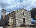
A very pretty circular walk around the village of Sorbollano. You’ll be walking through a very shaded setting, perfect for the heat of summer. You’ll discover old terraced fields, now covered by an imposing forest of holm oaks.
The Three Villages Trail starting from Quenza
 9.52 mi
+2,119 ft
-2,119 ft
6h 15
Moderate
Departure from Quenza (Corse-du-Sud)
9.52 mi
+2,119 ft
-2,119 ft
6h 15
Moderate
Departure from Quenza (Corse-du-Sud)
The Three Villages Trail offers a beautiful day's hike. Passing mainly through the Mare à Mare, this route allows you to discover authentic villages in the Alta Rocca region (Quenza, Serra di Scopamena and Sorbollano). You will follow connecting paths once used by locals to travel from village to village.
Punta di a Cuciurpula: in the footsteps of Lord Rinucciu della Rocca
 3.26 mi
+1,106 ft
-1,102 ft
2h 30
Moderate
Departure from Serra-di-Scopamène (Corse-du-Sud)
3.26 mi
+1,106 ft
-1,102 ft
2h 30
Moderate
Departure from Serra-di-Scopamène (Corse-du-Sud)
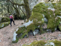
This is an attractive hike due to the panoramic views from the summit (view of the Rizzanese valley, the Aiguilles de Bavella, the Gulf of Valinco, etc.) and from a historical point of view. Indeed, numerous educational panels, starting from the point (3), retrace the history of the lord of Rinucciu Della Rocca and his castle. The descent to the village winds its way through impressive granite boulders, once inhabited, in a forest of holm oaks that is as beautiful as it is mysterious.
The Heritage Trail in Serra di Scopamena
 0.69 mi
+164 ft
-164 ft
0h 30
Easy
Departure from Serra-di-Scopamène (Corse-du-Sud)
0.69 mi
+164 ft
-164 ft
0h 30
Easy
Departure from Serra-di-Scopamène (Corse-du-Sud)
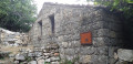
This walk will offer you a brief yet emotionally rich encounter with everything that constitutes a sign, a trace or a memory of the area. This sense of place will be brought to life through the many restored examples of dry-stone heritage (walls, fountains, wash houses, mills, etc.).
As you walk along this trail, you will be following in the footsteps of the generations who came before us and who have bequeathed to us an expression of civilisation and a testament to the history of a community.
The Sardinian plateau via Aullène from Serra di Scopamena
 6.07 mi
+958 ft
-928 ft
3h 35
Moderate
Departure from Serra-di-Scopamène (Corse-du-Sud)
6.07 mi
+958 ft
-928 ft
3h 35
Moderate
Departure from Serra-di-Scopamène (Corse-du-Sud)
A beautiful hike on the Sardinian plateau via the village of Aullène. Some of these trails connected villages in the days before roads existed. They are ideal for exploring the heights of Alta Rocca. This walk alternates between open and closed landscapes, holm oak forests and chestnut groves. A typical atmosphere of the Alta Rocca region.
Luviu sheepfolds and Monte Calva from the Illarata pass
 6.65 mi
+1,752 ft
-1,736 ft
4h 35
Moderate
Departure from Zonza (Corse-du-Sud)
6.65 mi
+1,752 ft
-1,736 ft
4h 35
Moderate
Departure from Zonza (Corse-du-Sud)
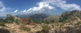
In Alta Rocca, in the Ospédale forest, a beautiful hike leads first along a shaded path to the Luviu sheepfolds in a beautiful clearing. From Monte Calva, after a short climb, there is a magnificent view of both sides of the island, to the south and the bay of Porto-Vecchio. At the Col d'Illarata (start and finish), to the west, the beautiful summit of the Pointe du Diamant (1,227 m) is clearly visible.
The Piscia di Gallu waterfall
 2.88 mi
+338 ft
-331 ft
1h 35
Moderate
Departure from San-Gavino-di-Carbini (Corse-du-Sud)
2.88 mi
+338 ft
-331 ft
1h 35
Moderate
Departure from San-Gavino-di-Carbini (Corse-du-Sud)
In French, cascade du pin, this is one of the seven wonders of the Alta Rocca. It's a truly beautiful 70-metre waterfall.
Punta di Serradu starting from Altagène
 5.00 mi
+1,575 ft
-1,575 ft
3h 40
Moderate
Departure from Altagène (Corse-du-Sud)
5.00 mi
+1,575 ft
-1,575 ft
3h 40
Moderate
Departure from Altagène (Corse-du-Sud)
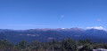
Only one climb and one descent, but what a beautiful view awaits you.
View of the villages of Alta Rocca: Zonza, Quenza and Serra di Scopamène, as well as the Bavella Needles.
Fumicosa Pass or Bocca di Fumicosa
 4.30 mi
+1,198 ft
-1,194 ft
3h 00
Moderate
Departure from Zonza (Corse-du-Sud)
4.30 mi
+1,198 ft
-1,194 ft
3h 00
Moderate
Departure from Zonza (Corse-du-Sud)
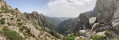
This is a hike off the beaten track where you are unlikely to meet many other walkers.
The name Fumicosa in the Corsican language evokes a smoky place, a metaphor here for a place where fog is quite common.
Circular Poggio di Tallano
 3.28 mi
+1,043 ft
-1,043 ft
2h 25
Moderate
Departure from Sainte-Lucie-de-Tallano (Corse-du-Sud)
3.28 mi
+1,043 ft
-1,043 ft
2h 25
Moderate
Departure from Sainte-Lucie-de-Tallano (Corse-du-Sud)
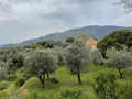
Starting from Poggio di Tallano, this circular route without any particular difficulties allows you to admire the Chapel of San Giovanni (St John the Baptist, a beautiful Romanesque church) and visit the pretty villages of Altagène, Sant'Andréa and Sainte-Lucie-de-Tallano.
There are many old buildings, fortified houses and an old oil mill along the way. Most of the route follows sunken paths, but this does not prevent you from enjoying magnificent views of the surrounding mountains.
The Punta di a Vacca Morta loop
 3.53 mi
+978 ft
-961 ft
2h 30
Moderate
Departure from Porto-Vecchio (Corse-du-Sud)
3.53 mi
+978 ft
-961 ft
2h 30
Moderate
Departure from Porto-Vecchio (Corse-du-Sud)
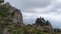
The 360° views from the summit over the bay of Porto-Vecchio, the Ospedale dam and the Alta Rocca are well worth the final climb, which is short but quite tough.
The loop starts near the Cartalavonu lodge, Le Refuge.
From Cartalavonu to the Bacinu Fountain via the Col de Bacinu
 4.80 mi
+1,444 ft
-1,450 ft
3h 30
Moderate
Departure from Porto-Vecchio (Corse-du-Sud)
4.80 mi
+1,444 ft
-1,450 ft
3h 30
Moderate
Departure from Porto-Vecchio (Corse-du-Sud)
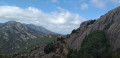
Head down to the Col de Bacinu via a balcony path, stopping off at a rocky plateau where a splendid view of Porto-Vecchio Bay awaits you. Continue on to the Bacinu Fountain and return via the same path.
To the Coscione Plateau via the official Shepherds’ Trail
 8.74 mi
+1,181 ft
-1,168 ft
5h 05
Moderate
Departure from Quenza (Corse-du-Sud)
8.74 mi
+1,181 ft
-1,168 ft
5h 05
Moderate
Departure from Quenza (Corse-du-Sud)
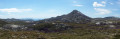
A marked discovery route on the southern side of the Coscione plateau from the Bucchinera Refuge, known as the Shepherds’ Trail, offering magnificent views of the plateau, the pozzines (wet meadows), Monte Incudine, the Aiguilles de Bavella and, in the distance, Monte Rotondo. The route follows the ‘Sentier des Bergers’, which is signposted and authorised by the plateau wardens to protect the pozzines. It is the longest circular route among the various circular routes on offer. Please note that many of the paths shown on the IGN TOPO25 map are unauthorised, and access to them is discouraged by information boards.
Bavella - Velaco - Promontoire - Bavella loop
 4.85 mi
+1,631 ft
-1,647 ft
3h 40
4.85 mi
+1,631 ft
-1,647 ft
3h 40
 Difficult
Departure from Quenza (Corse-du-Sud)
Difficult
Departure from Quenza (Corse-du-Sud)
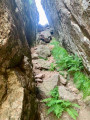
This loop allows you to visit the various remarkable points of the southern Bavella massif (Velacu massif), including Punta Velacu, the Promontory, the Campanile de Sainte-Lucie, the tafonu di u Cumpuleddu (incorrectly called "trou de la bombe" or "bomb hole"), the belvedere and the chapel, through the forest and rocky peaks. Magnificent views of the ravines of Punta Velacu and Calanca Murata, all with less than 500 m of elevation gain.
Col de Bavella: "U Cumpuleddu" (The Bomb Hole)
 3.54 mi
+643 ft
-663 ft
2h 10
Moderate
Departure from Quenza (Corse-du-Sud)
3.54 mi
+643 ft
-663 ft
2h 10
Moderate
Departure from Quenza (Corse-du-Sud)
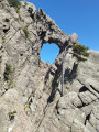
This hike will take you to "U Cumpuleddu", more commonly known as "Trou de la Bombe" (Bomb Hole), a geological formation caused by erosion. The route also offers beautiful views of the Aiguilles de Bavella mountain range. Much of the hike takes place under the cover of Laricio pine trees.
Tour of the Aiguilles de Bavella
 6.82 mi
+2,841 ft
-2,854 ft
7 hrs
6.82 mi
+2,841 ft
-2,854 ft
7 hrs
 Very difficult
Departure from Quenza (Corse-du-Sud)
Very difficult
Departure from Quenza (Corse-du-Sud)
A sublime hike around the Aiguilles de Bavella.
A long and demanding hike (see practical information).