Country:
 City:


Aullène is situated on the RD420, which links Petreto-Bicchisano to Zonza. Free parking is available in the square or in the adjacent streets.
The start is on the main square, at the junction of the RD420 and the RD69, in front of the small hut housing the Alta Rocca tourist information office.
The path is signposted at the start by pink markings and then by light blue arrows (painted metal triangles).
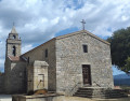
(S/E) From the square, behind the tourist information office, go down the steps leading to the foot of the old Protestant church, which was in use for a few years at the start of the 20th century.
To the left of the church, a small gate leads to a path that descends until it crosses the little stream (don’t forget to close any gates you come across along the way).
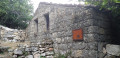
Once you reach the stream, which you cross, you’ll find a wash house that was renovated some time ago but has since been somewhat neglected.
Continue along the path which runs alongside some small gardens before heading back up Rue Santarella (RD 69).
(1) Without crossing the road, head back up to the left along the same pavement until you reach a large trough which was once used to water horses and livestock, particularly during the Saint-Antioche fair. Retrace your steps.
(1) Cross the street and take a narrow alleyway that winds its way between the houses until you reach a small street; follow this to the right to reach the square in front of Saint-Nicolas Church.
(2) The church, built in the early 19th century, features a rather curious pulpit supported by winged dolphins resting on a Moor’s head (a reference to Corsican history?).
Walk westwards past the church and up alongside the (superb) cemetery to an orientation point, from where there is a magnificent view of the village and the surrounding mountains.
Return towards the village via the main road (RD 420) and take the road branching off to the right above the Hôtel Restaurant de la Poste.
You are now on the Chemin de la Chapelle de Saint-Antioche, which is still celebrated on the first Sunday in August. On that day, right up until the Second World War, Aullène hosted Corsica’s largest livestock fair.
For the more adventurous, the chapel is about 700 m away, following Rue Cardelli.
(3) When you reach a small square, turn left (blue arrow) and head back down towards the village square. Cross the road (RD 69) and take Rue Andriaccia opposite, which starts to the left of a small café terrace.
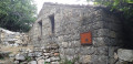
Walk up the street until you reach a small path on the right, marked by another blue arrow. At the top, turn left and walk alongside a partially ruined wall featuring a remarkable old stone washbasin (information panel).
Carry on and head back down the street to the left, then take the first left-hand bend opposite (blue arrow). The path takes you back onto the RD420 road, which you follow to the left until you come within sight of the Protestant church and the Alta Rocca information office (S/E).

 Local authority
 Moderate

 Visorando Member