The Punta di a Vacca Morta loop

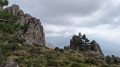
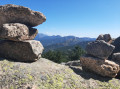
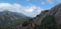
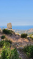
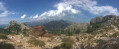
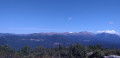
The 360° views from the summit over the bay of Porto-Vecchio, the Ospedale dam and the Alta Rocca are well worth the final climb, which is short but quite tough.
The loop starts near the Cartalavonu lodge, Le Refuge.

Details

1609497
Creation:
Last update:
Last review:
  • Walking
    Activity: Walking
  • ↔
    Distance: 3.53 mi
  • ◔
    Average duration: 2h 30 
  • ▲
    Difficulty: Moderate

  • ⚐
    Back to start: Yes
  • ↗
    Ascent: + 978 ft
  • ↘
    Descent: - 961 ft

  • ▲
    Highest point: 4,298 ft
  • ▼
    Lowest point: 3,356 ft

Photos

Description of the walk

Park in the car park near the "Le Refuge" lodge in Cartalavonu.

(S/E) Head west on the path (signposted Vacca Morta).
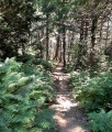
This path climbs gradually to a crossroads with several directions.

(1) Turn left towards Foce Alta. After a short distance, an orange-marked rock on the left indicates the direction to follow.
When you reach the pass, turn right onto the path, dotted with numerous cairns, which climbs steeply to Punta di Vacca Morta.

(2) Descend by the same path to the crossroads you passed earlier.

(1) Take the Mare Mare Sud trail on the left towards Carbini until you reach a new, well-marked crossroads at a spring.

(3) Go down to the right, cross a first and then a second path, follow it to the right before leaving it on the left to reach a car park along the road.

(4) Take this road on the right until you reach the stopover lodge (S/E).

Waypoints

  1. S/E : mi 0 - alt. 3,356 ft - Stopover lodge car park
  2. 1 : mi 0.71 - alt. 3,832 ft - Vacca Morta / Carbini crossroads
  3. 2 : mi 1.12 - alt. 4,295 ft - Punta di a Vacca Morta
  4. 3 : mi 2.02 - alt. 3,720 ft - Leave Mare Mare Sud and turn right
  5. 4 : mi 2.95 - alt. 3,468 ft - Parking on the Cartalavonu road
  6. S/E : mi 3.53 - alt. 3,356 ft - Stopover lodge car park

Notes

From Foce Alta, several drovers' roads lead to the summit. Numerous cairns.
Between (3) and (4) There is no water source before the valley.

Worth a visit

(S/E) Large car park and restaurants.
Coming from Porto-Vecchio, stop at the exit of the village of Ospédale to admire the view of Porto-Vecchio Bay.
At the summit of Punta di a Vacca Morta, enjoy a 360° panorama.

Reviews and comments

4.5 / 5
Based on 57 reviews

Reliability of the description
4.5 / 5
Ease of following the route
4.2 / 5
Route interest
4.7 / 5
Pat1969
Pat1969

Overall rating : 3.3 / 5

Date of your route : Sep 14, 2026
Reliability of the description : ★★★☆☆ Average
Ease of following the route : ★★★★☆ Good
Route interest : ★★★☆☆ Average
Very busy route : Yes

The walks started off really well with lovely views – absolutely magnificent!! It was just the end – the last kilometre back on the tarmac – that was a bit of a let-down. It’s a shame; we should have chosen a different route!! 😉

Machine-translated

User 30993239

Overall rating : 4.7 / 5

Date of your route : Sep 05, 2026
Reliability of the description : ★★★★★ Very good
Ease of following the route : ★★★★★ Very good
Route interest : ★★★★☆ Good
Very busy route : Yes

Use the Visio Rando route, otherwise it’s impossible!
At checkpoint 1, the orange arrows indicate a turn, but you need to carry on straight up.
Then the entire climb after that sign is unmarked

Machine-translated

User 7076929
• Edited:

Overall rating : 5 / 5

Date of your route : Aug 26, 2026
Reliability of the description : ★★★★★ Very good
Ease of following the route : Not used / Not applicable
Route interest : ★★★★★ Very good
Very busy route : No

A fairly easy route with a magnificent 360° view at the end. The GPS track is spot on. However, there are virtually no signposts.

Machine-translated

Grizz33
Grizz33

Overall rating : 4 / 5

Date of your route : Aug 16, 2026
Reliability of the description : ★★★★☆ Good
Ease of following the route : ★★★★☆ Good
Route interest : ★★★★☆ Good
Very busy route : Yes

A lovely walk, with a good portion through the forest and a stunning view from the summit. The walk is fairly busy, but nothing too bad; the only potential issue is the summit itself if visitors linger too long.

Machine-translated

User 29373542

In June, we didn’t come across a single soul! A lovely, shaded walk with no difficulty and a magnificent panoramic view – well worth doing

Machine-translated

iangot
iangot

Overall rating : 5 / 5

Date of your route : Aug 03, 2026
Reliability of the description : ★★★★★ Very good
Ease of following the route : ★★★★★ Very good
Route interest : ★★★★★ Very good
Very busy route : No

It really is a lovely walk, well worth doing even in hot weather as much of it is through woodland. The final ascent takes you up over rocky terrain, but it’s not too difficult if you’re wearing trainers or walking boots. The view over Lake Ospédale is superb. On the way back down, the shaded path was so pleasant that we extended the walk by just over a kilometre (from point 3, follow the path marked in white on the map, which takes a hairpin bend to rejoin the path marked in red). 7.09 km with 348 m of elevation gain. Hike reference no. 102629678.

Machine-translated

User 29373542

Overall rating : 4 / 5

Date of your route : Jun 22, 2026
Reliability of the description : ★★★★☆ Good
Ease of following the route : ★★★★☆ Good
Route interest : ★★★★☆ Good
Very busy route : No

In June, we didn’t come across a single soul! A lovely, shaded walk with no difficulties and a magnificent panoramic view – well worth a go

Machine-translated

User 29373542

Overall rating : 4 / 5

Date of your route : Jun 22, 2026
Reliability of the description : ★★★★☆ Good
Ease of following the route : ★★★★☆ Good
Route interest : ★★★★☆ Good
Very busy route : No

In June, we didn’t see a soul! A lovely, shaded walk with no difficulty at all and a magnificent panoramic view – well worth doing

Machine-translated

User 3527446

Overall rating : 4.7 / 5

Date of your route : Jun 07, 2026
Reliability of the description : ★★★★★ Very good
Ease of following the route : ★★★★★ Very good
Route interest : ★★★★☆ Good
Very busy route : Yes

A lovely walk offering stunning views. However, it is not possible to reach the base of the waterfall as it is too dangerous (there is a ‘no entry’ sign). The waterfall can only be seen from a viewing platform higher up, from a distance that doesn’t really do justice to its beauty. A bit of a let-down on arrival.
We recommend wearing sturdy footwear!

Machine-translated

Mantachr
Mantachr

Overall rating : 4 / 5

Date of your route : Jun 29, 2026
Reliability of the description : ★★★★☆ Good
Ease of following the route : ★★★☆☆ Average
Route interest : ★★★★★ Very good
Very busy route : No

There’s a lovely view once you reach the summit. In my opinion, the final stretch along the road is rather uninteresting. A lovely walk all the same.

Machine-translated

User 16537359

Not done

Machine-translated

sylviane henner
sylviane henner

Overall rating : 4.7 / 5

Date of your route : Jun 12, 2026
Reliability of the description : ★★★★★ Very good
Ease of following the route : ★★★★☆ Good
Route interest : ★★★★★ Very good
Very busy route : No

A lovely walk with a magnificent 360° view from the summit. No particular difficulties. If in doubt about the route, follow the cairns. Follow the orange markings up to the turning point at the summit, then follow the yellow markings.

Machine-translated

Joël 30
Joël 30

Overall rating : 4 / 5

Date of your route : May 23, 2026
Reliability of the description : ★★★★☆ Good
Ease of following the route : ★★★☆☆ Average
Route interest : ★★★★★ Very good
Very busy route : No

A lovely walk offering exceptional views of both the eastern and western gulfs, as well as Lake Ospedale, from the summit and even before reaching it. However, as mentioned in other reviews, the walk through the forest alone is well worth the trip. It’s worth noting that the second part of the circular route—the prettiest section—is also the easiest. The climb isn’t very difficult but requires good footwear and means you need to be comfortable on a path that can be a bit uneven at times. Finally, it’s true that the signposting leaves a bit to be desired and it’s best to use the app for guidance.

Machine-translated

jacquespat
jacquespat

Overall rating : 4 / 5

Date of your route : May 19, 2026
Reliability of the description : ★★★★☆ Good
Ease of following the route : ★★★☆☆ Average
Route interest : ★★★★★ Very good
Very busy route : No

Moderate difficulty, but the effort is rewarded by the view from the top of the hike.

Machine-translated

Prisca77
Prisca77

Overall rating : 4.7 / 5

Date of your route : Sep 15, 2025
Reliability of the description : ★★★★★ Very good
Ease of following the route : ★★★★☆ Good
Route interest : ★★★★★ Very good
Very busy route : Yes

We really enjoyed the hike, even though the weather wasn't ideal and we couldn't enjoy the views.

Machine-translated

Other walks in the area

For more walks, use our search engine .

The GPS track and description are the property of this route's author. Please do not copy them without permission.