To the Coscione Plateau via the official Shepherds’ Trail

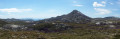
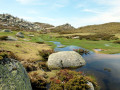
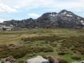
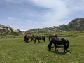
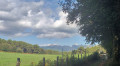
A marked discovery route on the southern side of the Coscione plateau from the Bucchinera Refuge, known as the Shepherds’ Trail, offering magnificent views of the plateau, the pozzines (wet meadows), Monte Incudine, the Aiguilles de Bavella and, in the distance, Monte Rotondo. The route follows the ‘Sentier des Bergers’, which is signposted and authorised by the plateau wardens to protect the pozzines. It is the longest circular route among the various circular routes on offer. Please note that many of the paths shown on the IGN TOPO25 map are unauthorised, and access to them is discouraged by information boards.

Details

95327534
Creation:
Last update:
Last review:
  • Walking
    Activity: Walking
  • ↔
    Distance: 8.74 mi
  • ◔
    Average duration: 5h 05 
  • ▲
    Difficulty: Moderate

  • ⚐
    Back to start: Yes
  • ↗
    Ascent: + 1,181 ft
  • ↘
    Descent: - 1,168 ft

  • ▲
    Highest point: 5,276 ft
  • ▼
    Lowest point: 4,393 ft
  • ⚐ Country: France
  • ⚐ City: Quenza (20122)
  • ⚑
    Start/End: N 41.805481° / E 9.13472°
  • ❏
    IGN map(s): Ref. 4253OT
  • Hour-by-hour weather

Photos

Description of the walk

The starting point is accessible by car from the village of Quenza, following signs for Plateau de Coscione. As the road is in poor condition, stop in a standard car 3 km before the Bucchinera cross-country ski lodge at a place called Bifurgia. Please note: there is no designated parking; you must park on the roadside.

(S/E) Follow the road as it climbs to reach the Bucchinera cross-country ski lodge.

(1) Go round the refuge and then take the Sentier des Bergers on the left (signposted), which heads off to the right towards the Castellu d’Ornucciu massif. You will reach the Ruisseau de Codi.

(2) Take care here: follow the route on the map and the information on the signs carefully. Keep to the right, following the ‘Sentier des Bergers’ sign. You will meet the Ruisseau de Codi again at a footbridge.

(3) Do not take this footbridge; instead, continue along the left bank of the stream, crossing it further on to reach the Pian d'Ornucciu spring.

(4) Continue along an almost level path until you reach a crossroads with several directions.

(5) Turn right heading due south; you will soon come to a T-junction.

(6) Turn left, then head towards the Chiralbella sheepfold.

(7) Head towards the Massif Castellu d'Ornucciu on the right, reaching the hamlet of Vigna d'Ornucciu.

(8) Here, take a detour from the IGN route to finish with a gentle climb to a pass.

(9) Cross the pass and, now heading downhill, make your way to the Bucchinera cross-country ski lodge.

(1) Follow the route taken on the way out in the opposite direction to return to the Bifurgia car park (S/E).

Waypoints

  1. S/E : mi 0 - alt. 4,396 ft - Roadside car park at Bifurgia
  2. 1 : mi 1.85 - alt. 5,020 ft - Bucchinera refuge
  3. 2 : mi 2.17 - alt. 5,010 ft - Sign for the Shepherds’ Trail
  4. 3 : mi 2.52 - alt. 5,062 ft - Codi Footbridge
  5. 4 : mi 3.29 - alt. 5,177 ft - Pian d'Ornucciu
  6. 5 : mi 3.94 - alt. 5,249 ft - Crossroads with several directions
  7. 6 : mi 4.23 - alt. 5,226 ft - T-junction
  8. 7 : mi 4.53 - alt. 5,249 ft - Chiralbella sheepfold
  9. 8 : mi 5.07 - alt. 5,128 ft - Crossroads: alternative routes
  10. 9 : mi 6.36 - alt. 5,171 ft - Pass
  11. S/E : mi 8.74 - alt. 4,396 ft - Roadside car park at Bifurgia

Notes

Information is available at the Bucchinera Refuge and on signs along the trail.
There are no water points or toilets along the route (refuge and sheepfold).
The pozzines are a very fragile environment; please explore them only via the designated path and do not walk elsewhere.

Please note: the access road from Quenza is in poor condition as, being a private road, it has never been maintained. In April 2026, access by a standard car is possible as far as the starting point of this hike, located 3 km before the Bucchinerale cross-country ski lodge, which is the official starting point of the marked trail. To continue, a 4x4 vehicle is required.

Worth a visit

(1) On the return journey to the Bucchinera cross-country ski lodge, from the pass between Monte Canoso and Punta di a Funtana Spartula, don’t miss the view of:
- the Aiguilles de Bavella behind you,
- the mountain ranges to the north: Monte Renoso, d'Oro and Rotondo in the background on the horizon to the right.

Other walks in the area

For more walks, use our search engine .

The GPS track and description are the property of this route's author. Please do not copy them without permission.