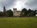
From Sorbollano to Serra di Scopamena and its heritage trail

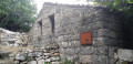
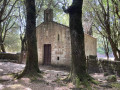
Starting from the village of Sorbollano, the route will take you to the village of Serra di Scopamena. As you enter this village, you’ll discover its historic built heritage – a mill, a wash house and a bread oven – via the heritage trail. You’ll then be treated to a magnificent panoramic view of the Rizzanese Valley and the village of Sorbollano.

Details

n°26868993
Creation:
Last update:
Last review:
  • Walking
    Activity: Walking
  • ↔
    Distance: 3.26 mi
  • ◔
    Average duration: 2h 30 
  • ▲
    Difficulty: Easy

  • ⚐
    Back to start: Yes
  • ↗
    Ascent: + 1,181 ft
  • ↘
    Descent: - 1,178 ft

  • ▲
    Highest point: 2,874 ft
  • ▼
    Lowest point: 1,752 ft
  • ⚐ Country: France
  • ⚐ City: Sorbollano (20152)
  • ⚑
    Start/End: N 41.751776° / E 9.109664°
  • ❏
    IGN map(s): Ref. 4253OT, 4254OT
  • Hour-by-hour weather

Photos

Description of the walk

You can park near the church in Sorbollano.

(S/E) From the church, take the steps on the left and follow the narrow lane which leads onto a tarmac road. When you reach a signpost, follow the signs for Serra di Scopamena. The path is marked in yellow. You will come to a junction with a road leading down to the sewage treatment plant.

(1) Cross the road and follow the yellow-marked path. Continue downhill, then climb slightly to reach the junction with the Mare à Mare route.

(2) Turn right here for a long climb, following the orange markings. Carry on until you reach another junction at the foot of the village of Serra-di-Scopamène.

(3) Carry on straight ahead towards Serra, following the orange markings. You’ll soon come to another crossroads with a signpost.

(4) Turn slightly right towards the mill, which is part of the Serra-di-Scopamène heritage trail. This is signposted with wrought-iron arrows. After passing the mill, join the main road. Turn left, continue along the road for about a hundred metres, then turn right, making sure to follow the wrought-iron arrows. You’ll come to a wash house, a fountain and a bread oven. Then head towards the Stop sign and turn right to reach a signpost.
Carry on straight ahead for about fifty metres to reach Serra-di-Scopamène Town Hall.

(5) Follow the same route back in the opposite direction; at the sign, veer right to reach the junction withthe first sign you passed on the way there.

(4) Turn right, towards Sorbollano, to return to the junction you also passed on the way there, the one at the bottom of the village of Serra-di-Scopamène.

(3) Leave the route you have already taken and turn left. Follow the yellow markings, cross a stream, then continue to the right along the path to return to the car park at Sorbollano church (S/E).

Waypoints

  1. S/E : mi 0 - alt. 2,356 ft - Car park at Sorbollano Church
  2. 1 : mi 0.25 - alt. 2,100 ft - Wastewater treatment plant
  3. 2 : mi 0.91 - alt. 1,768 ft - Mare a Mare junction
  4. 3 : mi 1.64 - alt. 2,572 ft - Crossroads – circular loop
  5. 4 : mi 1.75 - alt. 2,680 ft - Heritage Trail
  6. 5 : mi 2.45 - alt. 2,841 ft - Serra-di-Scopamena Town Hall
  7. S/E : mi 3.26 - alt. 2,359 ft - Car park at Sorbollano Church

Notes

(S/E) At the church, you can fill up with water from the fountain.

Water points in the villages of Sorbollano and Serra-di-Scopamena.

(5) A shop (bar/restaurant/pizzeria/grocery shop) with a stunning view of the Rizzanese Valley in the village of Serra-di-Scopamena.

Worth a visit

This route takes you along the heritage trail in the village of Serra-di-Scopamena.
You can combine this walk with Punta di a Cuciurpula, which will make for a 5-hour hike.

Reviews and comments

4.3 / 5
Based on 2 reviews

Reliability of the description
4 / 5
Ease of following the route
4 / 5
Route interest
5 / 5
cladid
cladid

Overall rating : 3.7 / 5

Date of your route : Aug 09, 2023
Reliability of the description : ★★★☆☆ Average
Ease of following the route : ★★★☆☆ Average
Route interest : ★★★★★ Very good
Very busy route : No

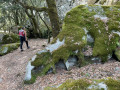
The start of the walk is in very poor condition. The rest of the route is well signposted and relatively well maintained. The route is well shaded. This route is classified as easy. It should be noted that, whilst there are no major difficulties, there is a continuous, physically demanding climb lasting approximately 1 hour 15 minutes.

Machine-translated

BAMX
BAMX

Overall rating : 5 / 5

Date of your route : Jun 06, 2023
Reliability of the description : ★★★★★ Very good
Ease of following the route : ★★★★★ Very good
Route interest : ★★★★★ Very good
Very busy route : No

Some lovely discoveries, especially the mill, which is in remarkable condition

Machine-translated

Other walks in the area

For more walks, use our search engine .

The GPS track and description are the property of this route's author. Please do not copy them without permission.