


 Country:

 City:
City:


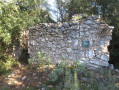
The walk starts from the car park by the old Saint-Zacharie pottery kilns, at the end of Rue des Malonniers.
(S/E) Return to the car park entrance and turn right onto Rue des Malonniers, then left onto Boulevard des Fours, following this road for approximately 200 m, passing the kilns.
(1) After number 1 on the boulevard, turn right, pass a small park and head down into the Huveaune riverbed, cross a metal bridge and follow the path back up to Avenue Jean Moulin. Turn left and walk for about 400 m to the junction of thefirst circular loop, just before the end.
(2) Turn right onto the path signposted: “Hostellerie de la Sainte Baume”. At the Fork in the road, 250 m further on, continue to the right. After a right-hand bend, you’ll reach a T-junction.
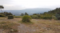
(3) Turn left. Follow the track for 2.5 km. You’ll reach the Plateau de la Mouère. Enjoy the panoramic view of Sainte Baume.
(4) Carry on straight ahead along the track until you reach a T-junction.
(5) Turn right and continue for about 500 m until you reach an X-junction (elevation 418).
(6) Leave the return path straight ahead and turn right; then, after a few dozen metres, turn right again (west). Continue along the track for 150 m, ignoring the paths branching off to the left, until you reach a path turning 90° to the left.
(7) Take this track, heading south-east, uphill. Climb for over 1 km, maintaining your direction and ignoring any paths branching off to the right and left. Shortly after the summit (alt. 550 m), you’ll reach a track.
(8) Begin the descent to the left for nearly 2 km until you reach a Y-junction where two tracks meet.
(9) Continue the descent to the right and, after about sixty metres, reach the junction of thesecond circular loop, which you passed on the way up.
(6) Carry on to the right along the track until you reach a T-junction (marker 384).
(10) Turn right to quickly reach another junction.
(11) Carry on to the right along the signpostedGR®9, which leads into the bed of the Huveaune (elevation 315).
(12) Continue along the stream until you join a path coming from the left.
(13) Carry on along the stream for about 2 km, passing the Moulin de la Sambuc (the owners are fairly lenient with walkers). You’ll eventually reach theGR®9Aand follow it to the left for about a hundred metres.
(14) Turn right towards the Fée des Eaux in Saint-Zacharie.
(15) Return to the path and admire the locks and an old Roman aqueduct a little further on.
Carry on until you reach a junction.
(16) Carry on straight ahead, moving away from the Huveaune, and return to the crossroads of thefirst circular route you passed on the way there.
(2) Follow the route back in the opposite direction to the outward journey to return to the car park (S/E).



 Visorando Member

 Difficult
 Easy
Easy 
