Around Saint-Zacharie

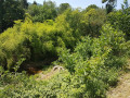
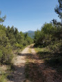
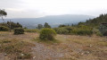
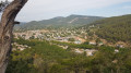
A walk through the forest for most of the route, which is particularly enjoyable on these summer days, taking in the Source des Nayes and the Ruisseau de Peyruis – which is unfortunately dry at the moment – with the return route along the banks of the Huveaune.

Details

35471877
Creation:
Last update:
Last review:
  • Walking
    Activity: Walking
  • ↔
    Distance: 5.98 mi
  • ◔
    Average duration: 3h 40 
  • ▲
    Difficulty: Moderate

  • ⚐
    Back to start: Yes
  • ↗
    Ascent: + 1,020 ft
  • ↘
    Descent: - 1,040 ft

  • ▲
    Highest point: 1,663 ft
  • ▼
    Lowest point: 846 ft

Photos

Description of the walk

The route starts from the car park on Boulevard des Fours, accessible via Rue des Mallonniers, at the eastern exit of Saint-Zacharie.

(S/E) Turn right, reach Boulevard Hoche, then follow the right bank of the Huveaune. You’ll come to a road.

(1) Turn left, follow the road for 150 m, then turn right at the junction onto Chemin des Nayes. Further on, stay on this track by turning left and following the signs for ‘Source des Nayes’. Continue straight on to reach a car park before the Ruisseau de Peyruis.

(2) Turn right, cross a small bridge over the stream and take the uphill track opposite. Follow this track until you reach the Route du Plan d’Aups. Cross it and climb, directly opposite, up a path that winds along the Ruisseau de Peyruis, which is almost dry at the moment (June 2023). The path, which does not always follow the IGN route, eventually reaches a junction; the path leading uphill from here goes to the Chapelle d’Orgnon, which is unfortunately on private land.

(3) Head straight down to the stream and continue straight ahead for 400 m past the stream, until you find a path leading uphill on the left.

(4) Follow this to reach a track. Cross it and head straight ahead, slightly to the right, along a well-marked path until you reach a Y-junction.

(5) Take a path on the left, which leads onto a cross-country track; follow this down to the left.

(6) Just before a bend to the left, take a path on the right, which does not follow the IGN route.
Continue for 400 m until you reach a small crossroads, then turn left. Join a track and turn right onto it, following it for 200 m until you reach a right-hand bend, after passing a meadow on your left.

(7) Turn left and you’ll soon reach a junction.

(8) Turn right, then, almost immediately afterwards, left. Continue straight on until you reach a track. Continue to the right along this track. After about 200 m, turn left onto a path. Continue along this path until you reach theGR® and follow it, turning right.

(9) Look out for the inconspicuous path on the right and head down into a wooded valley. Reach the Huveaune valley and follow theGR® to the left. Arrive at Avenue Jean Moulin and follow it to the left.

(10) Turn right towards the Huveaune, cross the footbridge and follow the right bank to reach the car park on Boulevard des Fours (S/E).

Waypoints

  1. S/E : mi 0 - alt. 883 ft - Boulevard des Fours car park
  2. 1 : mi 0.17 - alt. 869 ft - Chemin du Plan d’Aups
  3. 2 : mi 0.92 - alt. 866 ft - Car park
  4. 3 : mi 2.15 - alt. 1,112 ft - Chapel crossroads
  5. 4 : mi 2.47 - alt. 1,207 ft - Junction, path on the left
  6. 5 : mi 2.83 - alt. 1,512 ft - Junction, path on the left
  7. 6 : mi 3.31 - alt. 1,545 ft - Junction, path on the right
  8. 7 : mi 3.81 - alt. 1,266 ft - Path on the left
  9. 8 : mi 3.9 - alt. 1,234 ft - Crossroads, path on the right
  10. 9 : mi 5.19 - alt. 1,201 ft - Junction: GR to the right
  11. 10 : mi 5.74 - alt. 886 ft - Turn right towards the - Huveaune (fleuve)
  12. S/E : mi 5.98 - alt. 883 ft - Boulevard des Fours car park

Notes

(2) You can visit the Source des Nayes, located at the far end of the park on the left, before continuing along the track.

Always be cautious and plan ahead when you're outdoors. Visorando and the author of this route cannot be held responsible for any accidents occurring on this route.

The GR® and PR® markings are the intellectual property of the Fédération Française de Randonnée Pédestre.

Reviews and comments

3.9 / 5
Based on 4 reviews

Reliability of the description
4 / 5
Ease of following the route
3.5 / 5
Route interest
4.3 / 5
Valerie Urbain
Valerie Urbain

Overall rating : 3.7 / 5

Date of your route : Aug 11, 2025
Reliability of the description : ★★★★☆ Good
Ease of following the route : ★★★☆☆ Average
Route interest : ★★★★☆ Good
Very busy route : No

This route is more of a trail than a hike. A significant portion is marked as a trail. Be cautious of mountain bikes on the descent, as they do not always signal their presence. Otherwise, it is an ideal route on warm days as it is well shaded.

Machine-translated

francois stéphane
francois stéphane

Overall rating : 4 / 5

Date of your route : Jan 27, 2025
Reliability of the description : ★★★★☆ Good
Ease of following the route : ★★★☆☆ Average
Route interest : ★★★★★ Very good
Very busy route : No

A very lovely, very shaded walk, but with quite a few junctions where a moment’s inattention can lead to a longer route (which happened to us, but wasn’t a problem). The descent on the way back, on very damp ground, remains very slippery with a steep drop. Worth doing again, perhaps making it a bit longer.

Machine-translated

Claudine Wattrelot
Claudine Wattrelot

Overall rating : 3.7 / 5

Date of your route : Apr 01, 2024
Reliability of the description : ★★★★☆ Good
Ease of following the route : ★★★★☆ Good
Route interest : ★★★☆☆ Average
Very busy route : No

A pleasant walk after some rainy spells, but no problems with muddy paths, especially as a long climb takes place on a stony track… nothing too difficult, but the elevation gain shown at the end was 348m – quite a difference from what was expected…
The site at the Source des Nayes is a lovely spot for a picnic, but as it’s at the start of the walk… it’s then very difficult to find a place to stop…

Machine-translated

Voyageur nature
Voyageur nature

Overall rating : 4.3 / 5

Date of your route : Jul 06, 2023
Reliability of the description : ★★★★☆ Good
Ease of following the route : ★★★★☆ Good
Route interest : ★★★★★ Very good
Very busy route : No

In summer, it’s hard to find walks that are completely shaded; this one is only partially shaded. It was too hot, so we shortened the route, did a round trip and were therefore able to enjoy the Source des Nayes twice, as there’s water there and it’s a very relaxing spot. At the end of the walk, there’s no shade.

Machine-translated

Other walks in the area

For more walks, use our search engine .

The GPS track and description are the property of this route's author. Please do not copy them without permission.