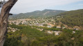
Around the Source des Nayes in Saint-Zacharie

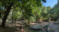
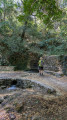
A walk where three-quarters of the route is shaded, around the famous Source des Nayes, which is particularly pleasant during the hot summer months. The area has been attractively landscaped with small streams flowing from the spring’s outlet.

Details

67561037
Creation:
Last update:
Last review:
  • Walking
    Activity: Walking
  • ↔
    Distance: 4.25 mi
  • ◔
    Average duration: 2h 30 
  • ▲
    Difficulty: Easy

  • ⚐
    Back to start: Yes
  • ↗
    Ascent: + 666 ft
  • ↘
    Descent: - 669 ft

  • ▲
    Highest point: 1,519 ft
  • ▼
    Lowest point: 843 ft

Photos

Description of the walk

The walk starts from the Source des Nayes car park. From the centre of Saint-Zacharie, take the Chemin du Plan d’Aups, turning immediately right at a bend, then take the Chemin des Nayes; 200 m further on, turn right again and follow the signposts to the car park.

(S/E) Continue carefully along the Chemin des Nayes ; 400 m further on, turn left onto the Chemin du Camps d’Aghas, cross the Ruisseau de Peyrus and arrive at the Chemin de Garnier.

(1) Follow this to the left for about 400 m.

(2) Turn left, then immediately turn right onto a clearly visible path that runs alongside the Chemin de Garnier. Please note that the PR® route shown on the IGN map, which links the Chemin de Garnier to the Source des Nayes, is unfortunately on private land and off-limits to walkers. One does wonder why, and who it might be bothering.

(3) Follow the path for 800 m and turn left at the Fork in the road.

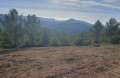
(4) Continue uphill at this crossroads. Unfortunately, this section of the track is currently in full sun. Carry on for 1,300 m until you reach a hairpin bend.

(5) Turn left immediately at this hairpin bend, heading down a well-shaded path to the D480.

(6) Turn left onto the track leading back to the car park. Another 1,300 metres and you’ll reach the Esplanade de la Source (S/E).

Waypoints

  1. S/E : mi 0 - alt. 873 ft - Source des Nayes car park
  2. 1 : mi 0.67 - alt. 853 ft - Chemin de Garnier
  3. 2 : mi 0.93 - alt. 909 ft - Turn left
  4. 3 : mi 1.41 - alt. 1,076 ft - Fork
  5. 4 : mi 2.21 - alt. 1,342 ft - Crossroads
  6. 5 : mi 3 - alt. 1,516 ft - Downhill path
  7. 6 : mi 3.48 - alt. 1,001 ft - D480 road
  8. S/E : mi 4.25 - alt. 873 ft - Source des Nayes car park

Worth a visit

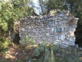
The spring and its lovely leisure area on the site of an ancient Roman camp.

Always be cautious and plan ahead when you're outdoors. Visorando and the author of this route cannot be held responsible for any accidents occurring on this route.

The GR® and PR® markings are the intellectual property of the Fédération Française de Randonnée Pédestre.

Other walks in the area

For more walks, use our search engine .

The GPS track and description are the property of this route's author. Please do not copy them without permission.