Refine your search for walks in Saint-Thiébaud
Saint-Thiébaud walks
 Salins-les-Bains – Arbois
 Visorando Member
 12.48 mi
 +2,365 ft
 -2,457 ft
 7h 50
7h 50
 Difficult
 Departure from Salins-les-Bains (Jura)
Fourth stage of the Échappée Jurassienne. Right from the start of this stage, things get serious with a demanding route punctuated by steep ascents and descents in the limestone massif of Revermont. Then, through undergrowth, pastures and picturesque viewpoints, the second part of the route reveals itself to be full of charm and tranquillity, offering a perfect transition before reaching Montigny-les-Arsures, a superb wine-growing village where the vineyards come into view. A few more kilometres will take you to Arbois, the capital of Jura wines. Louis Pasteur had his family home here, which is still open to visitors. This colourful town is full of Jura wine tasting cellars and great places to eat for food lovers.
Mont Poupet from Salins-les-Bains
 9.15 mi
+1,991 ft
-1,985 ft
5h 55
9.15 mi
+1,991 ft
-1,985 ft
5h 55
 Moderate
Departure from Salins-les-Bains (Jura)
Moderate
Departure from Salins-les-Bains (Jura)
Climb to the highest point of the extreme Jura at 851 m, with 360° views of the plains and mountains of the Jura and, on a clear day, even Mont Blanc.
Set off from Salins-les-Bains on the banks of the Furieuse, long known for its salt mining.
A scenic and slightly challenging hike without any major difficulties.
From La Chapelle-sur-Furieuse to the ruins of Vaulgrenant Castle (circular trail)
 9.93 mi
+1,345 ft
-1,348 ft
5h 45
Moderate
Departure from La Chapelle-sur-Furieuse (Jura)
9.93 mi
+1,345 ft
-1,348 ft
5h 45
Moderate
Departure from La Chapelle-sur-Furieuse (Jura)
From Chapelle-sur-Furieuse, through forests, vineyards and meadows, you will reach the ruins of Vaulgrenant Castle and then return to your starting point along the Furieuse river via a long descent. You will pass through the small village of Onay, then the suburbs of Salins-les-Bains, via the Voie Verte, before reaching Marnoz and heading towards Château de Vaulgrenant.
Enjoy beautiful views of Le Poupet and the forts of Salins-les-Bains.
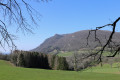
Fort Belin and the village of Clucy
 5.96 mi
+1,286 ft
-1,263 ft
3h 50
Moderate
Departure from Salins-les-Bains (Jura)
5.96 mi
+1,286 ft
-1,263 ft
3h 50
Moderate
Departure from Salins-les-Bains (Jura)
This circular loop climbs up to Fort Belin, where you can enjoy a majestic view of Salins-les-Bains to the north and the green hills of the Jura to the south, before crossing the charming village of Clucy and descending via the Roman road at the foot of Mont Poupet.
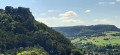
The forts of Salins and the Roman Way
 7.96 mi
+2,490 ft
-2,461 ft
5h 50
Moderate
Departure from Salins-les-Bains (Jura)
7.96 mi
+2,490 ft
-2,461 ft
5h 50
Moderate
Departure from Salins-les-Bains (Jura)
This circular route allows you to see both forts and the town of Salins from two different angles. The Roman Way is an excuse to get closer to Mont Poupet and increase the elevation. However, the great advantage of this walk is that it is shaded by trees, which is very practical in summer.
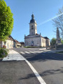
From La Chapelle-sur-Furieuse to Villars-St-Georges
 17.02 mi
+1,207 ft
-1,289 ft
8h 55
17.02 mi
+1,207 ft
-1,289 ft
8h 55
 Very difficult
Departure from La Chapelle-sur-Furieuse (Jura)
Very difficult
Departure from La Chapelle-sur-Furieuse (Jura)
Sixth stage from the Jura to Hauts-de-France via the Francigena: for this long stage, which features less elevation gain, you set off from La Chapelle-sur-Furieuse and, passing through forests, vineyards and meadows, you’ll reach Port-Lesney. From the Vieux-Pont in Port-Lesney, you’ll climb along beautiful forest paths winding through boxwood groves towards the Hermitage of Notre-Dame-de-Lorette, perched on a sheer cliff overlooking the valley, before reaching the village of Arc-et-Senans and its Royal Saltworks, listed as a UNESCO World Heritage Site since 1982. the Royal Saltworks of Arc-et-Senans is a former salt production facility, built on the initiative of King Louis XV between 1775 and 1779. This is followed by a forest trail leading you to Le Signal (467 m), the highest point of this stage. You then descend along beautiful, fairly undulating forest paths, with occasional views across the vast neighbouring state-owned forest, towards the Doubs valley.
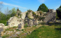
The medieval ruins of Vaulgrenant
 2.95 mi
+597 ft
-584 ft
1h 50
2.95 mi
+597 ft
-584 ft
1h 50
 Easy
Departure from Pagnoz (Jura)
Easy
Departure from Pagnoz (Jura)
A lovely little forest walk to the ruins of this medieval castle built in the 13th century, wiped off the map by the awful Louis XIV who, to punish us for our "Comtois, Rends-toi! Nenni, Ma foi!" ("Comtois, surrender! No way!"), dismantled all our medieval castles. At the top, there is a 360° view of the Chaux forest, the Val d'Amour, Mont de Pretin, the forts of Saint-André and Belin, and Mont Poupet. Return through beautifully rolling countryside, topped by Fort Saint-André in the distance.
Heritage and panoramic views between Pagnoz and Marnoz
 5.35 mi
+725 ft
-725 ft
3h 05
Easy
Departure from Pagnoz (Jura)
5.35 mi
+725 ft
-725 ft
3h 05
Easy
Departure from Pagnoz (Jura)
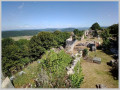
A 30-minute climb will take you to the feudal castle of Vaulgrenant, where you can enjoy a 360° panorama. Then you will walk between valleys and woods, with ever-changing views of Mont Poupet. After Marnoz, you will discover a very pleasant path leading back to Pagnoz. It allows you to walk along the railway line without realising it (except at the beginning). A hike away from the beaten track and through varied landscapes.
Fort Saint-André
 2.72 mi
+823 ft
-846 ft
2h 00
Easy
Departure from Salins-les-Bains (Jura)
2.72 mi
+823 ft
-846 ft
2h 00
Easy
Departure from Salins-les-Bains (Jura)
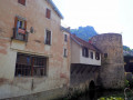
A short walk on the heights of Fort Saint-André to discover the exceptional natural site of Salins-les-Bains, protected by its two old forts.
Fort Saint-André and Croix de Pretin
 Association / Club / Walk leader
 10.34 mi
+1,860 ft
-1,864 ft
6h 20
Moderate
Departure from Aiglepierre (Jura)
10.34 mi
+1,860 ft
-1,864 ft
6h 20
Moderate
Departure from Aiglepierre (Jura)
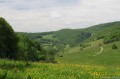
A hike for experienced walkers, with the chance to discover the village of Pretin, nestled in a valley, and magnificent views of Salins-les-Bains and its surroundings (Mont Poupet and Fort Belin in particular).
The Cross of Pretin
 5.87 mi
+1,785 ft
-1,762 ft
4h 15
Moderate
Departure from Pretin (Jura)
5.87 mi
+1,785 ft
-1,762 ft
4h 15
Moderate
Departure from Pretin (Jura)
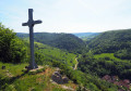
Discover the small village of Pretin on the heights of Salins and its beautiful old houses nestled in the valley. No fewer than six viewpoints over the Val de Marnoz, Mont Poupet and the Monts de Cernans dot the route to the imposing Fort Saint-André, a stern sentinel overlooking Salins-les-Bains.
The Edgar Faure and Notre-Dame de Lorette viewpoint
 5.69 mi
+922 ft
-912 ft
3h 25
Easy
Departure from Mouchard (Jura)
5.69 mi
+922 ft
-912 ft
3h 25
Easy
Departure from Mouchard (Jura)
Forest trail to discover the Edgar Faure viewpoint over the Loue valley and its vine-covered hillsides, then return, devoutly, to the Hermitage of Notre-Dame-de-Lorette perched on the cliff face above the valley, ending with a short break at the Espace Vöhl with its views of Mont Poupet and the Jura mountains.
Circular walk between Port Lesney and Rennes-sur-Loue
6.34 mi
+577 ft
-568 ft
3h 25
Moderate
Departure from Port-Lesney (Jura)
This easy walk begins with a crossing of a vast, open plain. It then follows a shaded path along the banks of the Loue, before returning up the hill via a shaded forest track.
Notre-Dame-de-Lorette
 7.03 mi
+948 ft
-938 ft
4h 05
Moderate
Departure from Port-Lesney (Jura)
7.03 mi
+948 ft
-938 ft
4h 05
Moderate
Departure from Port-Lesney (Jura)
From the remains of the Old Bridge of Port-Lesney, you will climb up beautiful forest paths winding through box trees to the viewpoint overlooking the village topped by Mont Poupet. From this cool, mossy forest, you will emerge into the sunny vineyards, greeting the Saline d'Arc-et-Senans from afar, before returning, devoutly, to the Hermitage of Notre-Dame-de-Lorette perched on the cliff above the valley.