Country:
 City:




(S) From your campsite, set off northwards and head towards Rennes-sur-Loue on theGR®®59. Walk along the Route de la Chapelle through vast meadows until you reach the ‘Stop’ sign at the junction with the N83.
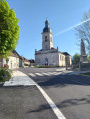
(1) Cross carefully and continue straight ahead along the one-way street. Walk past the church before entering the village of Rennes-sur-Loue. Stay on Rue des Murailles Neuves, walk past the town hall and continue along Rue du Village, which merges into Rue du Pont. You will come to a bridge.
(2) Cross the Loue, passing over the two bridges in succession, then turn left at the signpost towards Port-Lesney. Follow the river on your left along a lovely tree-lined path, then, as the path curves to the right, move away from the Loue by crossing a meadow, before reaching a junction.
(3) Head north and carry on until you reach the signpost for La Champagnole.
(4) Turn left onto the Chemin de Champagnole. At the stop sign, turn left and continue along Rue du Val d’Amour until you reach the Bow-String Bridge.
(5) Turn left towards Mouchard. Cross the River Loue and turn right opposite the campsite, towards Arc-et-Senans. Continue along the Route de Lorette until you reach the signpost just before the communal bins.
(6) Turn left onto the grassy path towards the Edgar Faure viewpoint. On Rue du Brillat, turn right twice and continue along Rue du Ruisseau. Carry on until you reach the junction with Rue du Belvédère.
(7) First turn left then right to begin the climb towards the woods. Carry on up to the junction with a wider, stony path.
(8) Keep heading north-west and continue the climb until you reach the five-way junction.
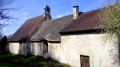
(9) Ignore thePR®® and continue north on theGR®®59. At the junction with the path signposted ‘Chapelle de Lorette’, turn right and carry on to the Ermitage Notre-Dame de Lorette. Enjoy the beautiful views over Port Lesney and the Loue Valley.
(10) Retrace your steps to rejoin theGR®®59and reach the junction with the D48E2. Turn left (south-west) and stay on this gently sloping road until you reach some vineyard plots.
(11) Turn right (north) onto the stony track. Continue until you briefly enter a woodland, then turn left towards the west and carry on to the high-voltage pylon at the crossroads.
(12) Head north-west along the edge of the vineyard and carry on until you reach the ‘Champs du Die’ signpost.
(13) Turn right towards the north-east and carry on until you reach the ‘Vignes de Fort’ signpost.
(14) Head north-west and, ignoring the two paths on the right, carry on to the junction with the D32, where you’ll find yourself facing the River Loue.
(15) Turn left and walk alongside the river on your right until you reach the signpost. Turn right onto the D17E towards Arc-et-Senans. Continue to the bridge.
(16) Cross the River Loue , taking care on the D17E, then walk along Avenue de la Saline to enter the town of Arc-et-Senans and arrive opposite the Saline Royale.
(17) After visiting the Saline Royale, with your back to the entrance, head right (north-east) onto the D17 towards Quingey and continue to the roundabout.
(18) Carry on straight ahead along the D17 towards Quingey/Besançon. Pass the Église Saint-Bénigne and then the path leading to the cemetery before reaching a junction near the GAEC De Roche Rodoz farm.
(19) Turn left onto the path lined with tall oak trees. Carefully cross the Lons–Besançon railway line and carry on until you reach the signpost for Bois de la Pérouse.
(20) Turn right, then left (north-west) to continue through the woods. Carry on to Grange Jouffroy.
(21) Stay on theGR®®59, heading north until you reach the T-junction. Turn right and continue to the signpost for Les Ressey.
(22) Turn left (north) to begin a steep climb and carry on to the Fork in the road.
(23) Veer to the right to continue the climb through the woods and carry on to the crossroads.
(24) First turn right then left, and carry on until you reach the highest point of this stage at the ‘Le Signal’ signpost.
(25) You will then begin a gradual descent and carry on until you reach a 90° left-hand bend.
(26) Carry on north-west and, after several bends, continue down theGR®®59towards the north-east. You’ll reach a Fork in the road at the ‘Bois de la Côte d’Or’ signpost.
(27) Turn left towards the north-east, following the slope which becomes steeper after a 90° bend. Continue down to the T-junction.
(28) Turn left, then right onto the wide forest track and carry on to the crossroads.
(29) Turn off towards the north-west and carry on to the junction with the D441.
(30) Cross this road carefully and continue straight ahead along the stony track, following the red and white markings until you reach the Combe Rousset signpost.
(31) Turn left towards the north to leave the woods and continue along the edge of a meadow before reaching a T-junction.
(32) Turn right onto the stony track, which leads onto a grassy path before joining the D105.
(33) Proceed with caution straight ahead along the grassy path running alongside a field. Carry on until you reach the crossroads marked by the ‘Champ du Chêne’ signpost.
(34) Carry on northwards and, at the Fork in the road, keep left on theGR®® to reach a crossroads.
(35) Head north-east into the woods of Combe Arange and carry on until you emerge from the woods next to a marble slab storage yard, on the D101.
(36) Turn left onto the Route du Jura heading towards the village. Carry on until you reach a right-hand bend where a path leading down from the village joins the road.
(37) Turn left onto the path closed to motor vehicles and head uphill to reach the village of Villars-Saint-Georges, on Rue de l’Église. Turn right and continue to the Stop sign.
(38) Turn left onto the Route du Jura, then at the junction, turn right towards the Grottes d’Osselle. Continue along the D400 to leave the village and carry on until you reach the end of the hairpin bend.
(39) Turn left onto the stony track; a little further on, you’ll find a secluded spot (E) where you can set up camp.
 Visorando Member
 Moderate
 Easy