Country:
 City:
City:


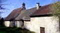
Park in the small car park on Rue Edgar Faure, halfway between the bridge over the Loue and the church.
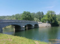
(S/E) Turn your back on the church and cross the bridge over the Loue (note, downstream, the remains of the old 15th-century stone bridge, of which only one arch remains; the current bridge, made of reinforced concrete, dates from 1938). As you come off the bridge, turn right. At the Fork in the road shortly afterwards, veer to the right.
(1) At the three-way junction, keep to the right, following the blue and red markings of the GR®59. Cross the large plain surrounded by the circular bend in the River Loue.
(2) At a fork in the road, keep left, still following the GR®. Further on, the path turns north-north-east and draws closer to the Loue.
(3) Follow the river along the GR® as it enters the woodland (magnificent views of the river’s meanders; following a spell of rain, this path may be muddy).
(4) Turn left, move away from the river and go through a cattle gate (don’t forget to close it behind you). You’ll reach a bridge over the Loue.
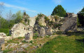
(5) Cross the bridge, which is actually a double bridge, on either side of a central island (a late 19th-century metal bridge and an older stone bridge, rebuilt in 1861). As you cross, admire the ‘Miroir de la Loue’ on the second branch of the river, which forms small waterfalls. You’ll arrive on the opposite bank, on Rue du Pont, at the foot of Rennes-sur-Loue Castle.
(6) Turn round and head back to the right bank.
(5) Follow the path that heads straight towards the hill between two fields. At the junction that appears shortly afterwards, take the path on the left. Climb a fairly steep section with three hairpin bends. Continue the ascent due north, on a gentler slope, following a path that winds its way through the forest in wide loops before turning north.
(7) At a fork in the road, turn left. Ignore a path branching off to the right and continue to a junction.
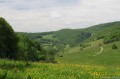
(8) Then turn left. Head downhill heading south-south-west. As you go, admire the views of the Jura foothills and, in particular, Mont Poupet.
(9) At a T-junction, turn left. After a right-hand bend, find another path and follow it to the left. Carry straight on, ignoring the paths branching off to the sides, and rejoin the three-way junction you took at the start of the walk.
(1) Turn right, quickly rejoining the D48 and following it to the left. Shortly afterwards, turn left, cross the Loue one last time and return straight to the car park (S/E).
 Visorando Member

 Easy
Easy 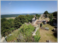
 Difficult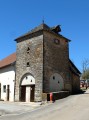
 Association / Club / Walk leader