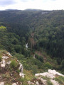
From the Bois de la Chênaie to the Bois de Rozet between By and Myon

A walk through the forest along dirt tracks and forest paths.

Details

n°20901645
Creation:
Last update:
Last review:
  • Walking
    Activity: Walking
  • ↔
    Distance: 5.95 mi
  • ◔
    Average duration: 3h 10 
  • ▲
    Difficulty: Easy

  • ⚐
    Back to start: Yes
  • ↗
    Ascent: + 486 ft
  • ↘
    Descent: - 515 ft

  • ▲
    Highest point: 1,900 ft
  • ▼
    Lowest point: 1,453 ft

Description of the walk

To reach the start, follow the D239 which links By to Bartherans. Park at the hunting car park.

(S/E) Take the path opposite, which has a fairly steep climb.

(1) Follow the forest track to the right. You’ll come to a junction.

(2) Turn right and continue along the white track until you come out onto the D261. Follow it to the left with care for about a hundred metres.

(3) Turn left onto the stony path, stop by the picnic table and enjoy the view of Mont Poupet. Then, take the path to the left and head towards the hunting lodge. Continue straight along this path, making sure to keep going in the same direction without being distracted by the paths to the right or left. This will take you from the Bois de la Chênaie to the Bois de Crête. You’ll come to a crossroads.

(4) Take the second path on the right and enter the Bois de Rozet.

(5) Turn left and head down through the woods until you reach a clearing. Continue along the stony path to the left until you reach the edge of the woods.

(6) Follow the forest track on the left which runs alongside the pasture and reaches a junction at the end of it.

(7) Carry on straight ahead along a grassy path which, further on, joins a forest track leading back to the car park where you started (S/E).

Waypoints

  1. S/E : mi 0 - alt. 1,532 ft - Hunting car park
  2. 1 : mi 0.09 - alt. 1,588 ft - Forest track
  3. 2 : mi 0.66 - alt. 1,611 ft - Junction, turn right
  4. 3 : mi 1.75 - alt. 1,850 ft - Stony path to the left, picnic table
  5. 4 : mi 3.85 - alt. 1,631 ft - T-junction, take the second turning on the right
  6. 5 : mi 4.4 - alt. 1,493 ft - Rozet Wood, on the left
  7. 6 : mi 4.62 - alt. 1,453 ft - Edge of the woodland, on the left
  8. 7 : mi 5.38 - alt. 1,503 ft - Junction, go straight on
  9. S/E : mi 5.95 - alt. 1,532 ft - Hunting car park

Notes

No signposting.
Grass and dirt paths.

Worth a visit

View of Mont Poupet.
Great wildlife sightings.
(3) Picnic table in good condition.

Reviews and comments

4.2 / 5
Based on 2 reviews

Reliability of the description
4.5 / 5
Ease of following the route
4.5 / 5
Route interest
3.5 / 5
MaelleN
MaelleN

Overall rating : 5 / 5

Date of your route : Sep 11, 2026
Reliability of the description : ★★★★★ Very good
Ease of following the route : ★★★★★ Very good
Route interest : ★★★★★ Very good
Very busy route : No

A really lovely walk in the woods. Not many views, but a superb woodland atmosphere.
The route isn’t signposted, and the start and finish are on a stretch that’s either not maintained or only minimally so (undergrowth, fallen branches, the path disappearing in places), but it’s no trouble to follow it with the help of the map – and if you like the rugged, unspoilt side of nature, you’ll be fine.
For the rest of the route, the paths are clear and easy to follow.
All along the way, you can enjoy beautiful forests, with a variety of tree species and ever-changing scenery.
We did this walk on a Friday afternoon in early September; it was dead quiet, with no one else on the trail.
It’s worth noting that it’s likely to be quite muddy in winter, so you might want to avoid very wet periods.
One minor annoyance: at one point we had to get over a pasture gate, but it was too difficult to open, so we had to crawl under the barbed wire.
All in all, a lovely walk through the woods, which we’ll happily do again – thanks for the suggestion.

Machine-translated

jean-luc et odile
jean-luc et odile

Overall rating : 3.3 / 5

Date of your route : Mar 04, 2024
Reliability of the description : ★★★★☆ Good
Ease of following the route : ★★★★☆ Good
Route interest : ★★☆☆☆ Disappointing
Very busy route : No

A route taken in early March; the path was particularly muddy due to the bad weather and forestry work

Machine-translated

Other walks in the area

For more walks, use our search engine .

The GPS track and description are the property of this route's author. Please do not copy them without permission.