Saint-Ours – Larche

Return to the starting point in Larche via theGRP® de la Frontière Fortifiée.

This walk is part of a multi-day hike: Tour du Sautron

Details

568684
Creation:
Last update:
Last review:
  • Walking
    Activity: Walking
  • ↔
    Distance: 5.26 mi
  • ◔
    Average duration: 3h 25 
  • ▲
    Difficulty: Moderate

  • ⚐
    Back to start: No
  • ↗
    Ascent: + 1,102 ft
  • ↘
    Descent: - 1,417 ft

  • ▲
    Highest point: 6,883 ft
  • ▼
    Lowest point: 5,495 ft

Photos

Description of the walk

(S) Set off again in the opposite direction along the previous day’s route as far as the 1925 high point. To do this, follow the red and yellow markings ofthe GRP® de la Frontière Fortifiée south-westwards.

(1) Pass close to Fort Saint-Ours.

(2) Continue to the right along this path, leaving yesterday’s route to your left. Shortly afterwards, the path turns left towards the east and then bends right towards the south before becoming a footpath after the 1957-metre mark.

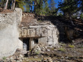
(3) Follow this footpath, which passes at the foot of the ruins of Fort de Mallemort.

(4) Continue on virtually flat ground until you reach the junction with theGR®5.

(5) Turn right and follow theGR®5downhill to an old blockhouse.

(6) Leave theGR®5and veer right onto a less-travelled path. Further down, head west and make a descending traverse.

(7) Start a gentle descent southwards, passing the Ruines du Colombier. Enjoy a beautiful view at the Rocher du Truc. Pass another ruined blockhouse and finish on the D900.

(8). Cross the road and turn left to reach Larche (E).

Waypoints

  1. S : mi 0 - alt. 5,837 ft - Auberge de Saint-Ours
  2. 1 : mi 0.76 - alt. 6,102 ft - Fort de Saint-Ours
  3. 2 : mi 1.39 - alt. 6,289 ft - Elevation 1925
  4. 3 : mi 1.68 - alt. 6,470 ft - Elevation 1957
  5. 4 : mi 2.09 - alt. 6,759 ft - Ruins of Fort de Mallemort
  6. 5 : mi 3.14 - alt. 6,883 ft - Junction with the GR 5
  7. 6 : mi 3.49 - alt. 6,519 ft - Junction with the GR 5
  8. 7 : mi 4.17 - alt. 6,037 ft - Descent towards the south
  9. 8 : mi 4.95 - alt. 5,502 ft - D900 road. Near the - Ubayette (rivière)
  10. E : mi 5.26 - alt. 5,505 ft - Larche - Gîte GTA (Larche)

Notes

No drinking water along the route.

Worth a visit

(4) Ruins of Fort de Mallemort.

Always be cautious and plan ahead when you're outdoors. Visorando and the author of this route cannot be held responsible for any accidents occurring on this route.

The GR® and PR® markings are the intellectual property of the Fédération Française de Randonnée Pédestre.

Reviews and comments

4.8 / 5
Based on 2 reviews

Reliability of the description
5 / 5
Ease of following the route
4.5 / 5
Route interest
5 / 5
GarlabanTaoume
GarlabanTaoume

Overall rating : 5 / 5

Date of your route : Aug 26, 2025
Reliability of the description : ★★★★★ Very good
Ease of following the route : ★★★★★ Very good
Route interest : ★★★★★ Very good
Very busy route : No

Very beautiful balcony crossing, gentle descent to Larche

Machine-translated

nahaika
nahaika

Overall rating : 4.7 / 5

Date of your route : Aug 03, 2020
Reliability of the description : ★★★★★ Very good
Ease of following the route : ★★★★☆ Good
Route interest : ★★★★★ Very good
Very busy route : No

A lovely walk

Machine-translated

Other walks in the area

For more walks, use our search engine .

The GPS track and description are the property of this route's author. Please do not copy them without permission.