


Refine your search for walks in Gîte GTA (Larche)
Gîte GTA (Larche) walks


 Saint-Ours – Larche
 Association / Club / Walk leader
 5.26 mi
 +1,102 ft
 -1,417 ft
 3h 25
 Moderate
 Departure from Meyronnes (Alpes-de-Haute-Provence)
Return to the starting point in Larche via theGRP® de la Frontière Fortifiée.
Tour du Sautron
32.99 mi
+10,499 ft
-10,469 ft
4 days
 Very difficult
Departure from Larche (Alpes-de-Haute-Provence)
A beautiful hike between the Ubayette Valley and Italy. The Vallon de l’Oronaye, the Stroppia Waterfalls and the Lac des Neuf Couleurs are among the most stunning places to discover in the Southern Alps.
I did this hike with a group of 14 people from the Randogym club in early September 2015. In mid-June 2006, I went on a 5-day hike that followed part of this route, and there were still plenty of snowfields at that time of year.
Trek around Chambeyron Mountain Range (5) Refuge Campo Base - Larche
 Visorando Member9.01 mi
+3,560 ft
-3,451 ft
7h 15
Very difficult
Departure from Acceglio (Cuneo)
Last stage of this trek around Chambeyron mountain range, taking you back to France through Col de Sautron. You'll find yourself in superb wildlife setting when arriving at the pass.
Trek around Chambeyron Mountain Range
 36.21 mi
+13,120 ft
-13,783 ft
5 days
 Difficult
Departure from Saint-Paul-sur-Ubaye (Alpes-de-Haute-Provence)
Reaching over 3000 metres in altitude, Aiguilles de Chambeyron and Brec de Chambeyron form an impressive mountain range halfway between Queyras and the Moncantour. This hike offers a trek with no techincal difficulty, with passes over 2700 m in altitude and a summit of over 3000 m. Set in an outstanding landscape and for the most part within a high mountain setting.
Walks near Gîte GTA (Larche)
Larche – Chiappera
 10.20 mi
+3,369 ft
-3,494 ft
7h 35
Difficult
Departure from Larche (Alpes-de-Haute-Provence)
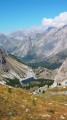
This stage will take you to the pretty Vallon de la Montagnette, then on to the Col des Monges, which offers a stunning view of the Southern Alps.
Larche - Saint-Dalmas-le-Selvage
17.35 mi
+5,102 ft
-5,633 ft
12h 25
Difficult
Departure from Larche (Alpes-de-Haute-Provence)
Étape de la traversée des Alpes par le GR®5 de Larche à Saint Dalmas le Selvage. Passage dans le Parc National du Mercantour sauvage et authentique puis transition entre la Haute Tinée et le Vallon de Jalorgues avec un passage sur la plus haute route d'Europe vers le Col de la Bonnette.
Col de Larche – Rifugio della Gardetta
 10.06 mi
+4,019 ft
-2,877 ft
8h 10
Difficult
Departure from Larche (Alpes-de-Haute-Provence)
On this fourth day, you’ll head briefly back into France to walk through the Orrenaye valley with its magnificent lake. You’ll return to Italy at the Col du Ruburent, then enjoy the beauty of Lake Ruburent as you walk around it. You’ll cross the very rocky Passo della Scaletta, which contrasts with the mountain pastures as you climb to the Passo della Gardetta.
Campo Base mountain hut – Saint-Ours
 10.65 mi
+3,799 ft
-3,412 ft
7 hrs
Very difficult
Departure from Acceglio (Cuneo)
A lovely walk that begins with a steep, winding climb followed by a descent offering remarkable views.
Chiappera - Chambeyron Refuge
 7.10 mi
+4,344 ft
-1,145 ft
6 hrs
Very difficult
Departure from Acceglio (Cuneo)
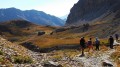
A lovely stage featuring a beautiful climb to the Stroppia Waterfall and the Lac des Neuf Couleurs.
From the Barenghi Bivouac to Larche via the Col du Vallonnet
13.36 mi
+3,953 ft
-7,723 ft
8 hrs
Very difficult
Departure from Saint-Paul-sur-Ubaye (Alpes-de-Haute-Provence)
This route largely followsGRP®® markings (Tour du Chambeyron). A safe option, yet still spectacular.Spectacular, because the route constantly alternates between stark, steep and rocky terrain and lush, rolling and reassuring landscapes.Safe, because it is fully signposted and even offers alternative routes to avoid the most difficult sections in the event of bad weather.
Chambeyron Mountain Hut – Saint-Ours
 10.40 mi
+1,660 ft
-4,400 ft
6h 15
Difficult
Departure from Saint-Paul-sur-Ubaye (Alpes-de-Haute-Provence)
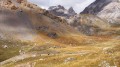
A walk through the valleys and passes of the Vallonnet in the high-altitude mountain pastures, passing by the old fortifications.
Trek around Chambeyron Mountain Range (3) Refuge du Chambeyron - Maljasset
 10.64 mi
+2,454 ft
-4,764 ft
8 hrs
Very difficult
Departure from Saint-Paul-sur-Ubaye (Alpes-de-Haute-Provence)
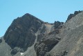
The most demanding stage of the hike during which you'll go through at least 4 passes at over 2700 metres in altitude. Beautiful scenery all along the way! The "Lacs Marinet" offer the opportunity for refreshments before the final descent.
From Fouillouse to Bousiéyas
 21.25 mi
+6,686 ft
-6,667 ft
15h 35
Very difficult
Departure from Saint-Paul-sur-Ubaye (Alpes-de-Haute-Provence)
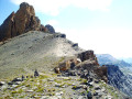
This sixteenth stage completes the crossing of the Chambeyron Massif and, after Larche, enters the Mercantour Massif. From Les Granges de Fouillouse, the GR®5 follows the Riou de Fouillouse upstream, passing the ruins of Fort de Plate Lombarde, then, via the Plate Lombarde valley, reaches the Col du Vallonnet. It then descends to Lac du Vallonnet Inférieur, where it heads due south to join an old military road that climbs towards the Viraysse barracks. From there, the GR®5 crosses the Col de Mallemort and descends to the hamlet of Larche. The route follows the Ubayette, then crosses it and reaches the Pont Rouge car park, which marks the entrance to the Mercantour National Park. It then heads due south, climbing to Lac du Lauzanier, then on to Lac de Derrière la Croix, before reaching the Pas de la Cavale. The descent starts off quite steep but then becomes gentler. After the Salse Morene plateau, the path climbs the Col des Fourches and, from the Camp des Fourches, reaches the hamlet of Bousiéyas.
Trek around Chambeyron Mountain Range (1) Fouillouse - Refuge du Chambeyron
 3.88 mi
+2,470 ft
-36 ft
3h 55
Moderate
Departure from Saint-Paul-sur-Ubaye (Alpes-de-Haute-Provence)
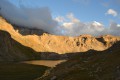
First stage around the Chambeyron Mountain Range which, after a steady climb, takes you to the shelter with the same name. You'll end up in a breath-taking setting, at the foot of Brec de Chambeyron.