The Rochail Circular

A lovely circular route, facing due south, during which the sweeping panoramic views echo the rich heritage you’ll encounter along the way.
July 2024. Larche Tourist Office: the route is no longer maintained.

Details

41983404
Creation:
Last update:
Last review:
  • Walking
    Activity: Walking
  • ↔
    Distance: 5.39 mi
  • ◔
    Average duration: 4h 00 
  • ▲
    Difficulty: Moderate

  • ⚐
    Back to start: Yes
  • ↗
    Ascent: + 1,722 ft
  • ↘
    Descent: - 1,722 ft

  • ▲
    Highest point: 6,371 ft
  • ▼
    Lowest point: 4,934 ft

Photos

Description of the walk

On the D900 road, heading towards the Col de Larche, as soon as you enter Meyronnes, park in the car park on the right.

(S/E) Cross the D900 with care, walk past a bar-restaurant, turn left onto Rue des Moulins and walk uphill a short way. At the corner by the town hall, turn left and look out for the start of the walk.

(1) Turn left towards Le Rochail, pass the Carrefour des Faysses and continue to the left towards the Holiday Centre. Walk past the building, then continue down the tarmac road until you reach a bend.

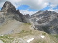
(2) Leave the road and take the path on the right that leads downhill. Cross the Torrent de Bouchier and, immediately on the left, take the path which initially runs alongside the stream. Continue to follow the path, which becomes more pleasant. Then, after a while, the path gradually begins to wind its way uphill. Pass the rockfall barriers. Continue climbing until you reach the viewpoint.

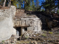
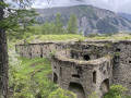
(3) Turn right and continue along the path. A few more hairpin bends further up and the climb is over. A lovely balcony-style traverse leads to a wooden hut and, further on, the Serre la Plate bunker.

(4) Continue along the balcony path, which turns due north, cross a stream, then head uphill again until you reach a sheep track. Turn right and follow it for a few metres, then look out for the start of the path on the right.

(5) Head towards Grange des Gascons, cross a stream and follow the path downhill to reach the large ruins of the Grange des Gascons

(6) Continue downhill, then cross the Torrent de Bouchier and head uphill on the opposite side to the La Combe crossroads.

(7) Turn left, towards Saint-Ours. Walk up the path until you come out onto the wide sheep track. Take it to the right and follow the track to the next crossroads.

(8) Carry on straight ahead along the path, which passes in front of a magnificent monolithic cross. Continue along this path to Saint-Ours.

(9) At the square in Saint-Ours, turn right onto the road and walk through the village until you reach the cemetery on the right, just outside the village.

(10) At the cemetery, turn left onto the path leading downhill. Join a track and turn left until you reach the next crossroads.

(11) Take the track on the left which goes uphill, then join the tarmac road (D225). Walk down this road until you reach the path at the bend. Walk down this path, passing some ruins. Cross the road and continue downhill. The path joins the road. Turn right until you reach the next crossroads.

(12) Take the path on the right which leads down to Meyronnes. Walk past the church and the town hall and head for the car park (S/E).

Waypoints

  1. S/E : mi 0 - alt. 4,993 ft - Meyronnes car park
  2. 1 : mi 0.08 - alt. 5,043 ft - Junction on the path
  3. 2 : mi 0.38 - alt. 5,003 ft - Junction on the path
  4. 3 : mi 1.87 - alt. 6,145 ft - Rochail viewpoint
  5. 4 : mi 2.55 - alt. 6,276 ft - Sere la Plate bunker
  6. 5 : mi 2.99 - alt. 6,030 ft - Junction
  7. 6 : mi 3.22 - alt. 5,889 ft - Grange des Gascons (ruins)
  8. 7 : mi 3.42 - alt. 5,728 ft - Carrefour de la Combe
  9. 8 : mi 3.98 - alt. 5,794 ft - Crossroads
  10. 9 : mi 4.07 - alt. 5,823 ft - Saint-Ours square
  11. 10 : mi 4.18 - alt. 5,814 ft - Cemetery
  12. 11 : mi 4.44 - alt. 5,653 ft - Junction on the track
  13. 12 : mi 4.88 - alt. 5,364 ft - Junction on the path
  14. S/E : mi 5.39 - alt. 4,993 ft - Meyronnes car park

Notes

  • Make sure you take some water with you, as there is only one drinking fountain at the end of the walk in Saint-Ours, on the square (9).
  • You can shorten the walk at the Carrefour de la Combe (7) by heading straight towards Meyronnes.
  • Yellow PR® signposted route.

Worth a visit

  • During the climb between (2) and (3), take a moment to admire the rockfall protection nets designed to safeguard the road below.
  • The Cabane des Bûcherons de Serre la Plate is a shelter available to walkers.
  • The Serre la Plate blockhouse is well worth a visit.
  • The Grange des Gascons is a large ruin – please take care.
  • In Saint-Ours: near the fountain, under the shelter, read the information boards.

- You can have a bite to eat or a drink at the inn.
- Visit the cemetery.

  • In Meyronnes, near the car park, read the information boards and, of course, you can grab a bite to eat at the bar-restaurant just opposite.

Always be cautious and plan ahead when you're outdoors. Visorando and the author of this route cannot be held responsible for any accidents occurring on this route.

The GR® and PR® markings are the intellectual property of the Fédération Française de Randonnée Pédestre.

Reviews and comments

3.8 / 5
Based on 3 reviews

Reliability of the description
4 / 5
Ease of following the route
3.3 / 5
Route interest
4 / 5
Baboubeth
Baboubeth

Overall rating : 4 / 5

Date of your route : Aug 19, 2024
Reliability of the description : ★★★★☆ Good
Ease of following the route : ★★★☆☆ Average
Route interest : ★★★★★ Very good
Very busy route : No

There had been quite a bit of bad weather in the area. The first few metres were difficult to navigate as the torrent had washed away the path. Many sections over scree were very tricky and slippery, as the path was on a slope and covered with slabs of schist. But the view and the climb through the trees were magnificent.

Machine-translated

lemarcheur65
lemarcheur65 ★
• Edited:

Hello, Gonza
Thank you for your comment and the information.
I’ve added a warning to the introduction of this description.

Machine-translated

gonza
gonza

Overall rating : 2.7 / 5

Date of your route : Jun 26, 2024
Reliability of the description : ★★★☆☆ Average
Ease of following the route : ★★★☆☆ Average
Route interest : ★★☆☆☆ Disappointing
Very busy route : No

Although this walk is recommended in the Ubaye Topoguide (rated as ‘moderate’), it is actually very dangerous. The start was hard enough to find, and then there was a seemingly endless, winding climb through the forest on a very slippery path that I wouldn’t have fancied having to walk down again. The path is not maintained. There are then several sections involving torrents and ravines that are quite dizzying and dangerous. It’s impossible to turn back if you can’t get past them.
Whilst visiting the Larche Tourist Office, the manager told us that this walk should be removed from the guidebooks, at least temporarily. The issue has already been raised several times, as we weren’t the first to have been caught out. The route is indeed no longer maintained.
I strongly advise against this walk, which, moreover, offers little of visual interest.

Machine-translated

kerand29
kerand29

Overall rating : 4.7 / 5

Date of your route : Jun 17, 2024
Reliability of the description : ★★★★★ Very good
Ease of following the route : ★★★★☆ Good
Route interest : ★★★★★ Very good
Very busy route : No

A very pleasant route.
The entire climb is through woodland
The path is in poor condition where it crosses two streams, but that’s nature for you!
Signposting needs improving after La Grange des Gascons

Machine-translated

Other walks in the area

For more walks, use our search engine .

The GPS track and description are the property of this route's author. Please do not copy them without permission.