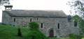
Saint-Julien de Fayret from Prades-de-Salars

A circular walk to enjoy the peace and quiet, the scenery and the local heritage.

Details

20782812
Creation:
Last update:
Last review:
  • Walking
    Activity: Walking
  • ↔
    Distance: 10.21 mi
  • ◔
    Average duration: 5h 25 
  • ▲
    Difficulty: Moderate

  • ⚐
    Back to start: Yes
  • ↗
    Ascent: + 876 ft
  • ↘
    Descent: - 863 ft

  • ▲
    Highest point: 3,199 ft
  • ▼
    Lowest point: 2,720 ft

Photos

Description of the walk

Car park near the church in Prades-de-Salars.

(S/E) Head towards the sports ground via the Chemin de Ravret.

(1) After the sports ground, turn right onto the sunken, damp track that climbs uphill. Follow it straight on until you reach the small road on the right leading to Lescure Fangel.

(2) In the hamlet, turn left onto a wide track that runs alongside a sheepfold and climbs up to the coniferous woodland.

(3) At the end of this track, turn left onto the wide path that climbs to Viarouge and continue past this hamlet.

(4) Cross the road or pass underneath it via the ‘boviduc’, join the small road to Saint-Julien and, after 200 m, turn right onto a wide track.

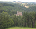
(5) At the end, turn left onto a small road leading to the hamlet of Saint-Julien de Fayret.

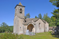
(6) Visit the church, then take the path lined with holly which joins the small road further down.

(7) At the junction with the D911, turn right onto it and follow it carefully for 1 km.

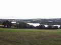
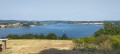
(8) At Roc de Rayret, on the left is a car park with a stunning view of Lake Pareloup. Then take the small road leading down to Rayret.

(1) Continue to the right and head towards Prades-de-Salars (S/E).

Waypoints

  1. S/E : mi 0 - alt. 2,733 ft - Prades-de-Salars car park
  2. 1 : mi 0.35 - alt. 2,749 ft - Junction in the village (A/R)
  3. 2 : mi 2.42 - alt. 2,927 ft - Lescure Fangel. Towards Viarouge
  4. 3 : mi 3.58 - alt. 3,087 ft - Les Pins de Viarouge
  5. 4 : mi 4.69 - alt. 3,179 ft - The “boviduc”
  6. 5 : mi 6.19 - alt. 3,077 ft - Road on the left
  7. 6 : mi 6.98 - alt. 2,940 ft - Church of Saint-Julien de Fayret
  8. 7 : mi 7.72 - alt. 2,989 ft - D911
  9. 8 : mi 8.37 - alt. 3,051 ft - Viewpoint at Roc de Rayret
  10. S/E : mi 10.21 - alt. 2,736 ft - Prades-de-Salars car park

Worth a visit

Reviews and comments

4.3 / 5
Based on 2 reviews

Reliability of the description
5 / 5
Ease of following the route
4.5 / 5
Route interest
3.5 / 5
Marie122
Marie122

Overall rating : 5 / 5

Date of your route : Mar 23, 2026
Reliability of the description : ★★★★★ Very good
Ease of following the route : ★★★★★ Very good
Route interest : ★★★★★ Very good
Very busy route : No

A lovely walk offering a variety of landscapes. The paths are pleasant and well-maintained. I highly recommend it

Machine-translated

ChrisduLevezou
ChrisduLevezou

Hello jolapsyko
I’ll take your comment on board. I was thinking of perhaps suggesting it as a cycle route – what do you think? Thanks, have a lovely day

Machine-translated

jolapsyko
jolapsyko

Overall rating : 3.7 / 5

Date of your route : Sep 14, 2023
Reliability of the description : ★★★★★ Very good
Ease of following the route : ★★★★☆ Good
Route interest : ★★☆☆☆ Disappointing
Very busy route : No

Up to point 4, the route remains pleasant, running alongside fields, with plenty of shade and easy going.
But then, from point 5 onwards, it’s basically just tarmac – completely uninteresting – but especially between points 7 and 8, a kilometre along the county road with absolutely no way to get to safety; it’s extremely dangerous!!!
In my view, this circular route should be revised or removed; it’s truly reckless to make people walk along the side of this road for 1 km.

Machine-translated

Other walks in the area

For more walks, use our search engine .

The GPS track and description are the property of this route's author. Please do not copy them without permission.