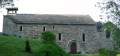
The Homo Faber and Saint-Martin de Cormières, starting from Le Vibal

A mix of roads and tracks, starting from Le Vibal, with points of interest including Saint-Martin de Cormières, its church and sarcophagus, the ‘Homo Faber’ sculpture and Claude Villefranque’s ‘Christ’. You can also visit Claude Villefranque’s creative studio in Le Vibal.

Details

67852217
Creation:
Last update:
Last review:
  • Walking
    Activity: Walking
  • ↔
    Distance: 5.57 mi
  • ◔
    Average duration: 3h 05 
  • ▲
    Difficulty: Moderate

  • ⚐
    Back to start: Yes
  • ↗
    Ascent: + 643 ft
  • ↘
    Descent: - 617 ft

  • ▲
    Highest point: 2,936 ft
  • ▼
    Lowest point: 2,500 ft

Description of the walk

Parking is available in the small car park in front of the town hall.

(S/E) Take the road opposite the town hall, Rue de la Quintaine. At the bend, turn left onto Route des Combettes, leaving the cemetery on your right, and head towards a three-way junction.

(1) Carry on straight ahead, staying on Route des Combettes, until you reach another three-way junction.

(2) Leave Route des Combettes and carry on straight ahead, veering slightly to the right towards the hamlet of Longuevernhe.

(3) Just before you reach it, at the crossroads, leave the road and take a path on the left, the one overlooking the house on the left. You’ll come to a field and follow an unmarked path which leads into a wood; walk along the edge of the wood. You’ll reach the hamlet of Les Combettes.

(4) Turn right onto the road and continue straight ahead. Cross the D29 with care and head straight on towards Saint-Martin de Cormières, as indicated on a sign.

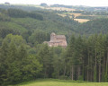
(5) In Saint-Martin, admire the cross by the sculptor Villefranque in the small square, then turn right to see the church and the sarcophagus. Retrace your steps to the statue of Christ.

(5) Cross the square and walk between the houses with their backs to the cross, then follow the natural course of the road to the right, then to the left. At the next junction, take the path on the right.

(6) Carry on straight ahead, staying on this path until you reach the D523.

(7) Walk alongside it on the right for a few dozen metres, then cross carefully to join the path on the left. Continue to the end to reach the junction with the D29.

(8) Cross carefully and walk a short way down the D29 to the left before turning right onto the Chemin de l’Homo Faber.

(9) Admire and discuss the Homo Faber with any fellow walkers you may have, whose opinions are generally quite divided: the statue’s interest and beauty, the meaning conveyed by the eye and the body. In short, it’s unlikely to leave anyone unmoved! Some loved it, whilst others, less receptive to contemporary art, did not. Then rejoin the route and head back down the dirt track which joins the RD523.
Follow this road towards Le Vibal and head for the small car park at the town hall (S/E).

Waypoints

  1. S/E : mi 0 - alt. 2,552 ft - Town hall car park
  2. 1 : mi 0.22 - alt. 2,621 ft - Three-way junction
  3. 2 : mi 0.57 - alt. 2,579 ft - Junction, go straight on
  4. 3 : mi 1.27 - alt. 2,687 ft - Path on the left
  5. 4 : mi 1.92 - alt. 2,671 ft - Les Combettes
  6. 5 : mi 2.34 - alt. 2,740 ft - Église Saint-Martin (Le Vibal)
  7. 6 : mi 2.67 - alt. 2,858 ft - Crossroads
  8. 7 : mi 2.95 - alt. 2,920 ft - D523
  9. 8 : mi 3.59 - alt. 2,894 ft - Crossing the D29
  10. 9 : mi 3.76 - alt. 2,900 ft - Homo Faber
  11. 10 : mi 5.24 - alt. 2,612 ft - D523
  12. S/E : mi 5.57 - alt. 2,552 ft - Town hall car park

Worth a visit

(S/E) The creative centre, just a stone’s throw from the town hall, on Route de Laissac. Open to visitors by appointment or at certain times during the summer.

(5) Saint-Martin’s Church.

Reviews and comments

5 / 5
Based on 2 reviews

Reliability of the description
5 / 5
Ease of following the route
5 / 5
Route interest
5 / 5
ThB
ThB

Overall rating : 5 / 5

Date of your route : Jan 27, 2026
Reliability of the description : ★★★★★ Very good
Ease of following the route : ★★★★★ Very good
Route interest : ★★★★★ Very good
Very busy route : No

Simple route, well signposted, beautiful views.

Machine-translated

jipe12
jipe12

Overall rating : 5 / 5

Date of your route : Sep 07, 2025
Reliability of the description : ★★★★★ Very good
Ease of following the route : ★★★★★ Very good
Route interest : ★★★★★ Very good
Very busy route : No

Very beautiful hike
The first 2 km on the road are a bit tedious
The trails that follow are very pleasant
The climb is 6 km long at the beginning
But I only found 149 metres of elevation gain

Machine-translated

Other walks in the area

For more walks, use our search engine .

The GPS track and description are the property of this route's author. Please do not copy them without permission.