Circular loop at the foot of Faraut

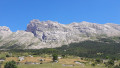
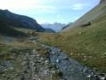
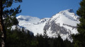
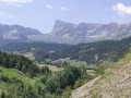
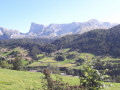
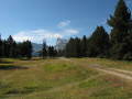
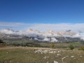
Mainly along ridges and through woodland, this route offers breathtaking views of the Dévoluy. The valley and hamlets, the Pic de Bure and its plateau, the Obiou massif and the Montagne de Faraut, emerging at every bend, will take your breath away.

Details

3549353
Creation:
Last update:
Last review:
  • Walking
    Activity: Walking
  • ↔
    Distance: 11.32 mi
  • ◔
    Average duration: 6h 45 
  • ▲
    Difficulty: Moderate

  • ⚐
    Back to start: Yes
  • ↗
    Ascent: + 1,818 ft
  • ↘
    Descent: - 1,831 ft

  • ▲
    Highest point: 5,249 ft
  • ▼
    Lowest point: 3,878 ft

Photos

Description of the walk

Park near the chapel in the village of Le Courtil.

(S/E) Join the D117 road and follow it to the left with care, heading south-southeast. In Giers, just below the last house on the left, look for the path that descends to the left, south-southeast, towards the River Souloise.
Cross the river without difficulty. The marked path winds through the woodland alongside the Souloise, heading north. You’ll reach a road junction.

(1) Turn right here and you’ll soon reach the D512, which forms part of the GR® 93 and theGRP® Tour du Dévoluy routes. Follow the red and white markings to the right. You’ll soon reach another crossroads.

(2) Leave the road, continue left on theGR® to climb up the Combe de Mayt – this is the steepest climb of the day. At the junction of the paths, keep left on theGR® 93and head towards the Pied de Faraut.

(3) Leave theGR® and turn left onto the track that climbs uphill. Well marked in yellow, this is also a mountain bike route.
At the first hairpin bend, carry straight on; the track turns into a path. Follow it to the hamlet of Roc Roux.

(4) The path narrows; follow it and cross, without wading, several streams flowing through the Ravins de Serre Uscla, du Passe and de la Charbounasse. You will reach the hamlet of Pierre Favier.

(5) Go round the rock and continue along the path. You’ll reach the edge of a small clearing at a place called Le Queyrou.

(6) Head back into the woods opposite, follow the path which widens for a few hundred metres before narrowing again. Follow the path in a circular manner to the right, arriving at the Torrent du Béal des Fontaines.

(7) Cross it and continue walking along the hillside until you reach a wider track.

(8) Carry on northwards through the forest along this track, which is suitable for vehicles. Shortly after leaving the forest, you’ll come to another crossroads with several directions.

(9) Turn left onto the path, which is clearly marked in yellow. Descend into the woods once more, following the Torrent des Queyras. You’ll reach theGR® 93.

(10) Turn left onto it and walk uphill for a few metres. Cross the Béal des Fontaines du Suippe. Continue on to reach the hamlet of La Chastre.

(11) Stay on theGR® path, which turns into a road here. Carry on until you reach the village of Collet.

(12) Take care here to take a path on the right, alongside the Lodge Les Miloux, which descends towards La Souloise. Take this path and follow it until you rejoin the route you took on the way there at the first crossroads.

(1) Cross the Souloise again and head back up towards Giers, then Le Courtil, until you reach the Chapelle car park (S/E).

Waypoints

  1. S/E : mi 0 - alt. 4,072 ft - Chapelle du Courtil car park
  2. 1 : mi 1.33 - alt. 4,075 ft - Crossroads of the circular loop - Souloise (rivière)
  3. 2 : mi 1.57 - alt. 4,114 ft - Foot of the Combe La Mayt
  4. 3 : mi 2.95 - alt. 4,908 ft - Foot of Faraut
  5. 4 : mi 3.87 - alt. 5,243 ft - Roc Roux
  6. 5 : mi 4.99 - alt. 4,997 ft - Large boulder known as Pierre Favier
  7. 6 : mi 5.3 - alt. 4,843 ft - Queyrou
  8. 7 : mi 5.77 - alt. 4,888 ft - Beal des Fontaines torrent
  9. 8 : mi 5.96 - alt. 4,843 ft - Les Preyts
  10. 9 : mi 7.07 - alt. 4,925 ft - Below the Col de l’Aup
  11. 10 : mi 8.16 - alt. 4,370 ft - GRP junction
  12. 11 : mi 8.62 - alt. 4,459 ft - La Chastre
  13. 12 : mi 9.37 - alt. 4,170 ft - Small pass
  14. S/E : mi 11.32 - alt. 4,072 ft - Chapelle du Courtil car park

Notes

(3) Shorter alternative route: leave a car near Le Barry, at the junction of the roads leading to the Col du Noyer, and walk there and back from Les Pieds de Faraut to the foot of the Col de l’Aup. Allow 4 hours 30 minutes for the whole walk, with 300 m of elevation gain and 14 km, all along a balcony path.

Shorter alternative: park and set off from Le Collet (12), and follow theGR® to La Combe la Mayt (2). This removes one water stop along the way…

(9) Alternative route: turn right to climb towards the Cabane de l’Aup and the pass of the same name, which will delight you with its views over the Pellafol plateau and Lac du Sautet. Retrace your steps to the fork in the path. Allow 40 minutes.

No special equipment required. Water available in the villages of Le Courtil and Le Collet; few shelters along the route.

Worth a visit

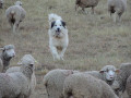
(11) La Chastre: Caution – dogs running loose.
- “Les Chanterelles” cheese shop in Le Courtil: sheep’s cheese and lamb.
- “Interstellaire du Dévoluy” brasserie in Le Courtil, just to quench your thirst a little...
Via Ferrata at Les Etroits.

Always be cautious and plan ahead when you're outdoors. Visorando and the author of this route cannot be held responsible for any accidents occurring on this route.

The GR® and PR® markings are the intellectual property of the Fédération Française de Randonnée Pédestre.

Reviews and comments

4.7 / 5
Based on 2 reviews

Reliability of the description
4.5 / 5
Ease of following the route
4.5 / 5
Route interest
5 / 5
Alain810
Alain810

Overall rating : 5 / 5

Date of your route : Aug 05, 2026
Reliability of the description : ★★★★★ Very good
Ease of following the route : ★★★★★ Very good
Route interest : ★★★★★ Very good
Very busy route : No

A very pleasant walk, partly through woodland, with beautiful and varied scenery

Machine-translated

Ankrajev
Ankrajev

Overall rating : 4.3 / 5

Date of your route : Aug 21, 2020
Reliability of the description : ★★★★☆ Good
Ease of following the route : ★★★★☆ Good
Route interest : ★★★★★ Very good
Very busy route : No

After passing La Souloise, you walk through a floodplain woodland – with a little imagination, you might think you were in the Amazon.
You can avoid this by leaving your car at the small pass: you’ll save nearly an hour, especially if you don’t take the shortcut, as we did (on the map between 1 and 2); this junction could do with being marked more clearly.

Machine-translated

Other walks in the area

For more walks, use our search engine .

The GPS track and description are the property of this route's author. Please do not copy them without permission.