Country:
 City:
City:


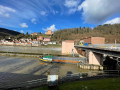
Behind the Köpfel indoor swimming pool (see address below), right by the roundabout, is the walking car park – the start and end of our circular walk. If you’re travelling by public transport, take bus route 33 towards Emmertsgrund and get off at the Ziegelhausen Köpfel stop.
(S/E) Starting from the viewing bench at the car park, which offers a magnificent view down into the valley towards the River Neckar and the Old Bridge, we walk a few metres to the left along the tarmac road, heading downhill. At the end of the car park, we turn left onto a dirt track which runs along the slope through gardens and turns into a well-trodden path.
We reach the road (Stiftweg), which we cross, and continue straight on along the paved path.
(1) Just before a long, descending right-hand bend, we come to a walnut tree and continue straight on along a barely visible grassy path, with blackberry bushes to our right. The path becomes steep for a short while, then we reach a flight of steps (take care if wet), which we descend. It appears as though we are on private property, but this is not the case. We reach the road (Am Büchsenackerhang), which we cross, and directly opposite we continue down some steps until we reach the Neuer Weg. At the bottom of the steps, we turn left and follow the ‘Red R on a white background’ sign downhill until we reach the road In der Neckarhelle. We follow this to the left until we come to a major junction, cross the road, continue straight ahead for a short distance along Peterstaler Straße, and take the first right into Kleingemünder Straße, which we follow as far as the church.
(2) Now we take the path to the left and walk straight ahead up Hahnbergweg. We are now on the European long-distance hiking trail E1, marked with a green saltire. At a fork, we see a tunnel on the right, but we continue to the left. At the next fork, carry on uphill along Friedhofsweg, passing the Ziegelhausen Friedhof bus stop, and finally take a sharp right onto Schönauer Abtweg, which takes us to the edge of the forest. Continue to follow the green saltire. The path leads past the Scouts’ grounds on the right-hand side, climbing gently all the way until we reach a crossroads.
(3) We leave the E1 and walk past two benches on the left, up the narrow path until, after about 50 metres, we reach another dirt track, which we follow to the left. In a left-hand bend, we come across the green saltire again, but turn right immediately after the bend. We take the wide path (Schimmelsteig) uphill, signposted as a cycle path.
(4) We take the middle path directly to the left of the mountain hut and continue walking slightly uphill. At the next junction, we cross the gravel path and continue uphill through the woods.
(5) At the next right-hand bend, we turn right. Our path joins a gravel track, which we follow uphill to the right. We keep to the left at first and, immediately after the three-way junction, turn right onto the unpaved meadow path, which we follow uphill until we reach a forest track at the top – the first long climb is behind us. We turn left onto the forest track (Suhlrückenweg) and stay on the wide forest track until the next junction; the path is almost flat.
(6) At the next mountain hut, we take the third path from the right (Lindenweg) – that is, the path which runs relatively flat directly to the right of the hut.
(7) We reach a hunting hide. Easy to spot in spring but relatively difficult to see in autumn, a narrow path branches off to the left here, which we follow through meadows and undergrowth. As soon as we reach a forest track again, we turn right onto it. We are now back on the E1 long-distance footpath, marked by the green saltire.
(8) At the next opportunity, we leave the E1 to the left onto an inconspicuous path. Our route leads slightly downhill and, if we look to the left, we can already see the telecoms mast at the Weißen Stein – the highest point of our walk. As soon as the denser woodland begins to the left of the path, we turn onto a barely visible path leading up to the right. Unfortunately, the path simply comes to an end because there is a protected area there; however, a detour has been created, which we follow to the right and uphill. We walk to the left along the forest track. We are back on the E1 and follow the green saltire.
(9) Five metres further on, the E1 turns right onto a narrow path (marked on a stone) and we reach a large barbecue area. It’s a good time for a break, as we’ve now covered almost half the route. We follow the E1 round the barbecue hut and turn right immediately after the hut. We reach a wider cross-path; the green cross turns left, whilst we continue straight on, slightly downhill.
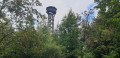
(10) At the next fork by a large beech tree, we follow a narrow path uphill to the left; it is clearly well-trodden at first, but becomes somewhat harder to make out due to tree-felling debris. Eventually, we rejoin the E1, which we follow to the right, and soon reach the wide forest track again. We stay on the E1, which continues straight on at the next junction, following the signpost to the Teltschik Tower as far as the Schriesheimer Kopf.
(11) We reach the Teltschik Tower and continue downhill on the E1; we turn left and, following the green saltire, take a sharp right shortly afterwards and then left at the next T-junction until we finally reach the Hinterbergweg woodland car park at the entrance to Wilhelmfeld. Here we leave the E1 for good and, after the car park, turn left onto a narrow path.
(12) At the seating area, we walk anti-clockwise along the fence and take the narrow path on the right back to the tarmac road; we turn left again immediately and are now on the Odenwald-Vogesen Trail, marked by a red bar on a white background. At the first fork, we keep to the right, then we reach Heidelberger Straße. The footpath runs a few metres to the left of the road; we cross over and continue to follow the signpost to the right.
(13) We reach the Wilhelmsfelder Eck mountain hut. Many paths converge here; we carry on straight ahead and follow the red bar on a white background signpost until we see the telecoms mast directly ahead of us.
(14) At the barrier, we initially continue to follow our markings, which take us round the inn; however, immediately after the building, we turn left along the terrace onto a narrow path (marked with a yellow 10) until we reach the next junction. Here, we turn right onto the tarmac road (marked with a white 10). At the next two forks in the path, we stay on the path straight ahead until we reach a junction with several paths. Here we come across the red bar on a white background trail marker again, which we follow slightly to the right until we reach the next crossroads.
(15) At the stone signpost, we turn left onto a narrow path, following the yellow 10 (Jagdhaus Fußweg). We cross several wide paths, staying on the yellow 10 for the time being. At Kreuzgrundweg, the 10 turns left; we continue straight ahead downhill on the Jagdhaus Fußweg.
(16) Shortly afterwards, we take the gravelly forest track (Brandplattenweg) to the right and uphill; at the next junction, we keep to the left and walk downhill along the Oberer Jesuitenweg to the Karlshütte.
(17) At the next junction, we take the second turn-off to the left; the path makes a sweeping S-bend, after which two spruce trees on the right mark the entrance to an unsigned but clearly visible sunken path to the right. We follow this downhill to the forest track (Kuhriegelweg), which we follow in a gentle S-bend to the left. At the end of this bend, we take the narrow path down to the right – be careful, it’s easy to miss. We reach a wide forest track, the Stiftsbuckelweg, which we follow slightly uphill to the left.
(18) We come to a bench and, just before it, turn right down the narrow path; we are now on the blue-signposted running trail. At a barely noticeable junction, we do not go downhill but follow the path to the left, uphill, directly towards the car park.
(S/E) Just a few more steps and we’re back at our starting point.
 Visorando Member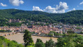

 Tourism professional
 Difficult
 Association / Club / Walk leader