


 Country:

 City:
City:


Park in the cemetery car park at the end of Rue de la Molière in Val-et-Châtillon.
(S/E) Take the narrow grassy path between the cemetery wall and the garage to reach the edge of the forest.
Blue Saltire signposting
Follow the forest path through the undergrowth to reach the forest track.
No signposting
(1) Continue to the right along this track towards the Klopstein Cross and the Collin Cross. Reach the T-junction at the hamlet known as La Salle de Danse.
Green Rectangle GR® 533 signpost
(2) Turn left, heading north-east, onto the grassy path, following the sign for “Croix Klopstein – Croix Collin”. Pass the Croix Klopstein and reach the forest road.
(3) Follow this to the right, passing the Club Vosgien shelter, until you reach the hamlet of Croix Collin on the bend.
(4) Continue following the sign for “Grand Rougimont – Croix de Fer”. Pass the Croix de Fer and reach a small clearing on the left, from where an unmarked forest track begins.
(5) Take this path to reach, on the right after about 200 m, a viewpoint at the summit of the Roches du Géant.
(6) Return to the junction.
(5) Continue left onto the GR® 533, towards “Todlaine – Col de la Charaille”, to reach the Roche des Druides junction.
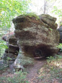
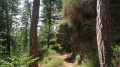
(7) The path signposted “Roche des Druides – 400 m” begins on the left between two Club Vosgien markers fixed to pine trees: a Green Rectangle and a Red Cross. It winds its way through the ferns to a beautiful viewpoint and its anvil-shaped rock.
(8) Retrace your steps back to the junction.
(7) Resume the route to the left and walk for about 200 m to reach the next crossroads.
Blue Disc signposting
(9) Turn right onto the forest track signposted “Roches du Corbet – 900 m”. When you reach a Fork in the road, turn left and then continue straight on at the next junction.
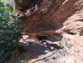
(10) The path on the left leads to the Roches du Corbet viewpoint on the right and, on the left, to a rock shelter signposted “tables and benches”, ideal for a picnic.
(11) Retrace your steps back to the previous junction.
No signposting
(10) Continue to the left to reach the junction with the forest track.
(12) Follow this long forest road straight ahead, which descends to Impasse de la Gagère.
(13) Follow it to the right for a few metres.
Yellow Disc markings
Turn right immediately after crossing the Ruisseau de la Noire Basse to join the forest track.
(14) At the fork in the road, take the forest track on the left, negotiate the hairpin bend to the left and continue to the junction with a forest path on the right.
Blue Disc Markings
(15) Turn onto this path and follow the forest track for about 500 m.
(16) To reach the hamlet known as Salle de Danse, turn left here and climb up the embankment, following the Club Vosgien markings. Important note: at this point, the actual topography differs from that shown on maps, as you must climb up the embankment to the left and continue up a short but steep slope to reach the upper path. Then rejoin the route to the right to reach the Salle de Danse junction, which you have already passed on the way there.
Red Ring markings.
(2) Continue along thesecond forest track on the left, heading due west towards Val-et-Châtillon.
(17) At the crossroads, head down to the left along the Route Forestière de la Basse du Rupt d’Achiffet to reach, after about 900 m, the start on the right of the path called the “Sentier circulaire Camille Parmentier”, leading to the Roches d’Achiffet.
(18) Turn right; at the top of the climb, you’ll reach the Roche du Solitaire and its bench.
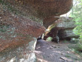
(19) Continue to the left and follow the narrow path at the foot of the rocky ridge to reach, in turn, the Roche de la Vierge, the Roche de l’Écureuil and then the Roche Pierrot Ramella.
(20) Retrace your steps, pass the Roche de l’Écureuil and continue straight on to climb to the summit of the rocky ridge at a place called Roches d’Achiffet: bench.
(21) Facing the bench, continue to the left, following the sign for the “Camille Parmentier Circular Trail”, and reach the junction with the return path after passing the pumping station trail.
Marked with a Yellow Ring.
(22) Take the path on the left and walk alongside the cemetery wall until you reach the car park (S/E) .
 Visorando Member

 Difficult
