Country:
 City:
City:


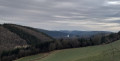
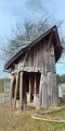
Car park at the Tourist Office on Von Orley Strasse in Burg-Reuland.
GR®® signposting
(S/E) With your back to the Tourist Office building, turn left. Walk past the church. You’ll return via the road on your right. Take thefirst road on the left. Go through the tunnel under the house and then cross over the Ulf. Ignore the RAVeL and follow the road uphill to Cross III on your left.
Unmarked
(1) Turn left onto the path near the bench. At the Fork in the road, keep left. The path descends close to the RAVeL. Stay on the path. Ignore the forest track on your right and stay on the path. Head back uphill and take in the view of Weweler Church on your right. Then head down towards the RAVeL.
(2) Follow it to the right. Cross the junction with the road carefully and carry on straight ahead. Go over the river and return to the road.
Yellow Rectangle Signposting
(3) Leave the RAVeL when it changes direction and carry on straight ahead along the road. Cross over the River Our and enter Steffeshausen. Atthe first junction, carry on straight ahead. Atthe second junction, turn right into Hohlweg. At the top, turn left. Walk uphill to a Fork in the road.
(4) Keep to the left and head uphill. Look back from time to time to take in the view over the Our valley. At the junction with the mast, turn left. Head downhill to the Fork in the road near the house.
(5) Turn right and walk past the house. The path bends to the right. Carry on straight ahead along the path that branches off to the left. At the edge of the woodland, you’ll reach a Fork in the road (not shown on OSM) and turn right. Enter the forest. The path bends to the left. Walk downhill to the junction (not shown on OSM and not fully shown on IGN).
(6) Carry on to the left. At the bottom, continue to the left. View of the Irmisch stream and its wetland, and Germany on the other side. Walk to the junction.
(7) Turn left. Follow the stream as it winds through wet meadows and then down into the valley below. Move away from the stream and leave the woods.
(8) Ignore the path on your left. When you reach a property, the path turns left. At the road, carry on to the left. Enter Auel and walk to thefirst road on the right.
Blue Rectangle Signposting
(9) Turn right. Walk downhill and, at the junction, take the hairpin bend to the right. Cross the bridge – and thus the River Our – then take the dirt track on the right. Further on, leave the path on your left, go round the hillock and pass under the RAVeL footbridge.
(10) Carry on straight ahead. Head uphill through the woods. At the Fork in the road, keep right. Leave the woods and enjoy a view of the other side of the hill where you were just walking. Ignore the path on the right. Head back under the trees.
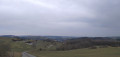
(11) Ignore the path on the left. Emerge from beneath the conifers to discover a superb panorama. A path joins from your right. Ignore this, as well as the grassy path a little further up on the left. Continue to the Tommerberg hikers’ shelter.
(12) Turn left and head down the road. Enter the village of Bracht. At the crossroads, carry straight on until you reach a Fork in the road.
(13) Turn right. Keep to the right at the next junction. Follow the road for about 1 km. As you climb, look out for Weweler Church in the distance on your left. Pass the farm and enter the village. Walk past the school and then head downhill to the T-junction with a wayside shrine attached to a house on your left.
No signposting
(14) Turn right, then left to explore the castle ruins. Then return to the junction with the wayside shrine attached to the house.
(14) Walk straight down towards the church. At the N 693, turn left and head back to the Tourist Office car park (S/E).

 Visorando Member


 Very difficult
 Difficult