The Grand-Bois de Vielsalm Circular Loop

Explore the villages on the edge of the Grand-Bois de Vielsalm, a state-owned forest.
A long route with some elevation gain, mostly through woodland – the perfect way to experience this beautiful region of the Ardennes! Along the way, you’ll pass through several magnificent villages in the municipality of Vielsalm.

Details

61033052
Creation:
Last update:
Last review:
  • Walking
    Activity: Walking
  • ↔
    Distance: 13.72 mi
  • ◔
    Average duration: 7h 20 
  • ▲
    Difficulty: Difficult

  • ⚐
    Back to start: Yes
  • ↗
    Ascent: + 1,175 ft
  • ↘
    Descent: - 1,188 ft

  • ▲
    Highest point: 1,939 ft
  • ▼
    Lowest point: 1,371 ft

Description of the walk

Park at Saint-Antoine Church or in the car park on the N675.

(S/E) Head downhill, cross the Ruisseau de Petit-Thier, and make your way to the Croix de Sart-Hennard and the Ravel.

(1) At the fork in the path, carry on straight ahead towards a house.

(2) Turn right, heading south, and join a track.

(3) Carry on to the right, towards Burtonville, until you reach the road junction.

(4) Carry on straight ahead along this road for about 600 m.

(5) Turn left, heading south towards Grand-Bois de Vielsalm, and follow the Green Diamond markings to the Quatre-Vents Nature Reserve. Follow the N823 to the left for 150 m and, at the bend, turn right for a few metres.

(6) Turn left and, from here on, follow theGR® 5 to Commanster.

(7) Walk past the old Château de Commanster, and do consider stopping there if it is open.

(8) Leave theGR® 5 and continue straight on for 200 m.

(9) Take the straight path on the right, heading due north.

(10) Return to the tarmac road and follow it to Kretels Farm.

(11) Carry on straight ahead.

(12) Turn left and walk for 300 m.

(13) Turn right, heading due north.

(14) At the multi-way junction, turn left.

(15) When you reach the tarmac, carry on straight ahead for 400 m until you reach the junction.

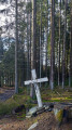
(16) Turn right before reaching the Red Rectangle marker, travelling in the opposite direction. Follow it (in the opposite direction) as far as the Raskin Cross.

(17) Turn left and walk for 200 m.

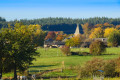
(18) Head slightly to the right before joining a path at the edge of the forest, which offers a view of Petit-Thier.

(19) Turn left and return to the fork in the path by the house, which you passed on the way there.

(2) Turn right and follow the path back the way you came, until you reach Saint-Antoine Church or the car park on the N675 (S/E).

Waypoints

  1. S/E : mi 0 - alt. 1,453 ft - Church of Petit-Thier
  2. 1 : mi 0.6 - alt. 1,391 ft - Ravel
  3. 2 : mi 0.69 - alt. 1,430 ft - House. Junction of the circular loop
  4. 3 : mi 1.63 - alt. 1,683 ft - Junction
  5. 4 : mi 1.76 - alt. 1,637 ft - Memorial
  6. 5 : mi 2.13 - alt. 1,634 ft - Green Diamond markings
  7. 6 : mi 3.44 - alt. 1,719 ft - Quatre-Vents Nature Reserve. GR5
  8. 7 : mi 7.51 - alt. 1,670 ft - Old Château de Commanster. GR5
  9. 8 : mi 8.07 - alt. 1,719 ft - End of the GR 5
  10. 9 : mi 8.17 - alt. 1,742 ft - Junction
  11. 10 : mi 8.68 - alt. 1,808 ft - Route
  12. 11 : mi 9.03 - alt. 1,870 ft - Kretels Farm
  13. 12 : mi 9.3 - alt. 1,890 ft - Junction
  14. 13 : mi 9.47 - alt. 1,926 ft - Junction
  15. 14 : mi 10.17 - alt. 1,939 ft - Junction
  16. 15 : mi 10.45 - alt. 1,900 ft - Junction
  17. 16 : mi 10.68 - alt. 1,896 ft - Junction
  18. 17 : mi 12.19 - alt. 1,634 ft - Croix Raskin
  19. 18 : mi 12.32 - alt. 1,657 ft - Junction
  20. 19 : mi 12.88 - alt. 1,457 ft - Junction
  21. S/E : mi 13.72 - alt. 1,453 ft - Church of Petit-Thier

Notes

The start and finish are at the church in Petit-Thier.
Car park with 20–30 spaces.
Difficult to reach by bus (only runs during term time)

Much of the route follows theGR® 5.
The route is largely signposted.

Enjoy your walk!

Worth a visit

- Once you arrive in Burtonville (4), you can explore the village, which is full of historic buildings.
- Do stop off at the Quatre-Vents Nature Reserve (6) to admire the flora and fauna typical of the area.
- Don’t forget to stay hydrated by stopping off at the Vieux Château de Commanster (7). The café is only open at weekends!
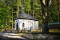
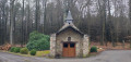
- When you reach the junction (17), you can turn right instead of left and walk 800 metres to reach the Tinseubois Chapel.

Always be cautious and plan ahead when you're outdoors. Visorando and the author of this route cannot be held responsible for any accidents occurring on this route.

The GR® and PR® markings are the intellectual property of the Fédération Française de Randonnée Pédestre.

Reviews and comments

4.8 / 5
Based on 2 reviews

Reliability of the description
4.5 / 5
Ease of following the route
5 / 5
Route interest
5 / 5
etiennedenis59
etiennedenis59

Overall rating : 5 / 5

Date of your route : Oct 15, 2025
Reliability of the description : ★★★★★ Very good
Ease of following the route : ★★★★★ Very good
Route interest : ★★★★★ Very good
Very busy route : No

A very beautiful walk, many thanks to whoever mapped it out!

Machine-translated

Guillaume Bruyère
Guillaume Bruyère

Overall rating : 4.7 / 5

Date of your route : Oct 02, 2025
Reliability of the description : ★★★★☆ Good
Ease of following the route : ★★★★★ Very good
Route interest : ★★★★★ Very good
Very busy route : No

A very beautiful hike with well-marked sections, which makes it easy to follow!

Machine-translated

Other walks in the area

For more walks, use our search engine .

The GPS track and description are the property of this route's author. Please do not copy them without permission.