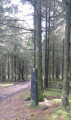
Le Grand-Bois in Vielsalm from Tinseubois

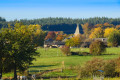
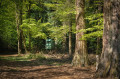
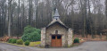
Starting from the chapel at Tinseubois, in the Grand-Bois forest near Vielsalm, this is an easy walk suitable for families.
The duration of the walk described is calculated on the basis of a leisurely stroll, allowing time to look at the plants, listen to the birds, take photos and stop for breaks.

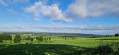
From the Ferme des Mauvaises Pierres, the walk follows the old Belgian-Prussian border, which today separates the province of Liège from the province of Luxembourg.

Details

92644779
Creation:
Last update:
Last review:
  • Walking
    Activity: Walking
  • ↔
    Distance: 4.75 mi
  • ◔
    Average duration: 2h 30 
  • ▲
    Difficulty: Easy

  • ⚐
    Back to start: Yes
  • ↗
    Ascent: + 325 ft
  • ↘
    Descent: - 331 ft

  • ▲
    Highest point: 1,870 ft
  • ▼
    Lowest point: 1,634 ft

Photos

Description of the walk

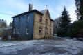
(S/E) There is a small car park in front of the chapel.

(1) Just past the barn, leave the tarmac road and take the stony path on the right.
(2) You will join the path leading from Poteau to the Mauvaises Pierres farm
(3) Just after the farm, take the path that passes to the right of the stone marker, then keep left to follow the meadow.
Cross the Dewulf road straight ahead
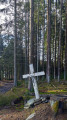
At this crossroads, if you feel like it, you can walk a few metres to your left to see if the Benoit cross is still standing. You’ll need to retrace your steps to continue the walk towards the Scmitz cross
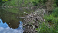
(7) Turn sharp right to see the beaver dams. If you wish to shorten the walk a little, you can turn left towards the Raskin cross and the Blanchefontaine road

(9) A few metres past the forest house, you’ll be back at the chapel

Waypoints

  1. S/E : mi 0 - alt. 1,693 ft - The chapel at Tinseubois
  2. 1 : mi 0.14 - alt. 1,706 ft - La Grange
  3. 2 : mi 0.84 - alt. 1,680 ft - Path from Poteau to Les Mauvaises Pierres
  4. 3 : mi 1.06 - alt. 1,745 ft - The Mauvaises Pierres farm
  5. 4 : mi 2.26 - alt. 1,867 ft - Crossing the Route Dewulf
  6. 5 : mi 2.81 - alt. 1,857 ft - The Benoit Cross
  7. 6 : mi 3.38 - alt. 1,785 ft - The Schmitz Cross
  8. 7 : mi 3.75 - alt. 1,690 ft - Forks towards the beaver dams
  9. 8 : mi 4.06 - alt. 1,709 ft - Beaver dams
  10. 9 : mi 4.69 - alt. 1,654 ft - The forest house
  11. S/E : mi 4.75 - alt. 1,693 ft - The chapel at Tinseubois

Notes

There are hardly any tarmac roads.

Worth a visit

You are near the hamlet of Poteau, which was the scene of a bloody battle in the early days of the Ardennes Offensive. A memorial has been erected at the site of the ambush.

Other walks in the area

For more walks, use our search engine .

The GPS track and description are the property of this route's author. Please do not copy them without permission.