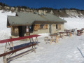
The Molière Plateau

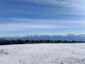
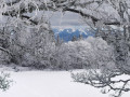
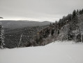
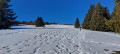
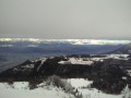
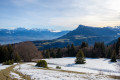
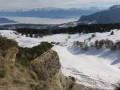
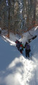
A winter snowshoe hike through magnificent landscapes, offering stunning views in unspoilt, peaceful natural surroundings.

Details

2982600
Creation:
Last update:
Last review:
  • Snowshoeing
    Activity: Snowshoeing
  • ↔
    Distance: 8.44 mi
  • ◔
    Duration according to the author: 5 hrs 
  • ▲
    Difficulty: Moderate

  • ⚐
    Back to start: No
  • ↗
    Ascent: + 1,604 ft
  • ↘
    Descent: - 1,621 ft

  • ▲
    Highest point: 5,358 ft
  • ▼
    Lowest point: 4,117 ft

Photos

Description of the walk

Park in the car park at the La Quoi chairlift, at La Sure station after Autrans. Please note! The total elevation gain for this hike, 496 m, includes the 350 m covered by the ski lift! The actual elevation gain is therefore 146 m.

(S) Take the La Quoi chairlift. Get off at the top station.

(1) Turn right and follow the signs forthe GR®9and the snowshoe trail markers (purple logos). Continue to Les Egarlettes.

(2) Pass the ski lift arrival point on your right; stay on the tracks to the left. To do this, do not head downhill; stay on the ridge line. Reach the junction ofthe GR® and the track leading to Plénouze.

(3) Stay on the track by turning right and follow the snowshoe markings. Leave theGR®9here. Continue on to reach Plénouze and its signpost.

(4) Follow the snowshoe markings and turn left, staying on the ridge. You will then rejoin the Sentier des Génisses; stay on this path as you leave the woods to reach the large crossroads at La Molière. Take a break at the orientation table.

(5) Leave the trails of the Sornin and Charande plateaus behind here and head right onto the track – known as the Route Forestière in summer – towards the Feneys mountain hut. Make your way to it.

(6) Turn 180° to the right onto the track and follow the snowshoe markings. You’ll come to a hairpin bend with a barrier.

(7) Turn sharply left and head down the Pichières forest track. Please note that the snowshoe markings are sporadic; pay close attention to the few signs present. You’ll join another track at a hairpin bend.

(8) Turn right through 180°, follow the track as it descends gently along the contour lines until you reach the crossroads before the Combe d’Huisse.

(9) Begin a gentle climb by turning right, eventually reaching the junction with the Sentier de Plénouze.

(10) Keep to the track straight ahead and descend gently until you reach the downhill ski run. Turn left then right, cross the ski run with great care, then cross the Sure ski lift.

(11) Continue straight ahead to reach the car park for the La Quoi chairlift (E).

Waypoints

  1. S : mi 0 - alt. 4,140 ft - La Quoi chairlift
  2. 1 : mi 0.63 - alt. 5,279 ft - Arrival at the summit
  3. 2 : mi 1.13 - alt. 5,246 ft - T-bar lift arrival point and ski run on the right
  4. 3 : mi 1.48 - alt. 5,167 ft - Trail junction (GR9 signpost)
  5. 4 : mi 1.85 - alt. 5,335 ft - Plénouze
  6. 5 : mi 3.05 - alt. 5,358 ft - La Molière - Table d'orientation de La Molière
  7. 6 : mi 3.81 - alt. 4,987 ft - Right-hand hairpin bend - Gîte des Feneys
  8. 7 : mi 4.49 - alt. 5,079 ft - Forest track barrier,
  9. 8 : mi 5.24 - alt. 4,672 ft - Right-hand hairpin bend
  10. 9 : mi 6.25 - alt. 4,501 ft - Trail junction, start of the ascent
  11. 10 : mi 6.76 - alt. 4,600 ft - Crossroads
  12. 11 : mi 7.88 - alt. 4,242 ft - Passing under the ski lift
  13. E : mi 8.44 - alt. 4,117 ft - Car park at the Quoi chairlift

Notes

(S) La Quoi chairlift: Please note, you must ascend between 09:00 and 10:00; collect your ticket from the ticket office 200 metres further on at Park Alpin; descent is not permitted.
(Between 1 and 5) The trail is shared with cross-country skiers as far as La Molière. Follow the signs on the small purple boards – these are the snowshoe logos.

Bring:
- Warm clothing, gloves, hats, balaclavas.
- Pack a rucksack with hot drinks and plenty of water, plus a packed lunch.
- Head torch, knife.
- First-aid kit, emergency blanket.
- A change of clothes for when you arrive.
- Compass.
- Binoculars.
- IGN map OT 3235 (preferably laminated).

This route passes through multiple protected areas, which may be subject to special regulations:

Worth a visit

(5) La Molière orientation point, with beautiful views across the Alps, from Switzerland to the Écrins.
(6) The Feneys mountain hut is open in winter; meals are available – hearty and very good (cheques or cash only, no credit cards).
As well as the scenery, there’s a chance to spot wildlife, such as ibex, and perhaps traces of dogs or wolves.

Always be cautious and plan ahead when you're outdoors. Visorando and the author of this route cannot be held responsible for any accidents occurring on this route.

The GR® and PR® markings are the intellectual property of the Fédération Française de Randonnée Pédestre.

Reviews and comments

4.2 / 5
Based on 3 reviews

Reliability of the description
4 / 5
Ease of following the route
4 / 5
Route interest
4.7 / 5
Bruno52
Bruno52

Overall rating : 3.7 / 5

Date of your route : Oct 15, 2024
Reliability of the description : ★★★☆☆ Average
Ease of following the route : ★★★☆☆ Average
Route interest : ★★★★★ Very good
Very busy route : No

A walk where you have to find your own route, as it’s rarely used. The paths are poorly marked.
Nevertheless, it’s a magnificent walk offering spectacular views.

Machine-translated

jp38
jp38

Overall rating : 4 / 5

Date of your route : May 13, 2024
Reliability of the description : ★★★★☆ Good
Ease of following the route : ★★★★☆ Good
Route interest : ★★★★☆ Good
Very busy route : Yes

A lovely view of the mountains.

Machine-translated

LaurenceMD69
LaurenceMD69
• Edited:

Overall rating : 5 / 5

Date of your route : May 27, 2020
Reliability of the description : ★★★★★ Very good
Ease of following the route : ★★★★★ Very good
Route interest : ★★★★★ Very good
Very busy route : Yes

A very easy walk – definitely best done early in the morning; after that, it’s like a motorway!
The cows hadn’t been taken up to the mountain pastures yet, but the marmots and vultures were out in force!

Machine-translated

Other walks in the area

For more walks, use our search engine .

The GPS track and description are the property of this route's author. Please do not copy them without permission.