Country:

 City:
City:


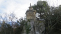
Park in the car park near the castle.
(S/E) At the top of the large car park, near the underground water cistern, set off along theGRP® Tour des Monts de Vaucluse trail, marked in yellow and red. Head straight up the main path which follows the ridge, ignoring any side paths to the right and left, until you reach a wider track. Continue, staying on the main path, until you reach a junction with a small road (signposted ‘Piste du Grand Puymians’).
(1) Follow the main track to the left. Pass a road on the right and arrive at a Fork in the road. Leave theGRP® to the left, continue straight ahead for 50 m and arrive at a trailhead on the left.
(2) Leave the main path and take this track on the left, towards the Monastery of Saint-Gens, and further on you’ll come to a fork.
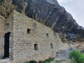
(3) Head down to the right, towards the Monastery of Saint-Gens, and join a road.
(4) Follow it to the right, towards La Carrière. At the junction, continue to the right for about thirty metres until you reach a sharp right-hand bend, where you’ll spot a signposted path on the left.
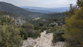
(5) Turn left, heading due south, onto this stony path (GR®) which climbs uphill (sign for ‘Miraculous Spring’ 350 metres ahead). Walk to this spring.
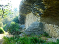
(6) In front of the spring, turn sharply to the right, then left, and head uphill, due south, along a path at the bottom of the valley, running alongside the rocks. Stay on the main path, ignoring any offshoots to the right and left, until you reach a T-junction.
(7) Turn left onto the path which leads into a section thick with boxwood. Reach thefirst junction (signpost for ‘Rochers des Trois Luisants’) and continue straight on until thesecond fork (signpost for ‘Les Trois Luisants’).
(8) Turn right and follow the path to a clearing (lookout post) at a multi-way junction.
(9) Head towards the lookout point to admire the 360° panoramic view over the Comtat plain. Then take the path to the right of the lookout point and head downhill, staying on the main path and ignoring any side trails until you reach a fork.
(10) Leave the path heading directly for Saumane and take theGR® to the left (signposted Mourre Pelé).
(11) At elevation 314, continue along theGR®, pass the Valescure farm and arrive at a multi-way junction at elevation 284.
(12) Turn right onto theGRP® Tour des Monts de Vaucluse, marked in yellow and red, towards Les Fayardes and Fontaine de Vaucluse. Stay on the path until you reach a track on the right and the continuation of the GRP®.
(13) Leave the main path and take thisGRP® track on the right towards Saumane (signposts). Continue down the main path. Further down, cross the road and continue along the path opposite, towards Saumane (signposted ‘Les Lauzes’). Walk all the way down an old paved slanting street (calade), taking care not to slip! At the end of the path, cross a ford and walk up the concrete path opposite to a road junction.
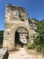
(14) Turn left onto Rue des Fontaines and continue to Place de la Libération. Walk up the small street to Place de la Mairie, pass the old wash house to explore the village via Rue de l’Église and reach the church.
(15) From Saint-Trophime Church, return to the old washhouse and continue straight ahead, due north, along the Montée du Château, pass the entrance to the castle and, via the Chemin de Saint-Gens, reach the car park (S/E).


 Visorando Member
 Moderate
 Easy
Easy