


Refine your search for walks in Saint-Joseph-de-Rivière
Saint-Joseph-de-Rivière walks


 The Herretang bog
 Visorando Member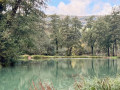
 3.58 mi
 +10 ft
 -10 ft
 1h 40
1h 40
 Easy
Easy
 Departure from Saint-Laurent-du-Pont (Isère)
In Saint-Laurent-du-Pont, there is a 6 km flat walk along a wetland discovery trail.
The Herrétang peat bogs and the Rocher de la Garde
7.29 mi
+1,001 ft
-988 ft
4h 15
 Moderate
Departure from Saint-Laurent-du-Pont (Isère)
Moderate
Departure from Saint-Laurent-du-Pont (Isère)
Explore the western part of the Herrétang peat bogs from its observation points, after following the cycle path uphill towards the Rocher de la Garde to enjoy its 360° panorama.
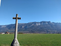
Way of the Cross around Saint-Laurent-du-Pont
 5.21 mi
+289 ft
-259 ft
2h 40
Easy
Departure from Saint-Laurent-du-Pont (Isère)
5.21 mi
+289 ft
-259 ft
2h 40
Easy
Departure from Saint-Laurent-du-Pont (Isère)
There are numerous crosses in the area around Saint-Laurent-du-Pont.
Here is a suggested route starting from the main church to see as many of them as possible, mainly in the plain.
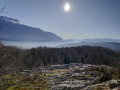
Crossey Gorges - Croix du Rocher de la Garde
 2.61 mi
+741 ft
-745 ft
1h 50
Moderate
Departure from Saint-Étienne-de-Crossey (Isère)
2.61 mi
+741 ft
-745 ft
1h 50
Moderate
Departure from Saint-Étienne-de-Crossey (Isère)
This is an easy hike, except for a short acrobatic passage on the sharp limestone pavement near the cross. Beautiful view of Saint-Étienne-de-Crossey and its surroundings.
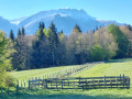
From the Crossey Gorges to the Pierre Chave Bridge, a circular route
 9.64 mi
+1,506 ft
-1,493 ft
5h 45
Moderate
Departure from Saint-Étienne-de-Crossey (Isère)
9.64 mi
+1,506 ft
-1,493 ft
5h 45
Moderate
Departure from Saint-Étienne-de-Crossey (Isère)
Starting from the impressive Crossey Gorges (200 m high), this double-circular route, mainly through woodland and without any technical difficulty or danger, will take you to the Tourniquet or Pont de Pierre Chave, a rather rare spiral structure where the road passes successively under and over the bridge. On the return journey, the route passes by the Rocher de la Garde, a lovely viewpoint overlooking Saint-Étienne de Crossey and the Voironnais region.
From distillery to distillery in Saint-Laurent-du-Pont
 Tourist office
 8.19 mi
+781 ft
-804 ft
4h 25
Moderate
Departure from Saint-Laurent-du-Pont (Isère)
8.19 mi
+781 ft
-804 ft
4h 25
Moderate
Departure from Saint-Laurent-du-Pont (Isère)
The Fourvoirie site marks one of the entrances to the Chartreuse Desert. One of the bridges, built in the 13th century, gave its name to the village of Saint-Laurent-du-Pont. On the right bank of the Guiers Mort, the Carthusians once started a major metallurgical industry, which continues today in the Saint-Laurent plain. On the other bank, the monks established a distillery, which was destroyed by a landslide in 1935.
La Grande Sure and the Chartreuse de Currière, starting from Saint-Laurent-du-Pont
 13.36 mi
+5,016 ft
-4,993 ft
10h 30
13.36 mi
+5,016 ft
-4,993 ft
10h 30
 Difficult
Departure from Saint-Laurent-du-Pont (Isère)
Difficult
Departure from Saint-Laurent-du-Pont (Isère)
This circular walk is a variation on route no. 107635379, the Grande Sure, a return walk from Saint-Laurent-du-Pont. The ascent to the summit of the Grande Sure is the same, but this route differs in its return leg, which starts from the Col de la Sure, from where the path leads to the Col des Charmilles, descends the opposite slope, then crosses the Rochers des Agneaux before hurtling down a steep cirque and joining the Route Forestière de la Charmette, which leads to the magnificent Chartreuse de Currière. This route offers the advantage of a different return journey with a similar elevation gain, despite being 2.8 km longer, but has the disadvantage of ending on a road.
La Grande Sure round trip from Saint-Laurent-du-Pont
 11.65 mi
+5,020 ft
-4,990 ft
9h 45
Difficult
Departure from Saint-Laurent-du-Pont (Isère)
11.65 mi
+5,020 ft
-4,990 ft
9h 45
Difficult
Departure from Saint-Laurent-du-Pont (Isère)
A lovely, shaded hike along steep slopes through the forest, passing through a cirque notable for its scree of dazzlingly white limestone. As you emerge from the forest, a superb view opens up over a grassy valley dotted with a few wooded areas and nestled between imposing rocky ridges. From the summit, you’ll enjoy a magnificent 360° panorama: to the east, from Mont Blanc to the Écrins via Belledonne and the Grandes Rousses; to the south, the Vercors; to the west, the Dauphiné Mountains; and to the north, the Chartreuse.
Pisserotte Waterfall
1.44 mi
+476 ft
-486 ft
1h 05
Easy
Departure from Saint-Joseph-de-Rivière (Isère)
Situated on the outskirts of Saint-Joseph-de-Rivière, the Pisserotte Waterfall plunges at full speed down from the Grande Sure mountain. It offers an easy, family-friendly walk to the foot of the waterfall. Nestled in the mountainside, it is a cool haven and a peaceful, relaxing spot.
This 64-metre-high waterfall is easily accessible via a 15-minute walk. It is particularly impressive in March and April, when the snowmelt results in a strong flow of water.
Côte Curt art trail
2.81 mi
+722 ft
-702 ft
1h 55
Easy
Departure from Saint-Laurent-du-Pont (Isère)
This short 1½-hour walk is suitable for families.An artistic discovery route: all along the route, you can admire and discover works of art set against the backdrop of the old Sardinian road.
The Rocher de la Garde
 3.29 mi
+1,099 ft
-1,096 ft
2h 30
Moderate
Departure from Saint-Étienne-de-Crossey (Isère)
3.29 mi
+1,099 ft
-1,096 ft
2h 30
Moderate
Departure from Saint-Étienne-de-Crossey (Isère)
A short walk through the woods starting from the Gorges de Saint-Étienne de Crossey, passing by the Rocher de la Garde and its lovely viewpoint over the western part of the Chartreuse and the eastern part of the Pays Voironnais.
Circular from Saint-Aupre
 7.53 mi
+1,598 ft
-1,591 ft
4h 50
Moderate
Departure from Saint-Aupre (Isère)
7.53 mi
+1,598 ft
-1,591 ft
4h 50
Moderate
Departure from Saint-Aupre (Isère)
A short, easy walk with some lovely views and a passage over the original Pont de Pierre Chave bridge.
La Grande Sure from the Chartreuse de Curière
 9.26 mi
+3,609 ft
-3,609 ft
7h 25
Difficult
Departure from Saint-Laurent-du-Pont (Isère)
9.26 mi
+3,609 ft
-3,609 ft
7h 25
Difficult
Departure from Saint-Laurent-du-Pont (Isère)
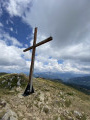
Another way to reach the summit of the Grande Sure. Most hikers from the Grenoble area access it via Proveysieux and the Col de la Charmette. For those coming from the Savoyard hinterland, access via Saint-Laurent-du-Pont and the Chartreuse de Curière is an interesting alternative.
From the start at (5), the route is not very busy.
The Grande Sure circular loop starting from Curière
 10.55 mi
+3,937 ft
-3,937 ft
8h 15
Difficult
Departure from Saint-Laurent-du-Pont (Isère)
10.55 mi
+3,937 ft
-3,937 ft
8h 15
Difficult
Departure from Saint-Laurent-du-Pont (Isère)
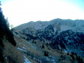
A varied but relatively long route up to the Grande Sure, favouring sections that are slightly steeper but above all wilder and less frequented than the usual routes: Pas de la Biche and Crête des Charmilles.
Crête des Charmilles via the Chemin des Agneaux
 5.98 mi
+2,654 ft
-2,631 ft
5h 05
Moderate
Departure from Saint-Laurent-du-Pont (Isère)
5.98 mi
+2,654 ft
-2,631 ft
5h 05
Moderate
Departure from Saint-Laurent-du-Pont (Isère)
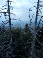
A lovely hike, mainly through the woods, allowing you to discover the Chartreuse de Currière, a little-known monastery, and enjoy beautiful views of the Chartreuse from the ridges.
La Roche de la Garde
 6.34 mi
+922 ft
-925 ft
3h 45
Moderate
Departure from Saint-Étienne-de-Crossey (Isère)
6.34 mi
+922 ft
-925 ft
3h 45
Moderate
Departure from Saint-Étienne-de-Crossey (Isère)
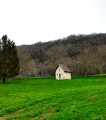
A lovely little walk, mostly through woodland. The tarmac sections are along a quiet road. The view from the Rocher de la Garde is very pleasant.
Circular Fétrus-Pertuis from Saint-Laurent-du-Pont
 6.37 mi
+2,917 ft
-2,900 ft
5h 30
Moderate
Departure from Saint-Laurent-du-Pont (Isère)
6.37 mi
+2,917 ft
-2,900 ft
5h 30
Moderate
Departure from Saint-Laurent-du-Pont (Isère)
This circular can be done in almost any season (except after storms or heavy rain) and allows you to discover some lesser-known parts of Chartreuse.
Gorges du Guiers Mort
 1.89 mi
+1,306 ft
-1,335 ft
2h 00
Easy
Departure from Saint-Laurent-du-Pont (Isère)
1.89 mi
+1,306 ft
-1,335 ft
2h 00
Easy
Departure from Saint-Laurent-du-Pont (Isère)
A walk along the Guiers Mort with small bridges and footbridges, also known as the ‘Balade des poissons bleus’. From the Pont Saint-Bruno to the Pic de l’Œillette, you can discover the legacy of the Carthusian monks.
⚠️ User comment>The route is currently (14/07/2026) closed for safety reasons. It features footbridges in poor condition, which could cause an accident. However, it is very popular for its refreshing atmosphere during heatwaves. Please check with the St Pierre de Chartreuse tourist office.
Around the Guiers Mort (2): the gorges
 1.75 mi
+610 ft
-584 ft
1h 20
Moderate
Departure from Saint-Laurent-du-Pont (Isère)
1.75 mi
+610 ft
-584 ft
1h 20
Moderate
Departure from Saint-Laurent-du-Pont (Isère)
A short hike around the Guiers Mort, a pretty little stream. The walk is mainly through the undergrowth at the bottom of the gorges along the Guiers, in search of coolness, with several opportunities to take a dip.
- User report on 24 August 2023:
The trail is currently closed for works from 14 August to 30 November 2023 (the "blasting" sign is very dissuasive).
Access from Saint-Pierre-de-Chartreuse by car is also closed (long detour via Saint-Pierre-d'Entremont).
Circular route: Sentier du Solitaire – Cheminée de Corde – Arpison Viewpoint
 6.35 mi
+3,297 ft
-3,274 ft
5h 45
Difficult
Departure from Saint-Laurent-du-Pont (Isère)
6.35 mi
+3,297 ft
-3,274 ft
5h 45
Difficult
Departure from Saint-Laurent-du-Pont (Isère)
A lovely circular route through little-known and little-visited parts of the Chartreuse, following old paths… which, sadly, are sometimes on the verge of disappearing.
Pic de l'Oeillette
 2.01 mi
+801 ft
-817 ft
1h 35
Moderate
Departure from Saint-Laurent-du-Pont (Isère)
2.01 mi
+801 ft
-817 ft
1h 35
Moderate
Departure from Saint-Laurent-du-Pont (Isère)
The Pic de l’Oeillette is a rocky monolith on the edge of the road between Saint-Laurent-du-Pont and Saint-Pierre-de-Chartreuse. There is no question of climbing it here; it serves merely as a visual landmark for a leisurely walk along the banks of the Guiers Mort.
Accessible outside the snowmelt season, it offers a welcome respite from the heat in summer.

More walks in Saint-Joseph-de-Rivière
Select a point of interest below: