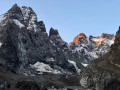
Crossing from Ailefroide to Chambran via the Cime du Paillon

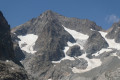
An alpine hike, largely off-trail, through very wild terrain; not particularly difficult but requiring sure-footedness. You’re more likely to encounter chamois than people! Stunning views of the Pelvoux.
Setting off early means you can complete much of the ascent in the shade.

Details

3603453
Creation:
Last update:
Last review:
  • Walking
    Activity: Walking
  • ↔
    Distance: 4.39 mi
  • ◔
    Duration according to the author: 6 hrs 
  • ▲
    Difficulty: Very difficult

  • ⚐
    Back to start: No
  • ↗
    Ascent: + 4,193 ft
  • ↘
    Descent: - 3,497 ft

  • ▲
    Highest point: 9,127 ft
  • ▼
    Lowest point: 4,908 ft
  • ⚐ Country: France
  • ⚐
    Areas: Alps, Ecrins, Dauphiné
  • ⚐ City: Pelvoux (05340)
  • ⚑
    Start: N 44.888263° / E 6.448024°
  • ⚑
    End: N 44.901465° / E 6.493061°
  • ❏
    IGN map(s): Ref. 3436ET, 3436ETR, 3536OT, 3536OTR
  • Hour-by-hour weather

Photos

Description of the walk

Park in the car park by the bridge at Ailefroide.

(S) Take the correct path to the Tête de la Draye.

(1) Turn left at the hairpin bend to begin the ascent, with vertiginous ledges over the first 200 metres of elevation gain. Reach the Tête de la Draye (2,077 m).

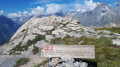
(2) Climb up a narrow path along a beautiful north-east-facing alpine ridge.

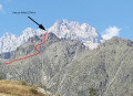
(3) Start of the off-trail section: at the 2,400-metre mark, head right along a steeply ascending traverse across the large rocky slope on the southern face of the Cime du Paillon. If there are several of you, stay close together to prevent stones dislodged by those in front from gaining speed! There are a few cairns. After a direct climb of about 50 m, reach a small gap, then continue along an ascending traverse to the right until you reach a scree couloir leading down from the summit. Navigate as best you can over small spurs to reach the summit.

(4) Follow the north ridge without difficulty for about 200 m.

(5) Turn right to descend easily down the eastern slope into the valley towards a large black boulder. Continue down the valley. At around the 2,400 m mark, you’ll find tracks on a gentle moraine.

(6) At the 2,300 m mark, traverse left whilst descending, crossing several streams along the way to reach a flat area with an old enclosure.

(7) From there, just below, a small stony path begins which leads easily to Chambran (E).

Waypoints

  1. S : mi 0 - alt. 4,934 ft - Car park at the bridge in Ailefroide - Gyr (cours d'eau) - Affluent de la Gyronde
  2. 1 : mi 0.23 - alt. 4,944 ft - Junction
  3. 2 : mi 1.41 - alt. 6,824 ft - Tête de la Draye
  4. 3 : mi 1.9 - alt. 7,835 ft - 2,400 m – Start of the off-trail section
  5. 4 : mi 2.42 - alt. 9,124 ft - Cime du Paillon
  6. 5 : mi 2.54 - alt. 9,052 ft - Small pass – Heading east
  7. 6 : mi 3.34 - alt. 7,543 ft - Elevation 2,300 m
  8. 7 : mi 3.61 - alt. 7,073 ft - Old enclosure – Flat area
  9. E : mi 4.39 - alt. 5,630 ft - The hamlet of Chambran

Reviews and comments

4.8 / 5
Based on 2 reviews

Reliability of the description
5 / 5
Ease of following the route
4.5 / 5
Route interest
5 / 5
Moloss28
Moloss28

Overall rating : 5 / 5

Date of your route : Aug 09, 2025
Reliability of the description : ★★★★★ Very good
Ease of following the route : ★★★★★ Very good
Route interest : ★★★★★ Very good
Very busy route : No

A beautiful, wild hike. After leaving the trail at around 2,400 metres, the original publication is excellent and the GPX track is flawless. What's more, there are plenty of cairns to help you find your way.
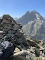
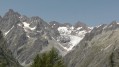
At the summit of Paillon: there is a viewpoint over Mont Pelvoux and its Glacier des Violettes, and the panorama over the Vallon du Sélé, the south face of the Barre des Écrins and the Glacier Blanc is well worth the detour
The descent to Chambran is fun and beautiful, despite its steepness, which is probably due to the lack of a trail. However, by following the GPX track, you can still go where you want to put your feet...

Machine-translated

randoguche
randoguche

Overall rating : 4.7 / 5

Date of your route : Jul 21, 2023
Reliability of the description : ★★★★★ Very good
Ease of following the route : ★★★★☆ Good
Route interest : ★★★★★ Very good
Very busy route : No

A relatively challenging off-trail hike over the final 250 metres leading to the summit and the pass, due to the steep slopes of its stony gullies. I particularly enjoyed it for its wild character and the exceptional view of the glacier and the Dent du Pelvoux. I didn’t come across anyone there, and unfortunately no animals either. I had to try several routes before finding the right one, as I was unable to follow the described route – my phone’s GPS had stopped working shortly after the Tête de la Draye… but the navigation guidance seems perfectly reliable. The route description is brief but effective. The off-trail descent to Chambran is quite gruelling and of little interest.
An alpine hike off the beaten track, suitable for experienced hikers.

Machine-translated

Other walks in the area

For more walks, use our search engine .

The GPS track and description are the property of this route's author. Please do not copy them without permission.