The Crossing from Le Casset to the Col du Lautaret

A classic route in the upper Briançon region: reach the Col du Lautaret via Lac d’Arsine and the Crevasses Trail from the hamlet of Le Casset, north of Monetier-les-Bains.

Details

92622
Creation:
Last update:
Last review:
  • Walking
    Activity: Walking
  • ↔
    Distance: 11.16 mi
  • ◔
    Average duration: 8h 10 
  • ▲
    Difficulty: Difficult

  • ⚐
    Back to start: No
  • ↗
    Ascent: + 3,451 ft
  • ↘
    Descent: - 1,693 ft

  • ▲
    Highest point: 8,097 ft
  • ▼
    Lowest point: 4,934 ft

Photos

Description of the walk

Park your vehicle in advance at the Col du Lautaret car park.
Return to Le Casset and park in the large car park before the hamlet when approaching from Monetier.

(S) Walk through the hamlet and take the footbridge over the Guisane to rejoin the red and white markings ofthe GR®54, Tour de l’Oisans.
Follow thisGR® route all the way, starting on the mountain pasture track to the Pont du Clot du Gué and then on to the footbridge over the Petit Tabuc.

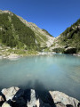
(1) Continue along the track, which soon becomes a path, until you reach Lac de la Douche.

(2) Cross over the stone embankment. After a steep climb, reach the Plan du Réou d’Arsine, where the slope levels out almost completely.

(3) Leave theGR® after the shepherd’s hut and reach a crossroads marked by a discreet cairn.

(4) Turn left onto the path leading to the track that takes you to the Arsine lakes and then to the two lakes.

(5) Follow the wide track to the Col d’Arsine to rejoin theGR®54.

(6) Begin a very gentle descent and reach the crossroads of footpaths.

(7) Turn left onto the path leading to the Refuge de l’Alpe de Villar d’Arêne.

(8) Continue north on this path to rejoin theGR®54just before the clearly visible weather station. Reach another junction.

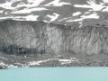
(9) Take the path on the right – this is the ‘Sentier des Crevasses’, which skirts the Pyramide de Laurichard. You’ll reach the viewing point.

(10) Continue along this path heading east to reach the Col du Lautaret with ease (E).
Waypoints

  1. S : mi 0 - alt. 4,934 ft - Le Casset car park. Take the footbridge at the - Guisane (rivière)
  2. 1 : mi 1.17 - alt. 5,315 ft - Petit Tabuc footbridge
  3. 2 : mi 2.3 - alt. 6,247 ft - Dike at the - Lac de la Douche
  4. 3 : mi 3.42 - alt. 7,274 ft - The Réou d’Arsine
  5. 4 : mi 4.18 - alt. 7,700 ft - Cairn on the Lakes Trail
  6. 5 : mi 4.84 - alt. 8,058 ft - Lacs d'Arsine
  7. 6 : mi 5.52 - alt. 7,713 ft - Col d'Arsine (2340m)
  8. 7 : mi 6.39 - alt. 7,241 ft - Carrefour Refuge
  9. 8 : mi 7.41 - alt. 6,818 ft - Refuge de l'Alpe de Villar d'Arêne
  10. 9 : mi 8.21 - alt. 6,739 ft - Crevasses Trail junction
  11. 10 : mi 9.53 - alt. 6,946 ft - Viewpoint
  12. E : mi 11.16 - alt. 6,677 ft - Car park at > - Col du Lautaret

Notes

There is plenty of water here; simply help yourself from any of the springs that flow upstream along the path.
Shelter at the Alpe de Villar d’Arêne refuge.
(3) Lac de la Douche: the path was relocated to the left bank of the lake a few years ago. The old route through the scree slope ran above the Petit Tabuc torrent, which flows underground along this stretch. The torrent ‘resurfaces’ shortly before the lake, and as it has a very high flow rate, during heavy rain it can sometimes ‘resurface’ much higher up. Crossing at that point had therefore become dangerous, hence the creation of the path on the opposite bank.
(9) Sentier des Crevasses: Please note that this path is regularly maintained by staff from the Écrins National Park; it is in excellent condition and wide, but it is carved out of schist and the gradient is steep. When it rains, it is often eroded by gullies and can therefore be very difficult to navigate. Hikers with little experience of this type of walk should not attempt this route on days of heavy rain or storms.
You are hiking in the heart of the Écrins National Park.
The Écrins massif is an exceptional area, open to all, with a natural, cultural and scenic heritage that is truly unique. To protect these treasures, the heart of the park is marked by blue, white and red flags, and certain regulations must be observed within this area. Please familiarise yourself with these regulations on the website whilst planning your hike, in order to preserve this shared heritage.

Worth a visit

Monetier-les-Bains and its hot spring.
La Grave and its glacier cable car.

Always be cautious and plan ahead when you're outdoors. Visorando and the author of this route cannot be held responsible for any accidents occurring on this route.

The GR® and PR® markings are the intellectual property of the Fédération Française de Randonnée Pédestre.

Reviews and comments

4.5 / 5
Based on 2 reviews

Reliability of the description
4.5 / 5
Ease of following the route
4.5 / 5
Route interest
4.5 / 5
val05
val05
• Edited:

Overall rating : 5 / 5

Date of your route : Aug 20, 2025
Reliability of the description : ★★★★★ Very good
Ease of following the route : ★★★★★ Very good
Route interest : ★★★★★ Very good
Very busy route : Yes

Superb hike with magnificent views. We opted for the trail that stays above the two refuges. Be careful on the crevasse trail, but it's nothing too bad... The advantage of this route is that there is less elevation loss on the descent, which is better for the knees.

Machine-translated

monts berthiand
monts berthiand

I was only talking about the pass to the village of Le Casset, which is 10.7 km
but I’ve just realised that the famous 6.7 km was only as far as Le Lauzet, so before Le Casset

and consequently the distance must be correct

Sorry for the mistake

and we did indeed go as far as the Arsine lakes, heading up from Le Casset via Lac de la Douche
Magnificent!!!!

Machine-translated

bernardino
bernardino ★

Hello, whilst reading your message I was a little surprised by the distances you mention.
The suggested route description gives 17.96 km via Lake Arsine. So I checked it, as I was also surprised by your measurement of 10.3 km, which seemed to me to be well below the actual distance. And the new route I’ve mapped out for this route comes to 15 km. The difference is due to the fact that it doesn’t go via Lake Arsine.
It really is a lovely walk, and the direction you’ve chosen is easier, with less uphill climbing; unfortunately, this results in a greater descent, which can be tough on the knees at times. On the other hand, the view of the Agneaux massif is much more interesting from that direction.
Have a lovely day and enjoy the rest of your time on the site.

Machine-translated

monts berthiand
monts berthiand

Overall rating : 4 / 5

Date of your route : Aug 28, 2020
Reliability of the description : ★★★★☆ Good
Ease of following the route : ★★★★☆ Good
Route interest : ★★★★☆ Good
Very busy route : No

We did it the other way round – that is, from the Col du Lautaret to Le Casset
and anyway, you can’t go wrong, but on my Visorando app it says 10,300 km instead of the 6,700 km advertised

Machine-translated

Other walks in the area

For more walks, use our search engine .

The GPS track and description are the property of this route's author. Please do not copy them without permission.