Col du Rasoir and Aiguilles Vertes

A very scenic hike starting from the car park at the Chalet Refuge de Cenise. After crossing a scree slope near the Arête de Chevry, a cliff section near the Pointe de Sosay, a stretch through a mountain pasture running along the foot of the Aiguilles Vertes, and then an ascent to the Col du Rasoir. You then follow the Arête du Rasoir to the start of the Cravatte before returning to the pass to descend via the Aiguilles Vertes. Superb views

Details

67230
Creation:
Last update:
Last review:
  • Walking
    Activity: Walking
  • ↔
    Distance: 4.35 mi
  • ◔
    Average duration: 4h 10 
  • ▲
    Difficulty: Difficult

  • ⚐
    Back to start: Yes
  • ↗
    Ascent: + 2,470 ft
  • ↘
    Descent: - 2,438 ft

  • ▲
    Highest point: 7,549 ft
  • ▼
    Lowest point: 5,108 ft

Photos

Description of the walk

Access: from Annemasse (Geneva), take the A40 motorway towards Chamonix, exit 16 (Bonneville), then follow signs for La Clusaz / Le Grand Bornand. Pass through Saint-Pierre and follow the D12 to Le Petit-Bornand-les-Glières. Roughly halfway through the village, before the town hall square, turn left (Puze). Drive up to a junction signposted Puze on the left; turn right, towards Cenise – Paradis. Further up, follow signs for ‘Chalet de Cenise’. Just before reaching the Chalet Refuge de Cenise, you can park on the left.

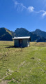
(S/E) From the car park (1,560m), head up to the refuge and turn right (signposted ‘Jallouvre – Cenise’). A little further up, you can follow the ‘Jallouvre’ sign for convenience. We continued towards Col de Cenise, then climbed a hundred metres further up to the right into the pasture, ‘heading’ for the Aiguilles Vertes.
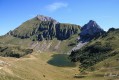
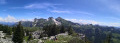
The meadow is beautifully flowered with an explosion of colours and a few erratic sandstone boulders. The view is already splendid; the Pointe de Sosay is in the foreground with its impressive rock face and, from right to left, the Voray, the Dent de Jallouvre, the Pic de Jallouvre, the Pointe Blanche, the Aiguilles Vertes, the Pointe de Balafrasse and the Pointe du Midi. Once on level ground, head slightly left towards the Aiguilles Vertes to reach the base of the cliffs.

(1) You should soon spot the path leading to the foot of the cliffs, which you will reach by descending slightly.
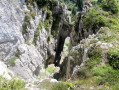
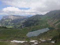
The path runs alongside the rock faces towards the Pointe de Sosay; there is a fine view of the Rochers de Leschaut and, in the distance, the Pointe de Sur Cou, the Roche Parnal and the Montagne de Sous-Dine. The path turns left and becomes steep in a narrow gully, allowing you to cross the cliffs and reach less rugged terrain.

(2) Spruce trees and scattered rocks, a chasm on the left, and after winding your way a little (irregular markings), you emerge onto a new mountain pasture; continue on level ground before beginning the ascent towards the Col du Rasoir.
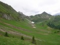
You can make out the Col de Sosay on the right, at the foot of the Dent de Jallouvre. The path isn’t always very well marked, but you can’t go far wrong as long as you keep the Col du Rasoir in your sights. When we were there, patches of snow covered the upper section of the path; we avoided the snow by keeping to the left until the junction leading to the Aiguilles Vertes (note the path we’ll take on the way back.

(3) Continue the climb up the scree slope (a short, tricky section of snow that hasn’t melted yet) just before reaching the Col du Rasoir.

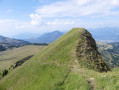
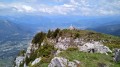
(4) Superb views of the Aravis, the Pointe Blanche and, of course, the Jallouvre. Follow the Rasoir ridge to the Cravate.

(5) Normally, the route to the summit of the Jallouvre is fairly obvious; however, we turned back as there were still several patches of snow that proved tricky to cross without snowshoes or crampons.

(5) Return to the Col du Rasoir.

(4) Head back down to the aforementioned fork.

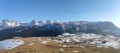
(3) Turn right and begin the section leading to the Aiguilles Vertes. Apart from the geological features of the Aiguilles Vertes, the views are exceptional: the Rochers de Leschaux, the Jura, the Salève, the Môle, several peaks of the Chablais; on the Bargy side, the Pechta, Balafrasse, Pointe du Midi, the Tour, the Grand and the Petit Bargy...
This part of the route is not always straightforward, and you should remain alert so as not to lose the ‘trail’; there are a few cairns placed in places towards the end of the Aiguilles, where you must descend slightly towards Pointe de Sosay before heading off to the right to walk along the cliff face. The path winds through fairly rugged terrain, with a few easy descents, before reaching the ground of the Plateau de Cenise once more; you cross this section to return to the starting point (S/E).

Waypoints

  1. S/E : mi 0 - alt. 5,108 ft - Car park (1560m) - Refuge de Cenise
  2. 1 : mi 1.28 - alt. 5,925 ft - Path leading to the foot of the cliffs
  3. 2 : mi 1.41 - alt. 6,096 ft - Nouvel alpage (1860m)
  4. 3 : mi 2 - alt. 7,041 ft - Common junction (out and back)
  5. 4 : mi 2.2 - alt. 7,408 ft - Col du Rasoir
  6. 5 : mi 2.35 - alt. 7,546 ft - La Cravate
  7. S/E : mi 4.35 - alt. 5,112 ft - Car park (1560m) - Refuge de Cenise

Notes

Difficulties: a few tricky sections on snowfields, which are persistent for the time of year, and crossings of scree slopes that may be daunting. Although not difficult, the crossing of the Rasoir may be daunting for those prone to vertigo; the route through the Aiguilles Vertes requires a degree of caution, particularly on the final section along the edge of sheer cliffs.

Reviews and comments

4.2 / 5
Based on 6 reviews

Reliability of the description
4 / 5
Ease of following the route
3.8 / 5
Route interest
4.8 / 5
zbh0170
zbh0170

Overall rating : 4 / 5

Date of your route : Jul 13, 2025
Reliability of the description : ★★★☆☆ Average
Ease of following the route : ★★★★☆ Good
Route interest : ★★★★★ Very good
Very busy route : No

Hello,

I completed the route in mid-July. It was noted that the lower part of the route was somewhat disrupted due to a landslide. The rest of the route was unchanged until the ascent to the summit of Jalouvre.
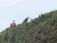
The descent via the Aiguilles Vertes presented the same difficulties as before (particularly at the start in a ravined section). However, we were rewarded with the sight of several bearded vultures on a small peak directly in front of us... something that doesn't happen every day...

Machine-translated

zbh0170
zbh0170
• Edited:

Hello,

To help some people, here is another route for 2021: (the link in my previous message no longer works). Towards the bottom of the route, you need to turn left to find another path.

Best regards

Machine-translated

User 17524763
• Edited:

Overall rating : 3.3 / 5

Date of your route : Jun 14, 2025
Reliability of the description : ★★★☆☆ Average
Ease of following the route : ★★☆☆☆ Disappointing
Route interest : ★★★★★ Very good
Very busy route : No

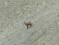
A superb hike with magnificent scenery; we even encountered a few chamois. The route was very quiet on a Saturday in June, which was very pleasant. There were no particular difficulties on the climb, although a little technical skill was required before reaching the Col du Rasoir with a few sections on snowfields and scree.
However, the return via the Aiguilles Vertes was difficult, and the route needs to be updated. After following the trail and the signs along the Crête des Aiguilles Vertes, we were unable to follow the route, which indicated a passage in the middle of the cliff. After turning back several times and trying different passages, we decided to abandon the route and return to the trail below.
Overall, it's a very beautiful hike, but the descent was a bit of a letdown. We lost a lot of time trying to understand the route, which was incorrect in several places.

Machine-translated

zbh0170
zbh0170

Overall rating : 4.7 / 5

Date of your route : Aug 25, 2019
Reliability of the description : ★★★★★ Very good
Ease of following the route : ★★★★☆ Good
Route interest : ★★★★★ Very good

A lovely hike today up to the Pic de Jallouvre in perfect weather: the view was particularly clear over Mont Blanc and the Pointe Percée (as well as the whole mountain range).

Be careful of a few tricky sections:

  • a short stretch on the ridge just after the Col du Rasoir (where a false step is forbidden),
  • on a few sections of the Sente des Aiguilles Vertes (very pleasant overall).

Take care with navigation on the Aiguilles Vertes path, especially around the rocky outcrops towards the end of the section: I hesitated slightly, as the marked route did not match the one I took (see my GPS track here ). Otherwise, following the directions poses no problem.

Machine-translated

moussia74
moussia74

Overall rating : 5 / 5

Date of your route : Aug 07, 2017
Reliability of the description : ★★★★★ Very good
Ease of following the route : ★★★★★ Very good
Route interest : ★★★★★ Very good

A lovely walk in glorious sunshine; the scenery is magnificent: unobstructed views of Mont Blanc, the Aravis range...
The path is well marked, so there’s no trouble finding your way.

Machine-translated

espritlibre
espritlibre

Overall rating : 4 / 5

Date of your route : Jun 18, 2017
Reliability of the description : ★★★★☆ Good
Ease of following the route : ★★★★☆ Good
Route interest : ★★★★☆ Good

This hike took place in very sunny weather and the route is well signposted
As soon as I reached the scree slope below the Col de Rasoir, I took the path on the far left of it, which is easier to walk on than going across the scree.
A truly beautiful panorama

Machine-translated

Other walks in the area

For more walks, use our search engine .

The GPS track and description are the property of this route's author. Please do not copy them without permission.