Roc Cornafion from Prélenfrey, via the Col Vert

The Roc Cornafion from Prélenfrey via the Col Vert. A steep climb along a tricky path (to be avoided at all costs in wet weather).
Warning: The final section involves climbing; it’s easy, certainly, but it’s still climbing. You’ll realise this all too well on the descent.

Details

n°38181
Creation:
Last update:
Last review:
  • Walking
    Activity: Walking
  • ↔
    Distance: 6.84 mi
  • ◔
    Duration according to the author: 5 hrs 
  • ▲
    Difficulty: Extremely difficult

  • ⚐
    Back to start: Yes
  • ↗
    Ascent: + 3,009 ft
  • ↘
    Descent: - 3,005 ft

  • ▲
    Highest point: 6,627 ft
  • ▼
    Lowest point: 3,809 ft

Photos

Description of the walk

Park at the last hairpin bend on the Bordeaux to Prélenfrey road.

(S/E) Take the forest track heading north until you reach the point where it begins to descend.

(1) Turn left onto a path that climbs steeply. Join the Chemin du Balcon Est, heading towards the Col Vert hut.

(2) Continue left to reach Col Vert.

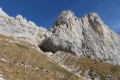
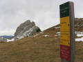
(3) Take the path heading north. Caution here: this path is tricky; it is narrow, winding in places, steep and often overhangs either rocky outcrops or very steep slopes where a slip would be very difficult to stop. Pay close attention to the markings; some tracks may lead you into dead ends. Follow this path to the old wooden signpost indicating Cornafion.

(4) Follow it until you reach a gully, just below the ridge. Climb up this gully to reach the secondary summit of Cornafion. Descend between the two summits – a tricky section – and reach the true summit of Cornafion.

(5). Return to the junction with the signpost.

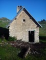
(4) Turn left onto the track to avoid having to climb back up to the Col Vert. This will take you to the Baraque du Col Vert.

(2). Follow the route taken on the way out in the opposite direction to return to the RF des Bordeaux car park (S/E).

Waypoints

  1. S/E : mi 0 - alt. 3,809 ft - RF des Bordeaux car park
  2. 1 : mi 0.33 - alt. 4,186 ft - Crossroads before the descent
  3. 2 : mi 1.45 - alt. 5,246 ft - Col Vert hut
  4. 3 : mi 2.11 - alt. 5,764 ft - Col Vert (1766m)
  5. 4 : mi 2.34 - alt. 5,636 ft - Signposted junction
  6. 5 : mi 3.41 - alt. 6,578 ft - Cornafion summit
  7. S/E : mi 6.84 - alt. 3,809 ft - RF des Bordeaux car park

Notes

It took me 5 hours 30 minutes in total: 1 hour 10 minutes to Col Vert, 3 hours to the summit of Cornafion. A rope of around 30 metres may be useful for the descent from the summit. Tied around a boulder at the summit, it will allow you to descend safely. This route is rarely used, yet a helmet may also prove useful. If there are people above you, the risk of falling rocks is not insignificant.

Worth a visit

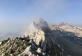
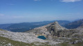
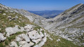
Take a camera with you – the view is magnificent. From the Chartreuse to the north, the Vercors plateau, La Grande Moucherolles and Mont Aiguille to the south, the Dévoluy, the Écrins, Belledonne and Mont Blanc. A 360° view. There is also a bird’s-eye view of Saint-Paul de Varces, Varces and a large part of Grenoble.

Reviews and comments

4.7 / 5
Based on 1 review

Reliability of the description
4 / 5
Ease of following the route
5 / 5
Route interest
5 / 5
jmund
jmund

What justifies this rather far-fetched ED grade? There are some exposed sections where you have to use your hands, certainly, but there’s nothing particularly difficult, either physically or mentally. This sort of over-grading undermines the consistency of the guidebooks for this area, such as this one or that one, and is misleading.

Machine-translated

matdu11
matdu11

OK, thanks a lot

Machine-translated

lulol
lulol

To be honest, 90 per cent of the time, yes, but I don’t know enough about dogs for the remaining 10 per cent, where you need to use your hands a bit. I suppose it’ll do.

Machine-translated

matdu11
matdu11

Hello, I’d like to know if this route is suitable for a dog? Thank you

Machine-translated

lulol
lulol

Overall rating : 4.7 / 5

Date of your route : Sep 14, 2020
Reliability of the description : ★★★★☆ Good
Ease of following the route : ★★★★★ Very good
Route interest : ★★★★★ Very good
Very busy route : No

A good guidebook for a challenging hike.
The final couloir is actually relatively short. You do need to use your hands, and a handrail would provide some extra security, but it can be negotiated without difficulty. The short section between the secondary summit and the main summit is a little less pleasant but remains easy. It’s a far cry from the ‘Cheminée du Paradis’ at the Dent de Crolles, or any comparable section.
The climb up the slopes of the Cornafion is truly beautiful; I highly recommend it.

Machine-translated

jean/grenoble
jean/grenoble

Hello, I didn’t go on the hike; I was just having a look to see how the website worked

Thanks, I’ll start in the spring

Machine-translated

Other walks in the area

For more walks, use our search engine .

The GPS track and description are the property of this route's author. Please do not copy them without permission.