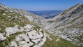
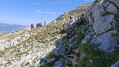
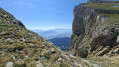
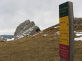
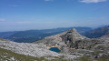
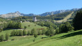
Col des Deux Sœurs and Pré de l’Achard as seen from the Cote 2000 cable car

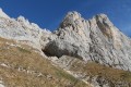
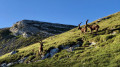
This circular walk allows you to explore a wild area of the Villard-de-Lans resort. After a steady climb to the Col des Deux Sœurs, the route transitions into a more rocky landscape where the scenery becomes increasingly open. The return journey follows an unmarked path, offering a sense of wandering and tranquillity far from the busier trails. This little-visited area is also renowned for its wildlife: it is not uncommon to spot ibex or chamois roaming the rocky slopes. A varied circular route that will appeal to walkers seeking wild landscapes and an immersion in the rocky world of the Vercors.

Details

103187816
Creation:
Last update:
Last review:
  • Walking
    Activity: Walking
  • ↔
    Distance: 4.51 mi
  • ◔
    Average duration: 3h 20 
  • ▲
    Difficulty: Moderate

  • ⚐
    Back to start: Yes
  • ↗
    Ascent: + 1,434 ft
  • ↘
    Descent: - 1,417 ft

  • ▲
    Highest point: 6,772 ft
  • ▼
    Lowest point: 5,646 ft

Photos

Description of the walk

Park in the car park at the Villard-de-Lans resort, then take the Cote 2000 cable car.

(S/E) On exiting the cable car, take the wide track on your left-hand side, heading due east, and begin the ascent.

(1) Leave the return path on your left and continue along the track for about 3 km, following the large signposts indicating “Lac de la Moucherolle”. Head towards the lake.

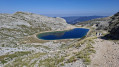
(2) When you reach the lake, stay on its left bank and take the path that climbs towards the Col des Deux Sœurs: there’s a Regional Nature Park signpost on your left. Keep heading south-east as you continue climbing for about 750 m.

(3) Look out for a very large cairn on your left and take the grassy path in that direction to reach it.

(4) Walk past it and turn right to reach the Col des Deux Sœurs after the final 100 metres of ascent.

(5) Begin the descent by following the same path back to the large cairn.

(4) When you reach the cairn, look out for a clearly marked track a few metres before it, on your right, heading north. Leave the signposted path here and follow this track for approximately 350 metres.

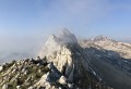
(6) Ignore the path branching off to your left (not shown on the IGN map but present on OSM). Continue straight on, heading north. The path is sometimes well marked, sometimes less so, but is easy to follow, and large cairns help you find your way easily. Reach the sharp limestone pavement at Pré de l’Achard.

(7) Look out for a very large cairn directly ahead of you, still due north, which marks the end of the “Pré”. Head towards it, crossing this sharp limestone pavement without much difficulty. Once you’ve left the Pré de l’Achard, continue the descent for about 600 metres to rejoin the PR® path and the Clot d’Aspres

(8) Turn left onto this path and head uphill for just over a kilometre towards the resort. You’ll come out onto the carriageway leading uphill.

(1) Follow this to the right to reach the top station of the Cote 2000 cable car (S/E).

Waypoints

  1. S/E : mi 0 - alt. 5,650 ft - Upper station of the - Télécabine Côte 2000
  2. 1 : mi 0.16 - alt. 5,748 ft - Junction of the circular loop
  3. 2 : mi 1.76 - alt. 6,371 ft - Lac de la Moucherolle
  4. 3 : mi 2.25 - alt. 6,660 ft - Start of the grassy path
  5. 4 : mi 2.35 - alt. 6,703 ft - Large cairn
  6. 5 : mi 2.4 - alt. 6,726 ft - Col des Deux Sœurs
  7. 6 : mi 2.57 - alt. 6,713 ft - Junction
  8. 7 : mi 3.37 - alt. 6,138 ft - Sharp limestone pavement at Pré de l’Achard
  9. 8 : mi 3.8 - alt. 5,768 ft - PR trail junction
  10. S/E : mi 4.51 - alt. 5,653 ft - Upper station of the - Télécabine Côte 2000

Notes

  • The climb up to Lac de la Moucherolle is steep (and a little monotonous) and accounts for three-quarters of the elevation gain on this hike.
  • Please note: there are no signposts between the points (4) and (8). There are plenty of cairns to help you find your way.
  • Between points (6) and (8), the terrain, whilst not technically difficult, requires good footwear (scree, sharp limestone pavement).
  • There is no water along the route.
  • In 2026, the ‘Pedestrian Return’ fare for the Cote 2000 cable car was €12 (book online: https://www.villardcorrencon.com/fr)

Worth a visit

  • (2) Lac de la Moucherolle.
  • (5) Col des 2 Sœurs.
  • You’ll see plenty of ibex and a few chamois if you’re patient and keep quiet.

Always be cautious and plan ahead when you're outdoors. Visorando and the author of this route cannot be held responsible for any accidents occurring on this route.

The GR® and PR® markings are the intellectual property of the Fédération Française de Randonnée Pédestre.

Other walks in the area

For more walks, use our search engine .

The GPS track and description are the property of this route's author. Please do not copy them without permission.