


Refine your search for walks in Regierungsbezirk Tübingen
Regierungsbezirk Tübingen walks


 Atzenberger Höhenweg
 Tourism professional
 8.48 mi
 +735 ft
 -732 ft
 4h 30
 Moderate
 Departure from Bad Schussenried (Regierungsbezirk Tübingen)
This scenic walk takes you through varied terrain and offers some lovely views. In good weather, you can enjoy a beautiful view stretching as far as the Alpine peaks.
Accessible walk in and around Immenstaad
4.27 mi
+102 ft
-112 ft
2h 05
 Easy
Departure from Immenstaad am Bodensee (Regierungsbezirk Tübingen)
A relaxing, accessible walk around Immenstaad: the route follows fully tarmac-surfaced paths along Lake Constance and through the region’s apple-growing areas. The walk is well suited to pushchairs and wheelchairs and combines the lakeside, sweeping views and a rural atmosphere to create a pleasant outing for everyone.
From the Schönbuchtrauf to the Saurucken, Entringen
1.37 mi
+108 ft
-105 ft
0h 45
Easy
Departure from Ammerbuch (Regierungsbezirk Tübingen)
The route from the hiking car park to Saurucken, with its game reserves and playgrounds, is an absolute highlight of the Schönbuch Nature Park.
The route starts at the popular Saurucken hiking car park above Entringen. From there, it follows a tarmac path into the forest to the game reserve at Saurucken, a fork in the path in the Schönbuch.
Baroque Trail, Bad Schussenried
7.31 mi
+436 ft
-427 ft
3h 45
Moderate
Departure from Bad Schussenried (Regierungsbezirk Tübingen)
This trail takes you on a journey from the Palaeolithic era to the Baroque period.
It leads past the source of the Schussen (a natural monument) to Steinhausen and the “most beautiful village church in the world”.
On the way back, the route passes a wayside shrine dedicated to Our Lady of the Mantle on the way to the Franzosengrab.
The monastery complex makes for an impressive end to the walk.
Historical city tour, Balingen
3.38 mi
+62 ft
-62 ft
1h 35
Easy
Departure from Balingen (Regierungsbezirk Tübingen)
The Balingen Historical City Tour combines history and experience in a particularly vivid way. Discover the town’s eventful past at your own pace or on a guided tour, and immerse yourself in times long past at numerous stops along the way. Buildings, monuments, bridges and squares tell fascinating stories that bring Balingen to life. The tour with the night watchwoman is particularly atmospheric; she brings the town centre to life in an entertaining way with her charm, anecdotes and historical knowledge.
To the heights of Judentenberg and Ochsenbach
5.87 mi
+607 ft
-617 ft
3h 15
Easy
Departure from Ostrach (Regierungsbezirk Tübingen)
Thanks to its high altitude, this circular walk promises stunning views of nature and the countryside.
From a distance, you can see the wind turbines atop the hill, which stretches southwards from Pfullendorf to the west of the Pfrunger-Burgweiler Ried. Almost a hundred metres above the Ried lie several small villages set in a varied landscape. The high altitude offers walkers magnificent views into the distance; in good weather, you can see as far as the Upper Swabian national mountain, the Bussen.
To the heights of Ringgenburg
4.63 mi
+495 ft
-512 ft
2h 35
Easy
Departure from Wilhelmsdorf (Regierungsbezirk Tübingen)
A historic hiking trail surrounded by rich flora
Rising a good hundred metres above the surrounding landscape on the edge of the Pfrunger Ried, the isolated Ringgenburg-Höhe proves to be a wonderful area for walking. Vertical Nagelfluh cliffs and caves still bear witness to the erosive power of the meltwater that carved out the Ostrach and Rotach valleys on either side. The porous Nagelfluh layers support a rich variety of flora.
Despite the woodland, the 725-metre-high mountain spur offers magnificent views down into the Ried. The fact that the Rinkenburg or Ringgenburg, a prehistoric refuge fortress whose moats are still visible, once stood here adds to its appeal for many.
Along panoramic paths to Bethlehem
6.17 mi
+367 ft
-348 ft
3h 10
Easy
Departure from Pfullendorf (Regierungsbezirk Tübingen)
Circular walk along sections of the Way of St James and through peaceful woodland.
This walk to Bethlehem leads directly from Pfullendorf into a beautiful woodland area with good farm tracks and moderate gradients. Along the way, we frequently follow sections of the Way of St James, which leads from Wald via Pfullendorf on to Überlingen.
Ammerbuch’s Gigeleswegle
2.93 mi
+325 ft
-292 ft
1h 40
Easy
Departure from Ammerbuch (Regierungsbezirk Tübingen)
The ‘Ammerbucher Gigeleswegle’ premium walking trail lives up to what its Swabian name promises throughout its entire length: from many spots, you can enjoy excellent views of the countryside.
The word ‘Gigele’ comes from the Swabian dialect and roughly means ‘to look’ or ‘to keep an eye out’. And the trail certainly offers some fantastic views. At times, the view opens up to intimate glimpses of picturesque vineyards, idyllic villages or quiet little valleys; at others, it stretches far and wide across the Gäu region and as far as the Swabian Alb.
Westerheim Cave Tour Ice Age Trail, Alb-Donau District
7.72 mi
+614 ft
-627 ft
4h 05
Moderate
Departure from Westerheim (Regierungsbezirk Tübingen)
Hiking tour from the climatic health resort of Westerheim to the Schertelshöhle and through the biosphere reserve.
High up and deep down. At 815 metres, the climatic health resort of Westerheim is the highest settlement in the Alb-Donau District. But the route also takes us deep underground, namely into Schertelshöhle, one of the most impressive show caves in the Swabian Alb. Its huge stalactites and stalagmites are of fairy-tale beauty.
On our walk starting from Westerheim, we reach the cave halfway along the route and can also visit the ‘Steinerne Haus’, which lies not far away. But the walk through the biosphere reserve has plenty more scenic beauty to offer. The circular route passes through both open farmland and attractive woodland areas, repeatedly reaching altitudes of over 800 metres.
Ice Age Trail: Sontheim Cave Tour, Alb-Donau District
8.33 mi
+669 ft
-682 ft
4h 25
Moderate
Departure from Heroldstatt (Regierungsbezirk Tübingen)
A walking tour from Heroldstatt to the Eistal and Tiefental valleys, combined with a visit to the Sontheimer Cave, Germany’s oldest cave open to the public.
This tour, characterised by the primeval Eistal and Tiefental valleys as well as the Sontheim Cave, offers a glimpse back into the Earth’s history.
Iller Floodplain Forest Tour – Ice Age Trail, Alb-Donau District
7.11 mi
+269 ft
-262 ft
3h 30
Moderate
Departure from Dietenheim (Regierungsbezirk Tübingen)
A walking tour through a magnificent beech forest and down to the banks of the Iller with its impressive floodplain woodland.
This walking tour offers two distinct landscape experiences. On the one hand, the densely wooded Holzstöcke; and on the other, the banks of the Iller with their beautiful floodplain forest.
Fohlenhausrunde Ice Age Trail, Alb-Donau District
6.95 mi
+617 ft
-594 ft
3h 45
Moderate
Departure from Bernstadt (Regierungsbezirk Tübingen)
A varied walking tour through one of the most beautiful sections of the Lone Valley and through the Eschental to the edge of the Markhau.
The Fohlenhaus rock formation in the Lone Valley is a relic from prehistoric times, formed from the reefs of the Jurassic Sea and fossilised into rock over millions of years. It stands clearly visible at a bend in the River Lone, and the lovely rest area next to it is ideal for barbecues and games.
The Fohlenhaus Loop encompasses one of the most beautiful sections of the Lone Valley. The walk follows mostly unspoilt paths and trails and is characterised by the stunning landscape. Whether along the river valley, through the rocky Eschental or at the Küchleshalde, the variety of valleys, woodland and elevation changes is perfect.
“Moor in a Nutshell” on the Wilhelmsdorf Ried Nature Trail
2.38 mi
+43 ft
-43 ft
1h 10
Easy
Departure from Wilhelmsdorf (Regierungsbezirk Tübingen)
An exciting circular walk for the whole family
The circular walk along the Wilhelmsdorf Ried Nature Trail begins right next to the Wilhelmsdorf Nature Conservation Centre, home to the interactive exhibition ‘Experience the Moor’.
Here, over a relatively short distance and along soft, well-maintained paths, you can walk through the various moorland habitats and make many exciting discoveries. A visit to the Ried Nature Trail is particularly worthwhile for families with children.
Panoramic views and the scent of juniper: from Offenhausen to the Sternberg
 Visorando Member4.02 mi
+594 ft
-594 ft
2h 20
Moderate
Departure from Gomadingen (Regierungsbezirk Tübingen)
This varied tour starts directly at the Restaurant & Landhotel Winter in Offenhausen and first takes you past the historic monastery courtyard and the traditional Marbach State Stud. Following the "Hochgesprudelt" route, you hike through the characteristic juniper heaths of the Alb up to the Sternberg Tower, where a spectacular 360-degree view of the Alps awaits you.
Lake Constance tour: From Friedrichshafen to Eriskirch lido
4.38 mi
+69 ft
-105 ft
2h 05
Easy
Departure from Friedrichshafen (Regierungsbezirk Tübingen)
This varied hike leads from Friedrichshafen through the idyllic Eriskircher Ried – one of the most important nature reserves on Lake Constance. Two viewing platforms with magnificent views over the unique reed landscape await you. Impressive views of Lake Constance open up again and again before the tour ends in a relaxed manner at the lido in Eriskirch. Ideal for nature lovers, families and anyone looking for a peaceful hike in beautiful surroundings.
HOCHGEHBERGE Tour ‘hochgehsprudelt’ – in Gomadingen
 Tourist office
 5.40 mi
+968 ft
-988 ft
3h 20
Moderate
Departure from Gomadingen (Regierungsbezirk Tübingen)
Anyone who has experienced this scenic premium hiking trail on a day with good visibility will be brimming with stories to share with friends later on.
The famous ‘Brünnele’ alone – from which, quite unusually, water still bubbles at almost the highest point of the Gomadingen district (the source of the name ‘hochgehsprudelt’) – more than makes up for and rewards every hiker for the slight effort of the ascent. Breathtaking views, unspoilt juniper heaths with unique flora and fauna, and these forest sections with their wonderfully fresh scent make this trail a special sensory experience. Anyone climbing up will look down from here – and see far into the distance. The panoramic view from the 32-metre-high Sternberg Tower, situated on one of the highest peaks in the central Swabian Alb, is second to none when visibility over the Swabian Alb is good.
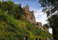
The Swabian Jura and Hohenzollern Castle
 1.43 mi
+551 ft
-531 ft
1h 10
Easy
Departure from Bisingen (Regierungsbezirk Tübingen)
The ancestral seat of the Prussian royal family and the Princes of Hohenzollern, Hohenzollern Castle is one of the most visited castles in Europe. Perched on a high hill in Swabia, the building, adorned with numerous towers, has a picturesque, medieval appearance when viewed from a distance. The view from Hohenzollern Castle is well worth the detour, though you’ll need to be prepared for a brisk 20-minute walk to finally reach the castle.
More walks in Regierungsbezirk Tübingen
Select an area below: