Country:

 City:
City:



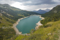
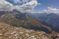
Set off from the final car park at the end of the road leading to Plan d’Amont (an easy track towards the end). The car park is situated at the foot of the Plan d’Amont dam.
(S/E) Continue along the track for a few dozen metres until you reach the top of the dam. Walk along the right bank of the dam. Gradually move away from it until you reach a crossroads at the Pont de la Sétéria.
(1) Turn left onto theGR®5, signposted in white and red. The path begins on gently sloping ground, then climbs more steeply to pass a bastion. Once past the bastion, the terrain flattens out again until you reach a four-way junction beside a stream.
(2) Leave theGR®, cross the stream and continue straight ahead. The path then climbs ever more steeply through increasingly rocky terrain. Follow the cairns carefully to reach, at the top of the steepest slopes, a large cairn marking a crossroads.
(3) Turn left onto a shortcut leading to the foot of the final ascent up the Râteau d’Aussois.
The cairns become more widely spaced, but the route – being the easiest and most obvious – is not difficult. Reach the foot of the Râteau d’Aussois.
(4) Continue leftwards to reach the northern slope of the Râteau, a sort of vast scree slope where numerous cairns indicate the direction to follow. This is the most difficult part of the walk: the cairns are not easy to spot and the passage through this scree, at over 3,000 metres, takes your breath away. One small advantage: all the rocks offer excellent grip and you can get through anywhere. So don’t worry if you’re not exactly on the track or if you miss a cairn now and then. Make your way to the ridge.
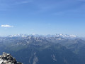
(5) Carry on to reach the summit of the Râteau d’Aussois.
(6) Turn back to return to the car park at the foot of the Plan d’Amont dam (S/E) via the same route you took on the way up.


 Visorando Member


 Tourism professional
 Very difficult
 Moderate