


Refine your search for walks in Refuge de Valmasque
Refuge de Valmasque walks


 Circular of Valmasque and Fontanalbe
 Visorando Member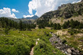
 13.60 mi
 +3,586 ft
 -3,586 ft
 9h 25
9h 25
 Difficult
 Departure from Tende (Alpes-Maritimes)
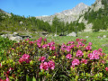
This magnificent circular takes you through the Valmasque and Fontanalbe valleys, with no fewer than five lakes and picture-postcard landscapes. It is a long but gradual hike with very few difficult sections.
Walks near Refuge de Valmasque
Nice Refuge - Merveilles Refuge
 5.74 mi
+1,995 ft
-2,303 ft
4h 20
Difficult
Departure from Belvédère (Alpes-Maritimes)
5.74 mi
+1,995 ft
-2,303 ft
4h 20
Difficult
Departure from Belvédère (Alpes-Maritimes)
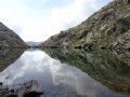
Starting from the Refuge de Nice, the fourth stage of this journey through the Mercantour is the shortest. Short but just as difficult. You’ll pass the Baisse du Basto, the highest point ofthe GR®52. You’ll cross over to Lac du Basto, then it’s the climb up the Baisse de la Valmasque, before descending into the Vallée des Merveilles.
Refuge de Nice - Refuge de la Madone de Fenestre
 3.36 mi
+1,512 ft
-2,533 ft
2h 50
Difficult
Departure from Belvédère (Alpes-Maritimes)
3.36 mi
+1,512 ft
-2,533 ft
2h 50
Difficult
Departure from Belvédère (Alpes-Maritimes)
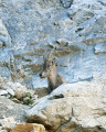
This route, which runs parallel to the border, is dominated throughout by the large peak of Gélas, the highest summit in the area.
From Valmasque to Lac des Mesches via Mont Bégo
 13.66 mi
+4,006 ft
-5,118 ft
10 hrs
13.66 mi
+4,006 ft
-5,118 ft
10 hrs
 Very difficult
Departure from Tende (Alpes-Maritimes)
Very difficult
Departure from Tende (Alpes-Maritimes)
This long one-way hike (two vehicles required) will take you up the pretty Valmasque Valley and its three beautiful lakes to the pass above the Vallée des Merveilles, before climbing to the summit of Mont Bégo via a sometimes steep and slightly vertiginous path, in an area where you may encounter magnificent ibex.
Finally, there is a very long descent to the lakes around the Refuge des Merveilles, then through the Vallon de la Minière to Lac des Mesches.
From Castérino to the Refuge des Merveilles
 8.31 mi
+3,058 ft
-1,736 ft
6h 30
Difficult
Departure from Tende (Alpes-Maritimes)
8.31 mi
+3,058 ft
-1,736 ft
6h 30
Difficult
Departure from Tende (Alpes-Maritimes)
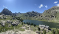
The first part of the magnificent circular walk starting from Castérino to explore the Vallée des Merveilles, passing by the Refuge de Fontanalba, the rock carvings in the Nature Reserve and the Voie Sacrée, and finishing at the Refuge des Merveilles.
From Casterino to the Refuge des Merveilles via Mont Bégo
7.36 mi
+4,951 ft
-3,051 ft
7h 40
Very difficult
Departure from Tende (Alpes-Maritimes)
Second stage of the five-day Vievola–Saint-Martin Vesubie hike.
⚠️ 20/07/2026: Do not undertake this hike. It is currently very dangerous from point 5 to the Refuge des Merveilles. Read the warnings. Currently being updated.
Pont du Countet - Refuge des Merveilles
 3.63 mi
+2,697 ft
-1,276 ft
4h 00
3.63 mi
+2,697 ft
-1,276 ft
4h 00
 Moderate
Departure from Belvédère (Alpes-Maritimes)
Moderate
Departure from Belvédère (Alpes-Maritimes)
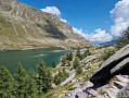
Discover the Vallée des Merveilles by connecting the Vallée de la Gordolasque to the famous Refuge des Merveilles.
From Pont du Countet to the Refuge des Merveilles
5.87 mi
+3,271 ft
-1,824 ft
5h 35
Difficult
Departure from Belvédère (Alpes-Maritimes)
The first stage of a three-day trek in the heart of the Mercantour National Park, this route immediately takes the hiker into the high mountains via a little-used alpine route, away from the classic Pas de l’Arpette. On the itinerary: a steady climb up the Vallon des Verrairiers from the Gordolasque Valley, crossing the Pas du Trem (2,477 m) at the foot of the legendary Cime du Diable (2,685 m), then a long descent past a string of glacial lakes – Lac du Diable, Lac de la Muta, Lac du Trem, Lac Fourca – down to Lac Long Supérieur and the Refuge des Merveilles (2,130 m). A route combining the geological richness of the upper Gordolasque, breathtaking views of the Authion, Mont Capelet Supérieur and the Mediterranean on clear days, and a majestic entrance to the Vallée des Merveilles, a site listed as a Historic Monument. Characteristic wildlife: chamois, ibex, marmots.
Refuge des Merveilles - Refuge de Nice
 5.43 mi
+2,543 ft
-2,201 ft
4h 45
Difficult
Departure from Tende (Alpes-Maritimes)
5.43 mi
+2,543 ft
-2,201 ft
4h 45
Difficult
Departure from Tende (Alpes-Maritimes)
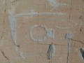
This itinerary allows you to discover the wonders of this valley. In particular, the famous engravings such as Christ, the Tribal Chief and the Altar Rock. But be careful, these areas are monitored!
Refuge des Merveilles - Baisse de Camp
 8.26 mi
+1,946 ft
-3,150 ft
5h 30
Difficult
Departure from Tende (Alpes-Maritimes)
8.26 mi
+1,946 ft
-3,150 ft
5h 30
Difficult
Departure from Tende (Alpes-Maritimes)
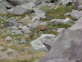
The fifth stage ofthe GR®52, where southern landscapes give way to mountain scenery. Challenging due to its elevation gain, this stage follows the old Italian border, where you’ll discover numerous military remains. Notably at Authion, where one of the last battles in France took place, resulting in the deaths of 273 French soldiers just a few weeks before the armistice of 8 May 1945. The views here are fabulous.
From the Refuge des Merveilles to L'Authion via the Pas du Diable
 6.11 mi
+1,850 ft
-2,159 ft
4h 25
Moderate
Departure from Tende (Alpes-Maritimes)
6.11 mi
+1,850 ft
-2,159 ft
4h 25
Moderate
Departure from Tende (Alpes-Maritimes)
A beautiful classic route on theGR®®52. As you progress along this three-part itinerary, you will appreciate the beauty of the lakes up to the Pas du Diable, then the very chaotic landscape at the foot of the Cime du Diable and Mont Capelet Supérieur. Finally, after the Baisse Cavaline, you will enter a more Mediterranean setting to discover the Authion massif, a historic site during the end of the Second World War.