From Castérino to the Refuge des Merveilles

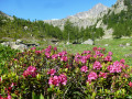
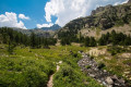
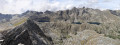
The first part of the magnificent circular walk starting from Castérino to explore the Vallée des Merveilles, passing by the Refuge de Fontanalba, the rock carvings in the Nature Reserve and the Voie Sacrée, and finishing at the Refuge des Merveilles.

This walk is part of a multi-day hike: Boucle de deux jours dans la Vallée des Merveilles

Details

58917149
Creation:
Last update:
Last review:
  • Walking
    Activity: Walking
  • ↔
    Distance: 8.31 mi
  • ◔
    Average duration: 6h 30 
  • ▲
    Difficulty: Difficult

  • ⚐
    Back to start: No
  • ↗
    Ascent: + 3,058 ft
  • ↘
    Descent: - 1,736 ft

  • ▲
    Highest point: 7,444 ft
  • ▼
    Lowest point: 5,568 ft
  • ⚐ Country: France
  • ⚐
    Areas: Alps, Mercantour
  • ⚐ City: Tende (06430)
  • ⚑
    Start: N 44.113566° / E 7.495394°
  • ⚑
    End: N 44.057398° / E 7.451889°
  • ❏
    IGN map(s): Ref. 3741OT, 3841OT
  • Hour-by-hour weather

Photos

Description of the walk

Park along the Route de Casterino as close as possible to marker 394.

(S) Walk up the road to marker 395, then turn right. Follow the path to marker 392 (elevation 1966).

(1) Leave the path leading up to Lac des Grenouilles on your right and continue straight on towards the Refuge de Fontanalba. Reach the junction just after a building on the left.

(2) Navigate the hairpin bend to the right and reach the Refuge de Fontanalba.

(3). Pass the refuge and continue along the path. At the crossroads, just before the Torrent du Vallon de Fontanalba, turn left and continue to a further junction at marker 387.

(4) Carry on straight ahead, then turn right and continue to marker 388.

(5) Follow the markers for the Discovery Trail to the right and pass along the Sacred Path. Walk alongside the Twin Lakes, then turn left onto the path.

(6) Turn left to explore the final engravings on the Discovery Trail.

(7) Turn back.

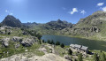
(6) Resume the route to the left, walk along the northern shore of Lac Vert de Fontanalba and return to marker 388.

(5) Continue straight ahead in the opposite direction to the way out until you reach marker 387.

(4) Take the path on the right which climbs up beneath the Baisse de Valauretta. You will soon reach the junction with the path leading down from the Baisse.

(8) Head due east up to the Baisse de Valauretta (marker 385).

(9) Descend south-west down the other slope towards the Gias de Valauretta and the small farm at the bottom.

(10) Once at the farm, cross the stream on the right and turn right at the next junction. Follow the cairns carefully, as the trail on the ground is hard to see. Much further on, rejoin the stony 4x4 track.

(11) Turn off to the right, pass between Lac Saorgine and Lac Long Inférieur, and follow the track to the Refuge des Merveilles (E).

Waypoints

  1. S : mi 0 - alt. 5,623 ft - Casterino car park
  2. 1 : mi 1.63 - alt. 6,424 ft - Marker 392
  3. 2 : mi 2.29 - alt. 6,345 ft - Junction - Lac des Grenouilles (2000m)
  4. 3 : mi 2.66 - alt. 6,581 ft - Refuge de Fontanalba
  5. 4 : mi 3.18 - alt. 6,962 ft - Marker 387. Common junction for the out-and-back route
  6. 5 : mi 3.24 - alt. 6,995 ft - Marker 388. Crossroads: circular trail on the nature trail
  7. 6 : mi 4.3 - alt. 7,211 ft - Round trip to the rock carvings
  8. 7 : mi 4.37 - alt. 7,182 ft - Engravings along the nature trail
  9. 8 : mi 5.05 - alt. 7,264 ft - Path junction - Baisse de Valauretta (2279m)
  10. 9 : mi 5.26 - alt. 7,405 ft - Baisse de Valauretta (2279m)
  11. 10 : mi 6.15 - alt. 6,424 ft - Gias de Valauretta junction
  12. 11 : mi 7.76 - alt. 6,785 ft - Gravel 4x4 track
  13. E : mi 8.31 - alt. 6,955 ft - Refuge des Merveilles

This route passes through a protected area, which may be subject to special regulations:

Reviews and comments

4.6 / 5
Based on 3 reviews

Reliability of the description
4.7 / 5
Ease of following the route
4.3 / 5
Route interest
4.7 / 5
thomasmontagnon
thomasmontagnon

Overall rating : 4.3 / 5

Date of your route : Sep 08, 2025
Reliability of the description : ★★★★☆ Good
Ease of following the route : ★★★★☆ Good
Route interest : ★★★★★ Very good
Very busy route : No

The descent from Bego is quite tricky, very exposed, and it's not always easy to find the path either..

Machine-translated

User 27486761

Overall rating : 4.7 / 5

Date of your route : Sep 01, 2025
Reliability of the description : ★★★★★ Very good
Ease of following the route : ★★★★☆ Good
Route interest : ★★★★★ Very good
Very busy route : No

The first day to the Refuge des Merveilles is relatively straightforward. The second stage is more challenging and technical, crossing Mont Bégo, which could be classified as a very difficult route but is worth the detour for its magnificent 360-degree views.

Machine-translated

User 22832921

Overall rating : 4.7 / 5

Date of your route : Aug 15, 2025
Reliability of the description : ★★★★★ Very good
Ease of following the route : ★★★★★ Very good
Route interest : ★★★★☆ Good
Very busy route : No

Stage completed on 15 August, no crowds to speak of...
No particular difficulties, pleasant as it was mostly shaded, however
Lac Vert de Fontanalba completely dry.
Be careful at point 10 to take the Cairns trail as there are no signs!

Machine-translated

Other walks in the area

For more walks, use our search engine .

The GPS track and description are the property of this route's author. Please do not copy them without permission.