The Cinca and La Larri Waterfalls

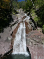
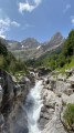
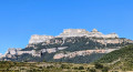
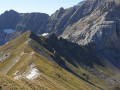
A lovely walk following the waterfalls, with magnificent scenery. This walk takes in the Cinca Waterfall, the Larri Waterfall, the Salto de la Larri Waterfall and a high vantage point overlooking the mountains. There are also numerous viewpoints, including several overlooking the Larri Waterfall. Please take care at a dangerous section where you have to cross a stream. There is also a lovely picnic spot with views of the mountains, right by the water. Please stay on the paths and respect the mountain

Details

102494141
Creation:
Last update:
Last review:
  • Walking
    Activity: Walking
  • ↔
    Distance: 5.69 mi
  • ◔
    Average duration: 3h 40 
  • ▲
    Difficulty: Moderate

  • ⚐
    Back to start: Yes
  • ↗
    Ascent: + 1,211 ft
  • ↘
    Descent: - 1,227 ft

  • ▲
    Highest point: 5,331 ft
  • ▼
    Lowest point: 4,193 ft
  • ⚐ Country: Spain
  • ⚐
    Area: Pyrenees
  • ⚐ City: Bielsa 
  • ⚑
    Start/End: N 42.676532° / E 0.084859°
  • ❏
    IGN map(s): Ref. 1748ET, 1748ETR, 1748OT, 1748OTR
  • Hour-by-hour weather

Waypoints

  1. S/E : mi 0 - alt. 4,209 ft - Pineta Nordic Area
  2. 1 : mi 1.14 - alt. 4,705 ft - Waterfall
  3. 2 : mi 1.84 - alt. 4,931 ft - Waterfall and viewpoint
  4. 3 : mi 2.37 - alt. 5,112 ft - Viewpoint
  5. 4 : mi 3.42 - alt. 5,331 ft - Waterfall
  6. 5 : mi 4.8 - alt. 4,810 ft - Viewpoint overlooking the waterfall
  7. 6 : mi 4.92 - alt. 4,633 ft - Viewpoint overlooking the waterfall
  8. 7 : mi 5.22 - alt. 4,262 ft - Dangerous rocky area
  9. 8 : mi 5.58 - alt. 4,203 ft - Picnic area
  10. S/E : mi 5.69 - alt. 4,206 ft - Pineta Nordic Area

Other walks in the area

For more walks, use our search engine .

The GPS track and description are the property of this route's author. Please do not copy them without permission.