Country:

 City:
City:


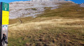
(S) The walk starts from the Refuge de la Soldanelle, below the Agathe and Sophie peaks. Head west, climbing towards the Deux Sœurs.
(1) At Pré Achard, continue along the path towards the west; it is an easy walk.
(2) Les Poules is a junction of paths. Take the one heading uphill to the right.
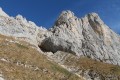
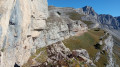
(3) At Mulet du Curé, turn right and head northwards uphill, staying on this narrow path which will take you past the Mur des Sarasins. You’ll reach the foot of the cliffs, where you’ll find a magnificent viewpoint.
(4) The Pas de la Balme is the highest point of the day (1,839 m). Continue down a gentle slope heading north.
(5) Combeauvieux marks the entrance to the Corrençon/Villard ski area. At this point, carry on straight ahead (north) and pass under the chairlift. Look out for the “Fenêtre” opposite
(6) Pass the Pas de la Fenêtre, which is easy to navigate on a wide ski run, and continue straight on towards the north.
(7) At Source Bressant, on the slopes, continue downhill towards the small chalet, still heading north. Pass by a chairlift arrival point (Grand Buisson), leaving it on your left, then pass underneath it twice. Head towards the departure point of the Télésiège des Crêtes, passing under a bridge just before the departure station, which you go round.
(8) At the Carrefour de l’Ours, continue along this very wide piste, heading uphill towards the gondola lift.
(9) Cote 2000 gondola lift (at 1,720 m), the gondola’s top station with its restaurant. Walk past the restaurant and head south-east, passing under a chairlift. Walk down a meadow for 150 metres towards the north and follow the Refuge chairlift. Continuing to head northwards, make your way towards the lake.
(10) Lac des Prés is an oasis with benches where you can rest. Go round the lake on the left and continue along the path, passing between the restaurant and the top station of the Télécabines des Prés cable cars as you head downhill. You can easily take a shortcut across the meadows rather than staying on the track.
(11) You can either head down the wide track towards the south-east or take the signposted path that leads into the forest. Take care: there is a steep slope as you emerge from the woods. Continue straight on along the path at the bottom of this slope towards La Cote.
(12) La Cote is a crossroads of paths. Continue northwards, straight ahead.
(13) When you reach L’Aversin, take the wide path to the right or go through the woods to reach the Clots car park (E).
 Visorando Member
 Extremely difficult
 Very difficult
 Moderate