


Not recommended in winter; check the weather forecast before setting off. Bring walking poles for both the ascents and descents. Take enough water for the day; refreshments are available at the mountain hut.
The eastern ridges of the Vercors over two days


This two-day hike takes you on a circular route around Villard-de-Lans via the eastern ridges.
A hike best undertaken in autumn or spring, when there is no snow. Spectacular scenery that is well worth the early start.
Details
Creation:
Last update:
Last review:
-
 Activity: Walking
 -
 Distance: 18.28 mi
 -
 Average duration: 2 days
 -
 Difficulty: Difficult
 -
-
 Back to start: Yes
 -
 Ascent: + 5,184 ft
 -
 Descent: - 5,148 ft
 -
-
 Highest point: 6,257 ft
 -
 Lowest point: 4,035 ft
-
 Country:
France
Country:
France
-

-
 City:
Villard-de-Lans (38250)
City:
Villard-de-Lans (38250) -
 Start/End: N 45.056031° / E 5.567624°
 -


 Hour-by-hour weather
Photos
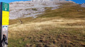
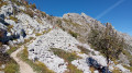
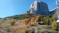
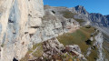
Stages of the route
This route needs several days, find the details below:
Notes
Reviews and comments
5 / 5
Based on 2 reviews
Reliability of the description
5 / 5
5 / 5
Ease of following the route
5 / 5
5 / 5
Route interest
5 / 5
5 / 5

EliseLG
Overall rating : 5 / 5
Date of your route : Oct 03, 2026
Reliability of the description : ★★★★★ Very good
Ease of following the route : ★★★★★ Very good
Route interest : ★★★★★ Very good
Very busy route : No
A lovely walk for a first visit to the Vercors, with superb views of the Vercors foothills and the Alps in general, and some wonderful wildlife (ibex, marmots, vultures).
Access to the start is easy and the whole route is well signposted.
We didn’t come across many people in early October 2026.
We followed a slightly different route to the suggested one, as we set off at around 9 am from the Les Clots car park and reached the Refuge de la Soldanelle at around 2 pm. We decided to carry on and go beyond the Pas de la Balme (which is magnificent) to camp near the Refuge du Grand Couloir, which is situated a little higher up than the main route of this hike (arriving around 5 pm). This spot offers an exceptional view of the valley, plenty of space for our tents, and the refuge where we could eat a meal in the warmth.
The next day, we returned to the car park by rejoining the original route, which follows the ski runs for much of the way. It’s less interesting, although we did enjoy some lovely views over the Villard-de-Lans plateau.
Two points to note:
- it is not possible to camp between the Col Vert and the Pas de la Balme (except perhaps near the Refuge de la Soldanelle, but we didn’t check), as the slopes are too steep.
- There were no water sources along the entire route in early October, as all the rivers had run dry and the refuge was closed for renovation. Remember to take enough water with you.
Machine-translated
marseille2
Overall rating : 5 / 5
Date of your route : Jul 10, 2023
Reliability of the description : ★★★★★ Very good
Ease of following the route : ★★★★★ Very good
Route interest : ★★★★★ Very good
Very busy route : No
On the second day, from point 16 onwards, the walk follows the resort’s ski runs. In very hot weather, the route therefore becomes gruelling (no shade) and rather uninteresting, apart from the view over Corrençon and Villard de Lans.
We received a very warm welcome at the Refuge de la Soldanelle on the evening of the first day (panoramic terrace and excellent food).
Machine-translated
Other walks in the area
Les Clôts – Refuge de la Soldanelle
 Visorando Member
8.21 mi
+2,139 ft
-1,283 ft
5h 40
Visorando Member
8.21 mi
+2,139 ft
-1,283 ft
5h 40
 Moderate
 Departure from Villard-de-Lans (Isère)
First stage of the hike. Set off from the Clôts car park towards the Refuge de la Soldanelle for an overnight stay.
Pas de l'Œille via the Vallon de la Fauge and return via Grande Combe
 7.90 mi
+2,733 ft
-2,723 ft
6h 00
Moderate
Departure from Villard-de-Lans (Isère)
7.90 mi
+2,733 ft
-2,723 ft
6h 00
Moderate
Departure from Villard-de-Lans (Isère)
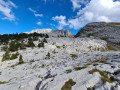
You start from a place called Les Clots and head to the magnificent Vallon de la Fauge. At the bottom, you climb up the Combe Charbonnière, reach the Pas de l'Œille and look out over Prélenfrey at 1,960 m and the Lac de Notre-Dame de Commiers on the Grenoble valley side. The return route passes through Grande Combe, offering spectacular views, and follows the tracks down to 1,350 metres. You return to Les Clots via L'Aversin. A feast for the eyes, sometimes with chamois!
Villard-de-Lans: From Les Clots to Col Vert, return via Combe Charbonnière
 6.91 mi
+2,152 ft
-2,126 ft
5h 05
Moderate
Departure from Villard-de-Lans (Isère)
6.91 mi
+2,152 ft
-2,126 ft
5h 05
Moderate
Departure from Villard-de-Lans (Isère)
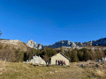
Climb from the very pretty spot called Les Clots towards the Col Vert and descend via the Combe Charbonnière, a scree slope that is a little tricky to navigate. View of the Belledonne massif from the Col.
This allows you to get a good view of the Vercors landscapes and enjoy the variety of the mid-mountain terrain.
Not to be attempted in winter! Between 6 and 7, there is a high risk of avalanches, especially towards the Combe de la Charbonnière.
Pas de l’Œille – Col des Deux Sœurs
 8.94 mi
+3,517 ft
-3,491 ft
7h 10
Difficult
Departure from Villard-de-Lans (Isère)
8.94 mi
+3,517 ft
-3,491 ft
7h 10
Difficult
Departure from Villard-de-Lans (Isère)
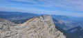
An ideal hike for spotting ibex and magnificent scenery! The return via the resort could probably be improved by taking a different route to make this hike absolutely perfect!
Cascade de la Fauge from Les Glovettes
 3.25 mi
+561 ft
-568 ft
2h 00
3.25 mi
+561 ft
-568 ft
2h 00
 Easy
Departure from Villard-de-Lans (Isère)
Easy
Departure from Villard-de-Lans (Isère)
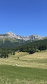
A short walk, partly through the woods, following the Ruisseau de la Fauge stream and discovering its pretty waterfall from the Glovettes car park.
You can also start from the Clos car park, which will shorten the walk and avoid the sunny, tarmac section (but you will miss out on the beautiful view...).
La Grande Moucherolle
 10.96 mi
+4,180 ft
-4,186 ft
8h 40
Difficult
Departure from Villard-de-Lans (Isère)
10.96 mi
+4,180 ft
-4,186 ft
8h 40
Difficult
Departure from Villard-de-Lans (Isère)
A challenging hike with the ascent of the second highest peak in the Vercors, the Grande Moucherolle (2,284 m).
For more walks, use our search engine .
The GPS track and description are the property of this route's author. Please do not copy them without permission.

